The long cruise leg crosses the Appalachians, the Rocky Mountain Front Range, the Wasatch Range and Great Salt Lake basin, and finally the Sierra Nevada - all facing the left side of the aircraft on its west-northwest heading. This string of major ranges and the Great Salt Lake gives the left side far more variety and drama than the flatter farmland and plains visible to the north, even though the right side edges out the takeoff and landing segments.
Flown BWI to SJC? Did we get it right?
Flight Path
Baltimore to San Jose is 2,433 miles (3,915 km), a flight of about 6 hours 10 minutes.
Rocky Mountain Front Range near Denver, the Great Salt Lake and Wasatch Mountains in Utah, and the high desert basins of Nevada before the Sierra Nevada
Great circle distance and headings ›


Phase by phase
Takeoff from BWI
RIGHTDeparting on runway 28, the right side faces north directly over Baltimore, giving a clear view of the Inner Harbor, downtown skyline, and the Patapsco River before the upper Chesapeake Bay fades into the distance. The left side mostly shows flat Maryland suburbs, with Washington D.C. too far away at that altitude to resolve clearly.
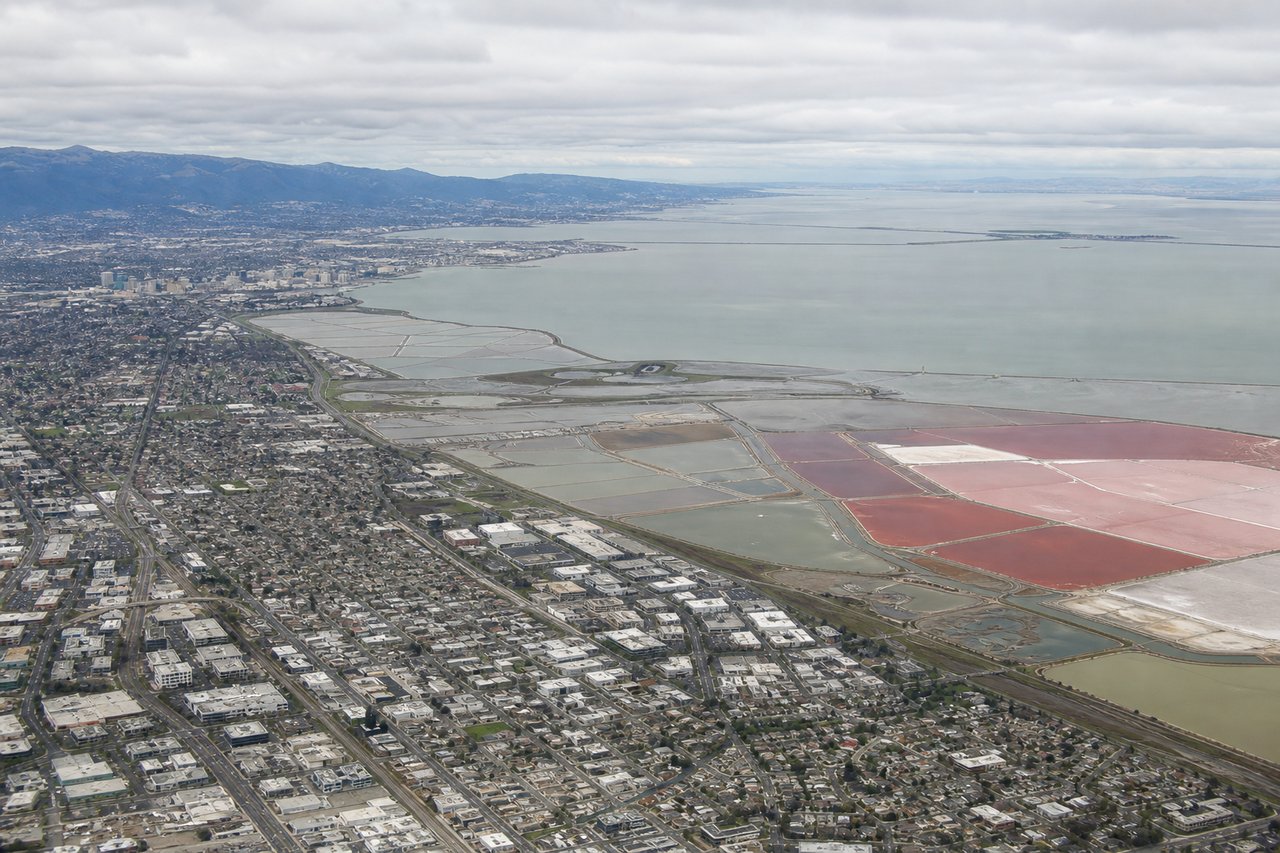
Landing at SJC
RIGHTOn the typical runway 30 approach into San Jose, the right side looks northeast across the Diablo Range, highlighted by Mount Hamilton's white observatory domes and the blue sweep of Calaveras Reservoir. The left side shows the lower, tree-covered Santa Cruz Mountains, which look more uniform and less distinct from altitude.
Will your flight be in sunlight?
Pick a date and time in the Sun Map to watch the sun move across your whole flight.
About This Route
Which side of the plane should I sit on flying from Baltimore Washington International (BWI) to Norman Y Mineta San Jose International (SJC)?
Sit on the Left side of the plane for the best views on flights from Baltimore to San Jose. The long cruise leg crosses the Appalachians, the Rocky Mountain Front Range, the Wasatch Range and Great Salt Lake basin, and finally the Sierra Nevada - all facing the left side of the aircraft on its west-northwest heading. This string of major ranges and the Great Salt Lake gives the left side far more variety and drama than the flatter farmland and plains visible to the north, even though the right side edges out the takeoff and landing segments.
What can I see during takeoff from Baltimore Washington International in Baltimore?
During takeoff from Baltimore Washington International (BWI), sit on the Right side for the best views. Departing on runway 28, the right side faces north directly over Baltimore, giving a clear view of the Inner Harbor, downtown skyline, and the Patapsco River before the upper Chesapeake Bay fades into the distance. The left side mostly shows flat Maryland suburbs, with Washington D.C. too far away at that altitude to resolve clearly. Notable sights include: Baltimore Inner Harbor and skyline, Patapsco River, upper Chesapeake Bay, Camden Yards area.
What can I see when landing at Norman Y Mineta San Jose International in San Jose?
When landing at Norman Y Mineta San Jose International (SJC), sit on the Right side for the best views. On the typical runway 30 approach into San Jose, the right side looks northeast across the Diablo Range, highlighted by Mount Hamilton's white observatory domes and the blue sweep of Calaveras Reservoir. The left side shows the lower, tree-covered Santa Cruz Mountains, which look more uniform and less distinct from altitude. Notable sights include: Mount Hamilton and Lick Observatory, Diablo Range foothills, Calaveras Reservoir, Santa Clara Valley suburban grid.
How long is the flight from Baltimore to San Jose?
The flight from Baltimore Washington International (BWI) to Norman Y Mineta San Jose International (SJC) takes about 6 hours 10 minutes. The shortest flight path between them is 2,433 miles (3,915 km); winds and air traffic control usually add a few percent.
What does the Baltimore to San Jose flight path pass over?
Rocky Mountain Front Range near Denver, the Great Salt Lake and Wasatch Mountains in Utah, and the high desert basins of Nevada before the Sierra Nevada