Belize City to San Francisco is 2,484 miles (3,997 km), a flight of about 4 hours 15 minutes.
While takeoff offers reef views, the landing descent provides more dramatic and varied scenery—the Sierra Nevada, Central Valley, and San Francisco Bay are all visually striking. Left side captures the best of the approach sequence.
Flight Path
The flight path crosses the Gulf of Mexico (visible as open water for the first 90 minutes), then passes over the Yucatan Peninsula, southern Texas coastline, and the Texas Hill Country. The Rocky Mountains appear on the horizon around the 2.5-hour mark as the aircraft crosses New Mexico and Arizona. The Sierra Nevada becomes prominent in the final hour of descent into California.
Great circle distance and headings ›

Phase by phase
Takeoff from BZE
RIGHTRight-side seats offer views of the Belize Barrier Reef and Caribbean Sea immediately after departure. The aircraft climbs northwestward, and right-side passengers see the reef system and coastal lagoons that define Belize's eastern geography.
Landing at SFO
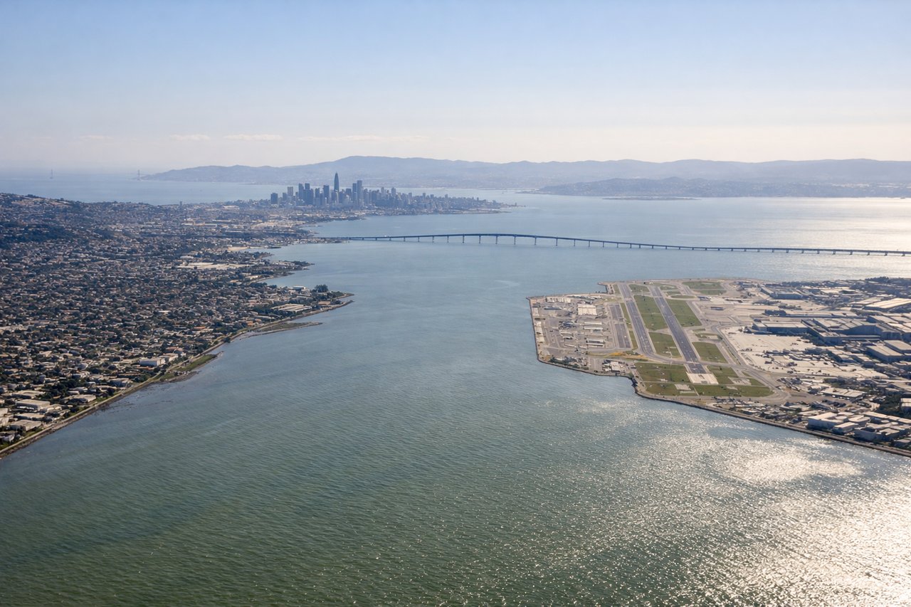
LEFTLeft-side seats provide excellent views during the descent into San Francisco. The aircraft approaches from the east, and left-side passengers see the Sierra Nevada mountains, the Central Valley, and the San Francisco Bay area as the plane descends toward the runway.
Landmarks on this routeAll landmarks →
Will your flight be in sunlight?
Pick a date and time in the Sun Map to watch the sun move across your whole flight.
About This Route
Which side of the plane should I sit on flying from Philip S W Goldson International (BZE) to San Francisco International (SFO)?
Sit on the Left side of the plane for the best views on flights from Belize City to San Francisco. While takeoff offers reef views, the landing descent provides more dramatic and varied scenery—the Sierra Nevada, Central Valley, and San Francisco Bay are all visually striking. Left side captures the best of the approach sequence.
What can I see during takeoff from Philip S W Goldson International in Belize City?
During takeoff from Philip S W Goldson International (BZE), sit on the Right side for the best views. Right-side seats offer views of the Belize Barrier Reef and Caribbean Sea immediately after departure. The aircraft climbs northwestward, and right-side passengers see the reef system and coastal lagoons that define Belize's eastern geography. Notable sights include: Belize Barrier Reef (world's second-longest reef system), Caribbean Sea, Belize City waterfront, Half Moon Caye atoll.
What can I see when landing at San Francisco International in San Francisco?
When landing at San Francisco International (SFO), sit on the Left side for the best views. Left-side seats provide excellent views during the descent into San Francisco. The aircraft approaches from the east, and left-side passengers see the Sierra Nevada mountains, the Central Valley, and the San Francisco Bay area as the plane descends toward the runway. Notable sights include: Sierra Nevada mountain range, San Francisco Bay, Golden Gate Bridge area, San Francisco Peninsula.
How long is the flight from Belize City to San Francisco?
The flight from Philip S W Goldson International (BZE) to San Francisco International (SFO) takes about 4 hours 15 minutes. The shortest flight path between them is 2,484 miles (3,997 km); winds and air traffic control usually add a few percent.
What does the Belize City to San Francisco flight path pass over?
The flight path crosses the Gulf of Mexico (visible as open water for the first 90 minutes), then passes over the Yucatan Peninsula, southern Texas coastline, and the Texas Hill Country. The Rocky Mountains appear on the horizon around the 2.5-hour mark as the aircraft crosses New Mexico and Arizona. The Sierra Nevada becomes prominent in the final hour of descent into California.