Belize City to Seattle is 2,822 miles (4,541 km), a flight of about 5 hours.
This flight offers distinct scenic value on both sides depending on phase. Right seats capture the Caribbean coastal beauty and reef systems during departure; left seats reward passengers during the final descent with views of the iconic Cascade Range and Mount Rainier. Neither side dominates the entire flight.
Flight Path
The flight path crosses the Gulf of Mexico, passing east of the Yucatan Peninsula and then over the continental United States. Notable midpoint features include the Gulf of Mexico coastline (Texas and Louisiana), the Mississippi River delta region, and the Great Plains. The aircraft typically cruises at 35,000-37,000 feet over these areas, making individual geographic features appear small, though the Mississippi River's meandering course and major river systems can be distinguished on clear days. The transition from Gulf coastal lowlands to the elevated terrain of the Rocky Mountain foothills occurs in the latter third of the flight, with the Rockies visible on the left side during descent into the Pacific Northwest.
Great circle distance and headings ›.jpg?width=600)


Phase by phase
Takeoff from BZE
RIGHTRight-side seats offer views of the Caribbean Sea and Belize's coastal lagoons and cayes as the aircraft climbs northward. The left side faces inland terrain with less distinctive visual features during the initial climb-out.
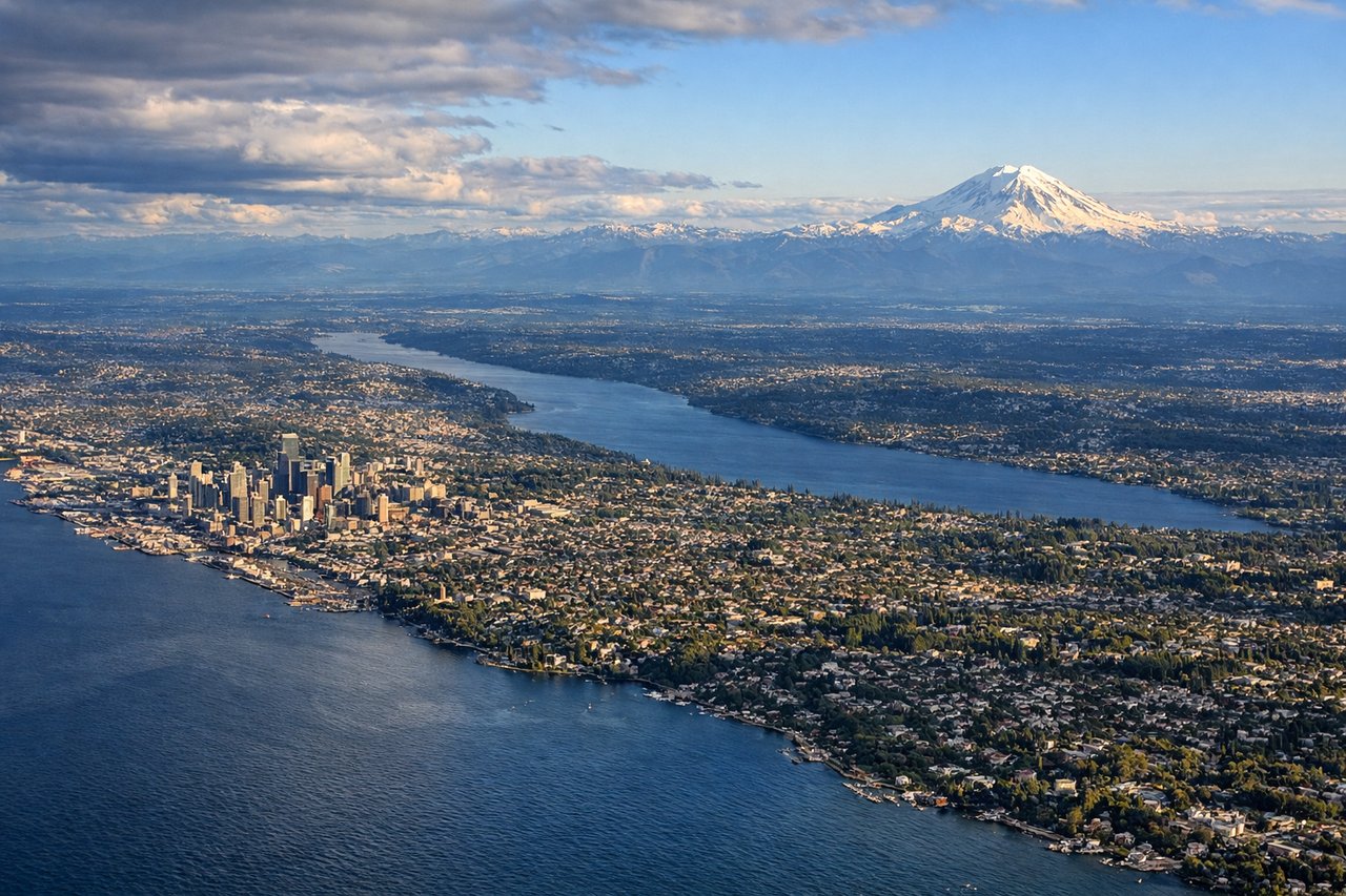
Landing at SEA
LEFTLeft-side seats provide excellent views of the Cascade Range and Mount Rainier during descent into Seattle. The aircraft approaches from the south, making the western slopes and surrounding peaks visible on the left side as the plane descends toward SeaTac.
Landmarks on this routeAll landmarks →
Will your flight be in sunlight?
Pick a date and time in the Sun Map to watch the sun move across your whole flight.
About This Route
Which side of the plane should I sit on flying from Philip S W Goldson International (BZE) to Seattle Tacoma International (SEA)?
Sit on the Right for takeoff, Left for landing side of the plane for the best views on flights from Belize City to Seattle. This flight offers distinct scenic value on both sides depending on phase. Right seats capture the Caribbean coastal beauty and reef systems during departure; left seats reward passengers during the final descent with views of the iconic Cascade Range and Mount Rainier. Neither side dominates the entire flight.
What can I see during takeoff from Philip S W Goldson International in Belize City?
During takeoff from Philip S W Goldson International (BZE), sit on the Right side for the best views. Right-side seats offer views of the Caribbean Sea and Belize's coastal lagoons and cayes as the aircraft climbs northward. The left side faces inland terrain with less distinctive visual features during the initial climb-out. Notable sights include: Caribbean Sea, Belize City waterfront, Half Moon Caye, Lighthouse Reef Atoll.
What can I see when landing at Seattle Tacoma International in Seattle?
When landing at Seattle Tacoma International (SEA), sit on the Left side for the best views. Left-side seats provide excellent views of the Cascade Range and Mount Rainier during descent into Seattle. The aircraft approaches from the south, making the western slopes and surrounding peaks visible on the left side as the plane descends toward SeaTac. Notable sights include: Mount Rainier, Cascade Range, Puget Sound, Lake Washington.
How long is the flight from Belize City to Seattle?
The flight from Philip S W Goldson International (BZE) to Seattle Tacoma International (SEA) takes about 5 hours. The shortest flight path between them is 2,822 miles (4,541 km); winds and air traffic control usually add a few percent.
What does the Belize City to Seattle flight path pass over?
The flight path crosses the Gulf of Mexico, passing east of the Yucatan Peninsula and then over the continental United States. Notable midpoint features include the Gulf of Mexico coastline (Texas and Louisiana), the Mississippi River delta region, and the Great Plains. The aircraft typically cruises at 35,000-37,000 feet over these areas, making individual geographic features appear small, though the Mississippi River's meandering course and major river systems can be distinguished on clear days. The transition from Gulf coastal lowlands to the elevated terrain of the Rocky Mountain foothills occurs in the latter third of the flight, with the Rockies visible on the left side during descent into the Pacific Northwest.