The left side wins overall because the Toronto arrival view — Lake Ontario, the CN Tower, and the downtown skyline — is one of the most dramatic urban approaches in North America. The Cabinda departure on the right is interesting but brief; the left side also picks up Atlantic Ocean views during the long oceanic crossing and glimpses of the Azores region if routing goes that way.
Flight Path
The route typically tracks northwest over the Gulf of Guinea, then across the central Atlantic Ocean. Depending on routing, the Canary Islands or Cape Verde Islands may be visible as small volcanic archipelagos in the ocean below. The flight crosses the ITCZ with associated cloud cover near the equator, then the Saharan dust layer over the mid-Atlantic. Approaching North America, the flight may pass near Newfoundland or Nova Scotia, where the rugged Canadian Shield coastline and scattered sea ice in winter become visible before the descent into the Great Lakes region.
Great circle distance and headings ›.jpeg?width=600)

Phase by phase
Takeoff from CAB
RIGHTCabinda Airport's primary runway runs roughly north-south. Departing northward toward the Atlantic routing, the right (east) side gives you views over the Cabinda enclave's dense equatorial forest and the Congo River estuary mouth to the south. The left side faces open ocean almost immediately.
Landing at YYZ
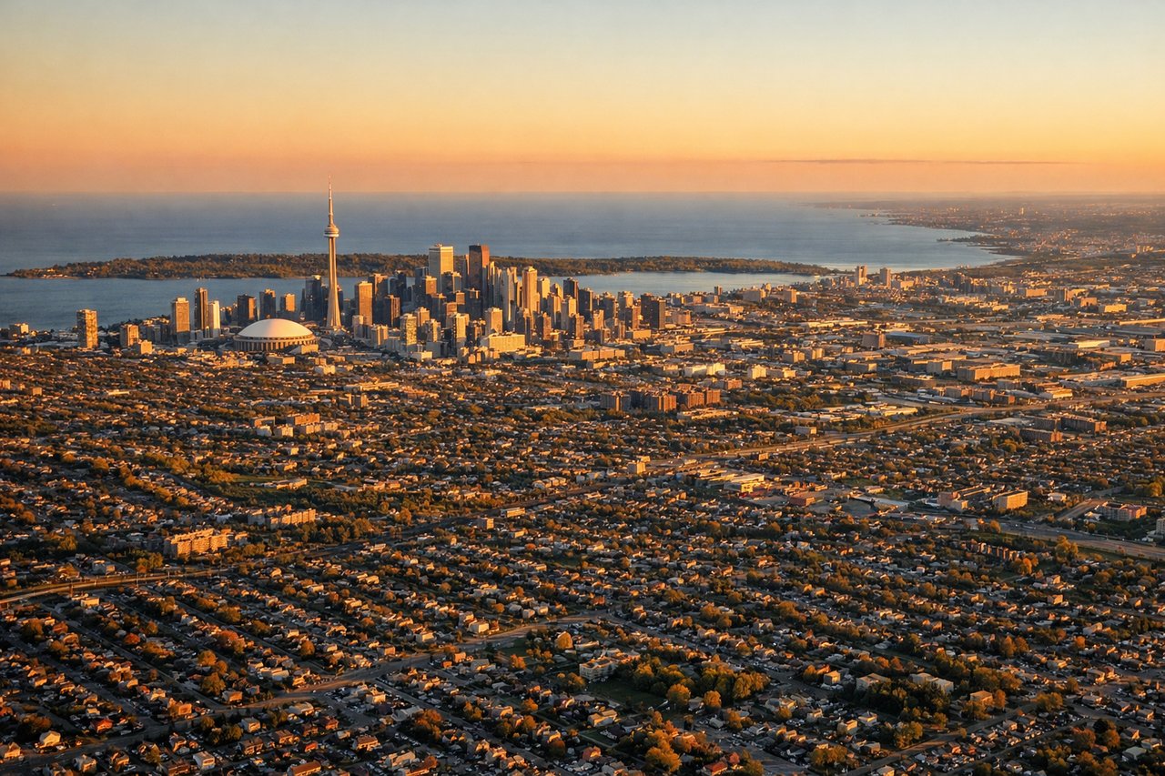
LEFTPearson's primary arrival runways (06L/06R or 24L/24R) mean westbound arrivals typically approach from the east over the city. The left (south) side on approach gives a clear view over downtown Toronto's skyline, Lake Ontario, and the Toronto Islands. The right side looks north over suburban sprawl.
Landmarks on this routeAll landmarks →
Will your flight be in sunlight?
See exactly which side of the plane gets sun and shade at your departure time.
About This Route
Which side of the plane should I sit on flying from Cabinda (CAB) to Lester B Pearson International (YYZ)?
Sit on the Left side of the plane for the best views on flights from Cabinda to Toronto. The left side wins overall because the Toronto arrival view — Lake Ontario, the CN Tower, and the downtown skyline — is one of the most dramatic urban approaches in North America. The Cabinda departure on the right is interesting but brief; the left side also picks up Atlantic Ocean views during the long oceanic crossing and glimpses of the Azores region if routing goes that way.
What can I see during takeoff from Cabinda in Cabinda?
During takeoff from Cabinda (CAB), sit on the Right side for the best views. Cabinda Airport's primary runway runs roughly north-south. Departing northward toward the Atlantic routing, the right (east) side gives you views over the Cabinda enclave's dense equatorial forest and the Congo River estuary mouth to the south. The left side faces open ocean almost immediately. Notable sights include: Congo River estuary mouth, Cabinda town and port, Atlantic Ocean coastline, equatorial rainforest canopy of the Mayombe forest.
What can I see when landing at Lester B Pearson International in Toronto?
When landing at Lester B Pearson International (YYZ), sit on the Left side for the best views. Pearson's primary arrival runways (06L/06R or 24L/24R) mean westbound arrivals typically approach from the east over the city. The left (south) side on approach gives a clear view over downtown Toronto's skyline, Lake Ontario, and the Toronto Islands. The right side looks north over suburban sprawl. Notable sights include: Downtown Toronto skyline with CN Tower, Lake Ontario, Toronto Islands, Niagara Peninsula visible to the southwest on clear days.
How long is the flight from Cabinda to Toronto?
The flight from Cabinda (CAB) to Lester B Pearson International (YYZ) takes Approximately 11 to 13 hours depending on routing and winds.
What does the Cabinda to Toronto flight path pass over?
The route typically tracks northwest over the Gulf of Guinea, then across the central Atlantic Ocean. Depending on routing, the Canary Islands or Cape Verde Islands may be visible as small volcanic archipelagos in the ocean below. The flight crosses the ITCZ with associated cloud cover near the equator, then the Saharan dust layer over the mid-Atlantic. Approaching North America, the flight may pass near Newfoundland or Nova Scotia, where the rugged Canadian Shield coastline and scattered sea ice in winter become visible before the descent into the Great Lakes region.