While takeoff favors the left, the landing approach over the Congo River estuary and Atlantic coastline is the more dramatic and geographically significant portion of this long transoceanic flight. Right-side seats capture the most visually distinctive feature of the entire journey.
Flight Path
The flight path crosses the Atlantic Ocean for roughly 8-10 hours with no visible landmarks. Over the ocean, passengers may see the curvature of the Earth and cloud formations, but no geographic features. As the aircraft approaches the African coast near Gabon and Congo, the transition from open ocean to the dense rainforest of central Africa becomes visible, with the Congo River system appearing as a massive silvery network cutting through dark green forest canopy. The approach to Cabinda reveals the distinctive estuary system where the Congo meets the Atlantic.
Great circle distance and headings ›
.jpeg?width=600)
Phase by phase
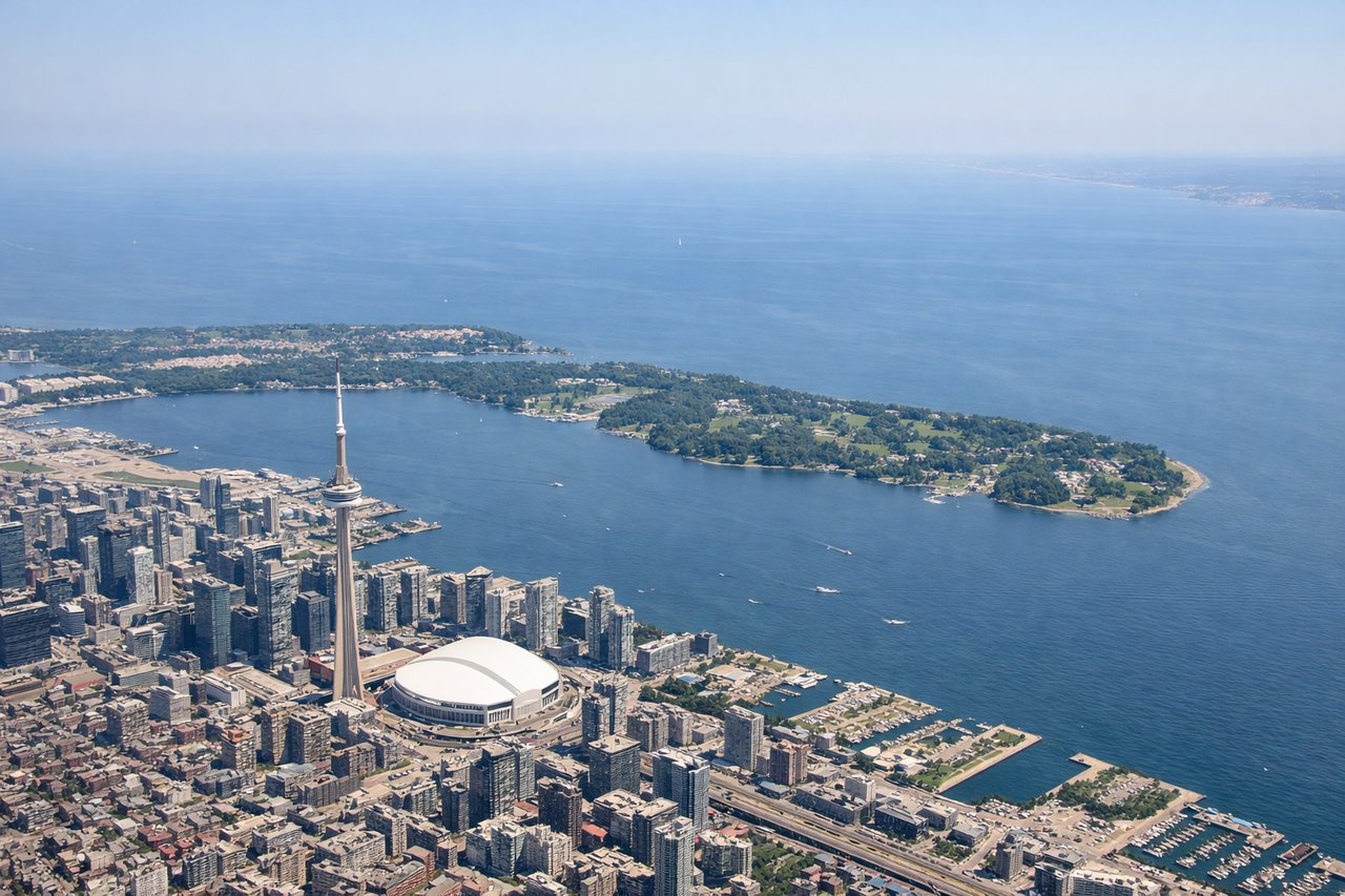
Takeoff from YYZ
LEFTLeft side offers views of Lake Ontario and the Greater Toronto Area's urban sprawl during the initial climb-out. The aircraft typically departs westbound or southwestbound, positioning left-side passengers to see the lake's northern shoreline and Toronto's downtown core receding below.
Landing at CAB
RIGHTRight-side seats provide views of the Congo River estuary and the Atlantic coastline as the aircraft descends toward Cabinda. The approach typically brings the aircraft in from the northwest over the ocean, making the right side ideal for seeing the river's massive delta system and the coastal landscape of northern Angola.
Landmarks on this routeAll landmarks →
Will your flight be in sunlight?
See exactly which side of the plane gets sun and shade at your departure time.
About This Route
Which side of the plane should I sit on flying from Lester B Pearson International (YYZ) to Cabinda (CAB)?
Sit on the Right side of the plane for the best views on flights from Toronto to Cabinda. While takeoff favors the left, the landing approach over the Congo River estuary and Atlantic coastline is the more dramatic and geographically significant portion of this long transoceanic flight. Right-side seats capture the most visually distinctive feature of the entire journey.
What can I see during takeoff from Lester B Pearson International in Toronto?
During takeoff from Lester B Pearson International (YYZ), sit on the Left side for the best views. Left side offers views of Lake Ontario and the Greater Toronto Area's urban sprawl during the initial climb-out. The aircraft typically departs westbound or southwestbound, positioning left-side passengers to see the lake's northern shoreline and Toronto's downtown core receding below. Notable sights include: Lake Ontario (northern shore), Toronto downtown skyline, Scarborough Bluffs (eastern lakeshore), Niagara Escarpment (distant, southwest).
What can I see when landing at Cabinda in Cabinda?
When landing at Cabinda (CAB), sit on the Right side for the best views. Right-side seats provide views of the Congo River estuary and the Atlantic coastline as the aircraft descends toward Cabinda. The approach typically brings the aircraft in from the northwest over the ocean, making the right side ideal for seeing the river's massive delta system and the coastal landscape of northern Angola. Notable sights include: Congo River estuary and delta (massive braided waterway system), Atlantic Ocean coastline, mangrove forests (dark green patches along river), Cabinda enclave's coastal plain.
How long is the flight from Toronto to Cabinda?
The flight from Lester B Pearson International (YYZ) to Cabinda (CAB) takes Approximately 13-14 hours (including typical routing via European airspace or direct over Atlantic).
What does the Toronto to Cabinda flight path pass over?
The flight path crosses the Atlantic Ocean for roughly 8-10 hours with no visible landmarks. Over the ocean, passengers may see the curvature of the Earth and cloud formations, but no geographic features. As the aircraft approaches the African coast near Gabon and Congo, the transition from open ocean to the dense rainforest of central Africa becomes visible, with the Congo River system appearing as a massive silvery network cutting through dark green forest canopy. The approach to Cabinda reveals the distinctive estuary system where the Congo meets the Atlantic.