While takeoff on the right offers good local views, the landing approach on the left provides more dramatic and sustained scenery—the Chattahoochee River valley and Atlanta's urban landscape are more visually distinctive than the Columbia departure. Left-side seats capture the more memorable portion of this relatively short flight.
Flown CAE to ATL? Did we get it right?
Flight Path
Colombia to Atlanta is 191 miles (307 km), a flight of about 1 hour 15 minutes.
During cruise, the flight passes over central Georgia's Piedmont region. You'll cross the Ocmulgee River valley and see the transition from South Carolina's coastal plain into Georgia's rolling, forested terrain. The landscape is predominantly wooded with scattered small towns and agricultural clearings. No major mountain ranges are visible on this route—the terrain remains relatively low and rolling throughout.
Great circle distance and headings ›Phase by phase
Takeoff from CAE
RIGHTRight-side seats offer views of the Congaree River and the broader Columbia urban area as you climb out northwestward. The river's distinctive meandering pattern is clearly visible during initial climb, and you'll see the grid of downtown Columbia and surrounding suburban sprawl.
Landing at ATL
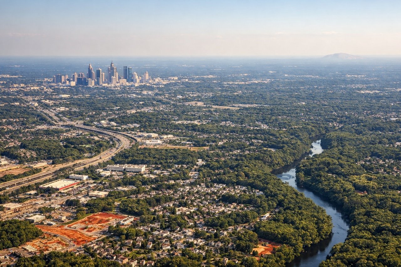
LEFTLeft-side seats provide excellent views during approach into Atlanta. You'll see the Chattahoochee River valley, the sprawling Atlanta metropolitan area, and the transition from forested terrain into the city's urban core as you descend toward Hartsfield-Jackson.
Will your flight be in sunlight?
Pick a date and time in the Sun Map to watch the sun move across your whole flight.
About This Route
Which side of the plane should I sit on flying from Columbia Metropolitan (CAE) to The William B Hartsfield Atlanta International (ATL)?
Sit on the Left side of the plane for the best views on flights from Colombia to Atlanta. While takeoff on the right offers good local views, the landing approach on the left provides more dramatic and sustained scenery—the Chattahoochee River valley and Atlanta's urban landscape are more visually distinctive than the Columbia departure. Left-side seats capture the more memorable portion of this relatively short flight.
What can I see during takeoff from Columbia Metropolitan in Colombia?
During takeoff from Columbia Metropolitan (CAE), sit on the Right side for the best views. Right-side seats offer views of the Congaree River and the broader Columbia urban area as you climb out northwestward. The river's distinctive meandering pattern is clearly visible during initial climb, and you'll see the grid of downtown Columbia and surrounding suburban sprawl. Notable sights include: Congaree River, Columbia downtown grid, Broad River confluence, suburban residential areas extending east and south.
What can I see when landing at The William B Hartsfield Atlanta International in Atlanta?
When landing at The William B Hartsfield Atlanta International (ATL), sit on the Left side for the best views. Left-side seats provide excellent views during approach into Atlanta. You'll see the Chattahoochee River valley, the sprawling Atlanta metropolitan area, and the transition from forested terrain into the city's urban core as you descend toward Hartsfield-Jackson. Notable sights include: Chattahoochee River, Atlanta downtown skyline, Piedmont plateau terrain, suburban sprawl of greater Atlanta.
How long is the flight from Colombia to Atlanta?
The flight from Columbia Metropolitan (CAE) to The William B Hartsfield Atlanta International (ATL) takes about 1 hour 15 minutes. The shortest flight path between them is 191 miles (307 km); winds and air traffic control usually add a few percent.
What does the Colombia to Atlanta flight path pass over?
During cruise, the flight passes over central Georgia's Piedmont region. You'll cross the Ocmulgee River valley and see the transition from South Carolina's coastal plain into Georgia's rolling, forested terrain. The landscape is predominantly wooded with scattered small towns and agricultural clearings. No major mountain ranges are visible on this route—the terrain remains relatively low and rolling throughout.