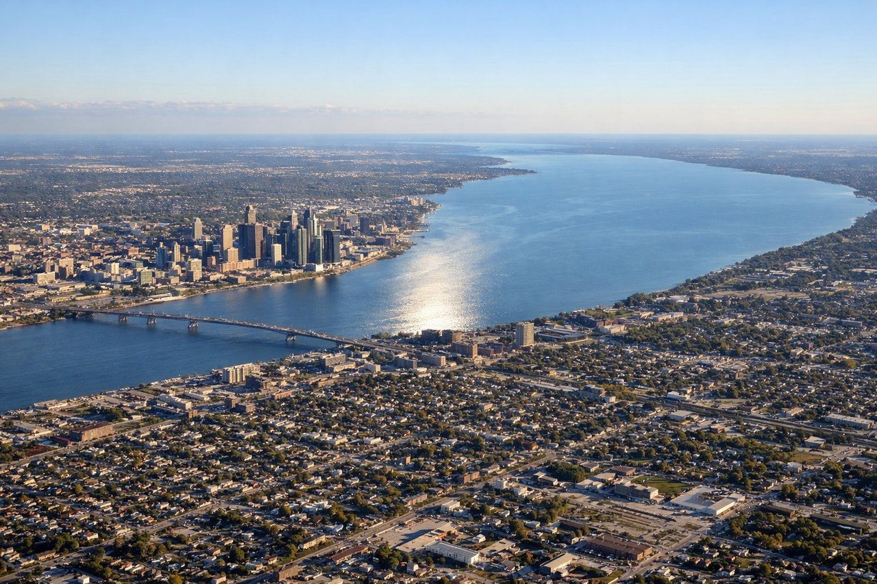
While takeoff favors the right, the landing approach into Detroit offers more dramatic and sustained water views (Lake St. Clair and Detroit River system) that dominate the final 30 minutes of flight. The left side captures the most geographically significant features of the destination.
Flown CAE to DTW? Did we get it right?
Flight Path
Colombia to Detroit is 584 miles (941 km), a flight of about 2 hours 15 minutes.
The flight path crosses the Appalachian foothills of West Virginia and Ohio (visible as rolling terrain with ridge lines), then transitions to the Great Lakes basin. You'll pass east of the Ohio River valley and west of the Allegheny Plateau. The landscape shifts from forested hills to agricultural plains as you approach Michigan. Lake Erie becomes visible on the left during descent into Detroit, with the Ohio shoreline visible on the right during the approach corridor.
Great circle distance and headings ›Phase by phase
Takeoff from CAE
RIGHTColumbia typically departs runway 11 (northeast) or 29 (southwest). Right-side seats offer views of the Congaree River floodplain and the city's eastern sprawl during northeast departures, which are more common. You'll see the transition from urban development to pine forests and wetlands as you climb.
Landing at DTW
LEFTDetroit Metro typically lands on runways 03L/03R (northeast) or 21L/21R (southwest). Left-side seats during northeast approaches offer views of Lake St. Clair and the Detroit River system. During descent, you'll see the Great Lakes shoreline, suburban sprawl patterns, and the transition from water to developed land.
Will your flight be in sunlight?
Pick a date and time in the Sun Map to watch the sun move across your whole flight.
About This Route
Which side of the plane should I sit on flying from Columbia Metropolitan (CAE) to Detroit Metro Wayne Co (DTW)?
Sit on the Left side of the plane for the best views on flights from Colombia to Detroit. While takeoff favors the right, the landing approach into Detroit offers more dramatic and sustained water views (Lake St. Clair and Detroit River system) that dominate the final 30 minutes of flight. The left side captures the most geographically significant features of the destination.
What can I see during takeoff from Columbia Metropolitan in Colombia?
During takeoff from Columbia Metropolitan (CAE), sit on the Right side for the best views. Columbia typically departs runway 11 (northeast) or 29 (southwest). Right-side seats offer views of the Congaree River floodplain and the city's eastern sprawl during northeast departures, which are more common. You'll see the transition from urban development to pine forests and wetlands as you climb. Notable sights include: Congaree River, Columbia city grid, pine forest canopy, Lake Murray (visible on westbound departures).
What can I see when landing at Detroit Metro Wayne Co in Detroit?
When landing at Detroit Metro Wayne Co (DTW), sit on the Left side for the best views. Detroit Metro typically lands on runways 03L/03R (northeast) or 21L/21R (southwest). Left-side seats during northeast approaches offer views of Lake St. Clair and the Detroit River system. During descent, you'll see the Great Lakes shoreline, suburban sprawl patterns, and the transition from water to developed land. Notable sights include: Lake St. Clair, Detroit River, Lake Erie (distant), suburban Detroit grid.
How long is the flight from Colombia to Detroit?
The flight from Columbia Metropolitan (CAE) to Detroit Metro Wayne Co (DTW) takes about 2 hours 15 minutes. The shortest flight path between them is 584 miles (941 km); winds and air traffic control usually add a few percent.
What does the Colombia to Detroit flight path pass over?
The flight path crosses the Appalachian foothills of West Virginia and Ohio (visible as rolling terrain with ridge lines), then transitions to the Great Lakes basin. You'll pass east of the Ohio River valley and west of the Allegheny Plateau. The landscape shifts from forested hills to agricultural plains as you approach Michigan. Lake Erie becomes visible on the left during descent into Detroit, with the Ohio shoreline visible on the right during the approach corridor.