While takeoff offers the unique spectacle of the Nile Delta, the landing approach into Brussels provides more sustained scenic interest with the Meuse River valley and Ardennes landscape. Right side captures the most visually distinctive terrain during descent.
Flown CAI to BRU? Did we get it right?
Flight Path
Cairo to Brussels is 1,994 miles (3,209 km), a flight of about 5 hours 15 minutes.
The flight path crosses the Mediterranean Sea (no landmarks visible), then over Greece (Peloponnese peninsula and Aegean islands visible on some routing), continues over the Balkans with the Rhodope Mountains and Danube River valley, then over Hungary's plains, and finally the Rhine valley approaching Belgium. Most of the flight crosses water or relatively featureless terrain; the most notable midpoint feature would be the Danube River valley if the aircraft passes near it, and the Rhine valley in the final approach to Western Europe.
Great circle distance and headings ›


Phase by phase
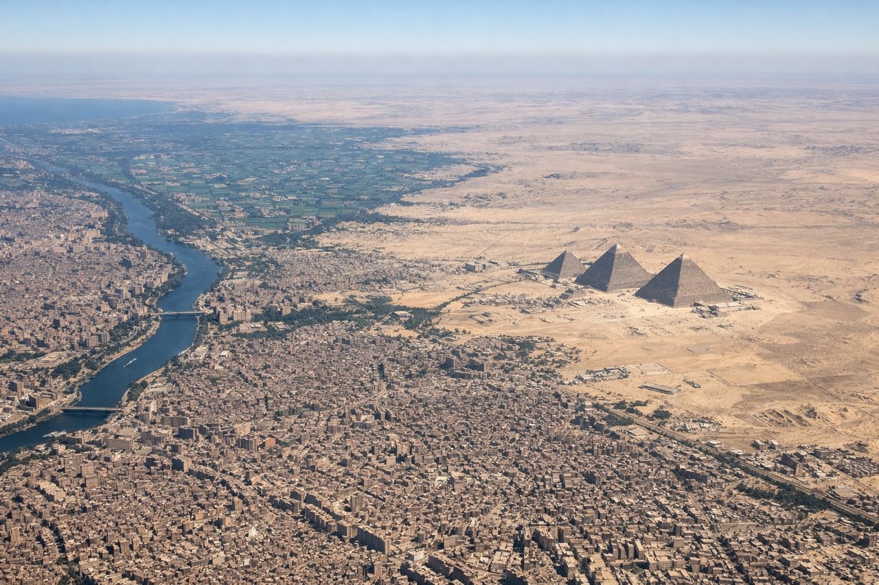
Takeoff from CAI
LEFTLeft side offers views of the Nile Delta's intricate waterways and agricultural fields immediately after departure. The delta's distinctive branching pattern and contrast between green cultivated land and desert is striking from low altitude during climb-out.
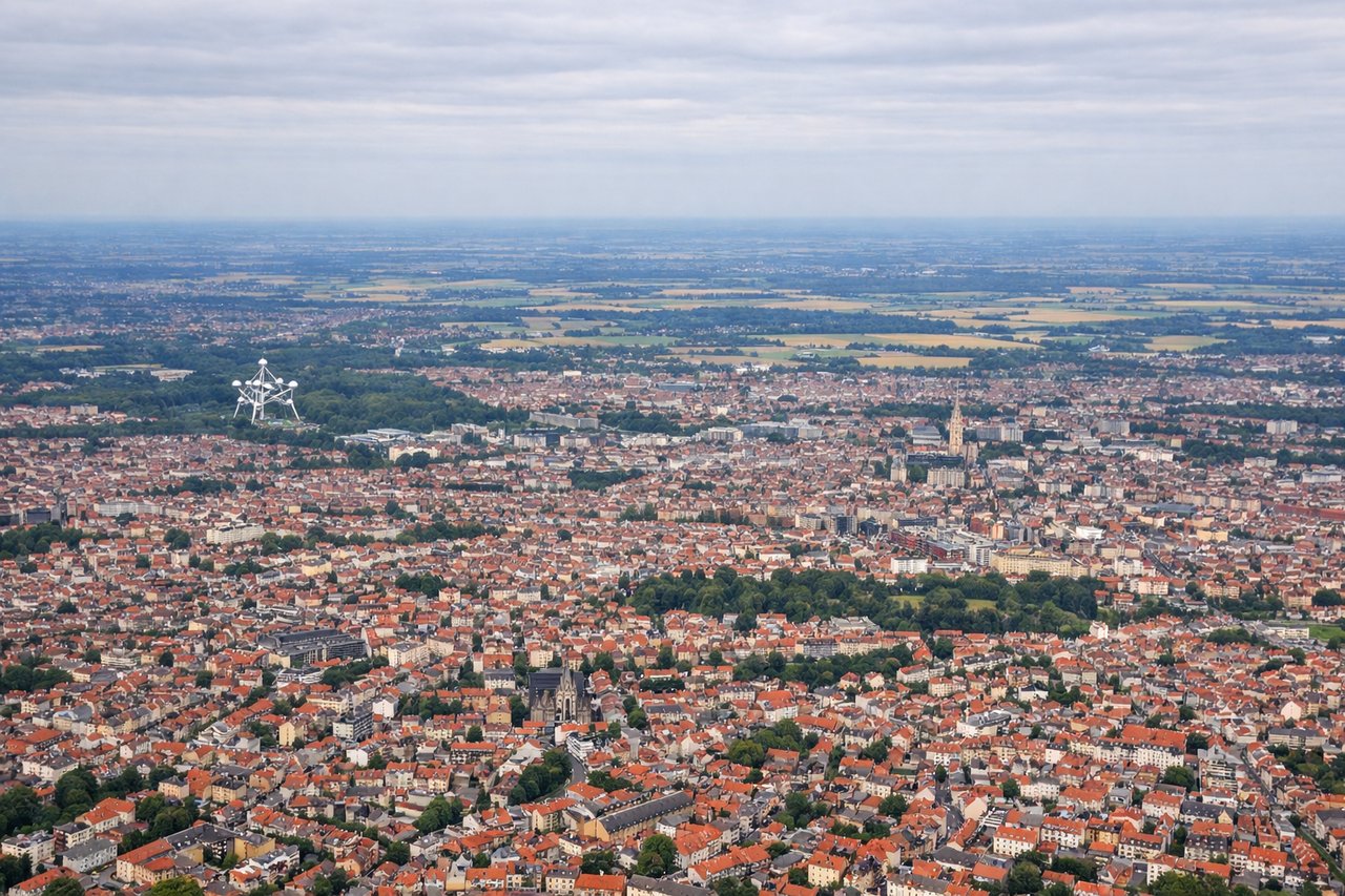
Landing at BRU
RIGHTRight side provides excellent views of the Meuse River valley and the Ardennes plateau as the aircraft descends into Brussels. The river's winding course through forested terrain and the transition from rural Belgium to suburban Brussels is visually distinctive.
Will your flight be in sunlight?
Pick a date and time in the Sun Map to watch the sun move across your whole flight.
About This Route
Which side of the plane should I sit on flying from Cairo International (CAI) to Brussels Natl (BRU)?
Sit on the Right side of the plane for the best views on flights from Cairo to Brussels. While takeoff offers the unique spectacle of the Nile Delta, the landing approach into Brussels provides more sustained scenic interest with the Meuse River valley and Ardennes landscape. Right side captures the most visually distinctive terrain during descent.
What can I see during takeoff from Cairo International in Cairo?
During takeoff from Cairo International (CAI), sit on the Left side for the best views. Left side offers views of the Nile Delta's intricate waterways and agricultural fields immediately after departure. The delta's distinctive branching pattern and contrast between green cultivated land and desert is striking from low altitude during climb-out. Notable sights include: Nile Delta with its fan-shaped irrigation channels, Cairo city sprawl to the south, Mediterranean Sea coastline to the north, desert plateau to the west.
What can I see when landing at Brussels Natl in Brussels?
When landing at Brussels Natl (BRU), sit on the Right side for the best views. Right side provides excellent views of the Meuse River valley and the Ardennes plateau as the aircraft descends into Brussels. The river's winding course through forested terrain and the transition from rural Belgium to suburban Brussels is visually distinctive. Notable sights include: Meuse River with its meandering course, Ardennes forest plateau, Brussels urban sprawl and city center, Scheldt River valley to the north.
How long is the flight from Cairo to Brussels?
The flight from Cairo International (CAI) to Brussels Natl (BRU) takes about 5 hours 15 minutes. The shortest flight path between them is 1,994 miles (3,209 km); winds and air traffic control usually add a few percent.
What does the Cairo to Brussels flight path pass over?
The flight path crosses the Mediterranean Sea (no landmarks visible), then over Greece (Peloponnese peninsula and Aegean islands visible on some routing), continues over the Balkans with the Rhodope Mountains and Danube River valley, then over Hungary's plains, and finally the Rhine valley approaching Belgium. Most of the flight crosses water or relatively featureless terrain; the most notable midpoint feature would be the Danube River valley if the aircraft passes near it, and the Rhine valley in the final approach to Western Europe.