While takeoff offers excellent desert and delta views on the right, the landing approach provides more dramatic and sustained visual interest with the Hooghly River's distinctive meanders and Calcutta's urban character. Left-side seats capture the most geographically significant feature of the approach.
Flown CAI to CCU? Did we get it right?
Flight Path
Cairo to Calcutta is 3,533 miles (5,686 km), a flight of about 7 hours 10 minutes.
The flight path crosses the Rajasthan Desert (sparse, tan landscape with occasional settlements), then transitions over the Indo-Gangetic Plain with increasing green agricultural fields and scattered towns. The Ganges River system becomes visible in the final approach phase. Major cities passed near but not directly overhead include Jaipur (to the south of typical routing) and various towns across Uttar Pradesh and Bihar. The landscape transitions from arid to increasingly humid and green as you move eastward toward the Ganges delta region.
Great circle distance and headings ›


Phase by phase
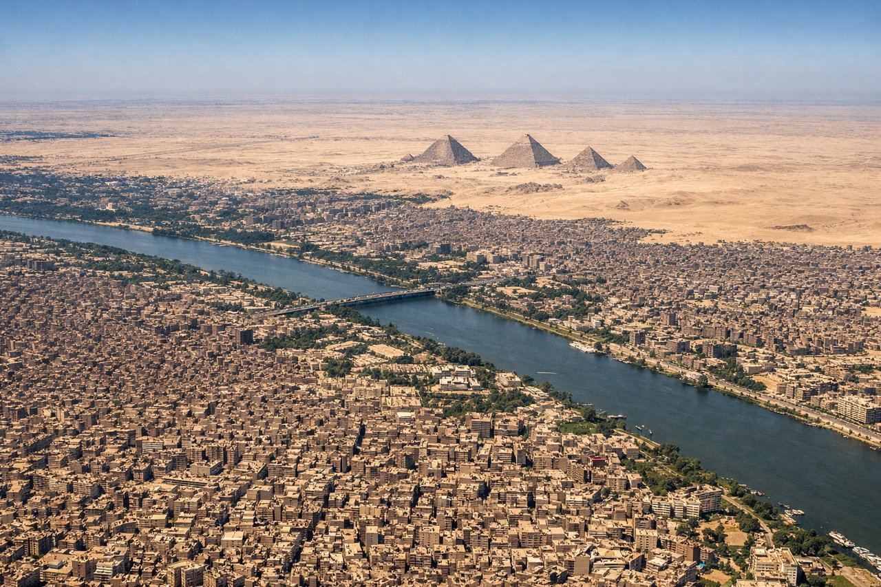
Takeoff from CAI
RIGHTCairo International typically departs eastbound (runways 05R/05L). Right-side seats offer views of the Nile Delta's irrigation channels and the sprawling Cairo metropolitan area receding westward, with the desert plateau becoming visible as you climb.
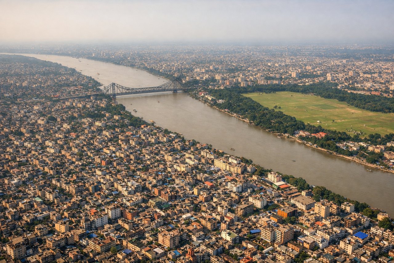
Landing at CCU
LEFTCalcutta's Netaji Subhash Chandra Bose airport typically uses runways 10/28. Westbound approaches (runway 10) give left-side views of the Hooghly River's dramatic meanders and the city's eastern sprawl along the river. The river's oxbow bends and industrial areas are striking from altitude.
Will your flight be in sunlight?
Pick a date and time in the Sun Map to watch the sun move across your whole flight.
About This Route
Which side of the plane should I sit on flying from Cairo International (CAI) to Netaji Subhash Chandra Bose International (CCU)?
Sit on the Left side of the plane for the best views on flights from Cairo to Calcutta. While takeoff offers excellent desert and delta views on the right, the landing approach provides more dramatic and sustained visual interest with the Hooghly River's distinctive meanders and Calcutta's urban character. Left-side seats capture the most geographically significant feature of the approach.
What can I see during takeoff from Cairo International in Cairo?
During takeoff from Cairo International (CAI), sit on the Right side for the best views. Cairo International typically departs eastbound (runways 05R/05L). Right-side seats offer views of the Nile Delta's irrigation channels and the sprawling Cairo metropolitan area receding westward, with the desert plateau becoming visible as you climb. Notable sights include: Nile River Delta with its distinctive fan-shaped irrigation grid, Cairo city sprawl (particularly visible around Helwan to the south), Eastern Desert plateau edge, Suez Canal corridor in the distance to the northeast.
What can I see when landing at Netaji Subhash Chandra Bose International in Calcutta?
When landing at Netaji Subhash Chandra Bose International (CCU), sit on the Left side for the best views. Calcutta's Netaji Subhash Chandra Bose airport typically uses runways 10/28. Westbound approaches (runway 10) give left-side views of the Hooghly River's dramatic meanders and the city's eastern sprawl along the river. The river's oxbow bends and industrial areas are striking from altitude. Notable sights include: Hooghly River with its distinctive meandering oxbow loops, Calcutta city sprawl (eastern districts), Sundarbans mangrove forest edge to the south, industrial zones and docks along the river.
How long is the flight from Cairo to Calcutta?
The flight from Cairo International (CAI) to Netaji Subhash Chandra Bose International (CCU) takes about 7 hours 10 minutes. The shortest flight path between them is 3,533 miles (5,686 km); winds and air traffic control usually add a few percent.
What does the Cairo to Calcutta flight path pass over?
The flight path crosses the Rajasthan Desert (sparse, tan landscape with occasional settlements), then transitions over the Indo-Gangetic Plain with increasing green agricultural fields and scattered towns. The Ganges River system becomes visible in the final approach phase. Major cities passed near but not directly overhead include Jaipur (to the south of typical routing) and various towns across Uttar Pradesh and Bihar. The landscape transitions from arid to increasingly humid and green as you move eastward toward the Ganges delta region.