The Cairo departure offers more distinctive geographical features (Nile Delta, river system, urban concentration) than the Dallas landing, which is dominated by flat suburban sprawl. While neither side is dramatically scenic, the Nile Delta's unique morphology and Cairo's concentrated urban footprint provide more visual interest than Texas prairie and generic metropolitan expansion.
Flown CAI to DFW? Did we get it right?
Flight Path
Cairo to Dallas-Fort Worth is 6,931 miles (11,154 km), a flight of about 10 hours 15 minutes.
Atlantic Ocean crossing (5+ hours of open water with minimal landmarks), Azores archipelago potentially visible if flight path passes south, Appalachian Mountains on approach to North America, Mississippi River valley in central United States
Great circle distance and headings ›


Phase by phase
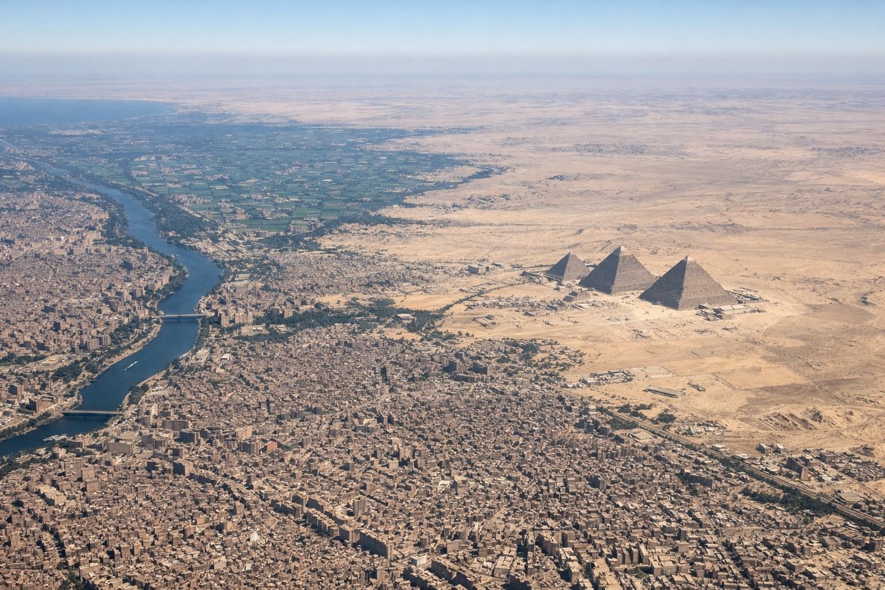
Takeoff from CAI
LEFTLeft side captures Cairo's urban sprawl and the Nile Delta during departure, with the river's distinctive fan-shaped delta visible from altitude. Right side offers only desert and open Mediterranean.
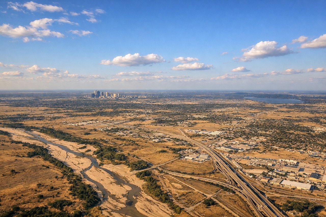
Landing at DFW
RIGHTRight side (north-facing approach to DFW) reveals the Fort Worth-Dallas metropolitan area, urban sprawl, and the Trinity River system. Left side shows only flat Texas prairie and open farmland with minimal visual interest.
Will your flight be in sunlight?
Pick a date and time in the Sun Map to watch the sun move across your whole flight.
About This Route
Which side of the plane should I sit on flying from Cairo International (CAI) to Dallas Fort Worth International (DFW)?
Sit on the Left side of the plane for the best views on flights from Cairo to Dallas-Fort Worth. The Cairo departure offers more distinctive geographical features (Nile Delta, river system, urban concentration) than the Dallas landing, which is dominated by flat suburban sprawl. While neither side is dramatically scenic, the Nile Delta's unique morphology and Cairo's concentrated urban footprint provide more visual interest than Texas prairie and generic metropolitan expansion.
What can I see during takeoff from Cairo International in Cairo?
During takeoff from Cairo International (CAI), sit on the Left side for the best views. Left side captures Cairo's urban sprawl and the Nile Delta during departure, with the river's distinctive fan-shaped delta visible from altitude. Right side offers only desert and open Mediterranean. Notable sights include: Nile River and delta, Cairo metropolitan area, Mediterranean coastline to the north.
What can I see when landing at Dallas Fort Worth International in Dallas-Fort Worth?
When landing at Dallas Fort Worth International (DFW), sit on the Right side for the best views. Right side (north-facing approach to DFW) reveals the Fort Worth-Dallas metropolitan area, urban sprawl, and the Trinity River system. Left side shows only flat Texas prairie and open farmland with minimal visual interest. Notable sights include: Dallas-Fort Worth metropolitan skyline, Trinity River, Lake Lewisville to the north, suburban grid pattern.
How long is the flight from Cairo to Dallas-Fort Worth?
The flight from Cairo International (CAI) to Dallas Fort Worth International (DFW) takes about 10 hours 15 minutes. The shortest flight path between them is 6,931 miles (11,154 km); winds and air traffic control usually add a few percent.
What does the Cairo to Dallas-Fort Worth flight path pass over?
Atlantic Ocean crossing (5+ hours of open water with minimal landmarks), Azores archipelago potentially visible if flight path passes south, Appalachian Mountains on approach to North America, Mississippi River valley in central United States