Left side scores higher due to superior scenery at both takeoff and landing. Cairo's Nile Delta and urban landscape provide engaging departure views, while Johannesburg's approach over the Witwatersrand ridge, mining landscape, and city skyline delivers more visual drama than the featureless highveld visible from the right. The cruise phase over central Africa favors neither side significantly, but the bookend sequences strongly favor left.
Flown CAI to JNB? Did we get it right?
Flight Path
Cairo to Johannesburg is 3,892 miles (6,264 km), a flight of about 7 hours 15 minutes.
Zambezi River valley (northern Zimbabwe/Zambia border region), Victoria Falls area (visible on clear days), Kalahari semi-arid transition zone, Limpopo River valley, central African savanna and woodland plateau
Great circle distance and headings ›Phase by phase
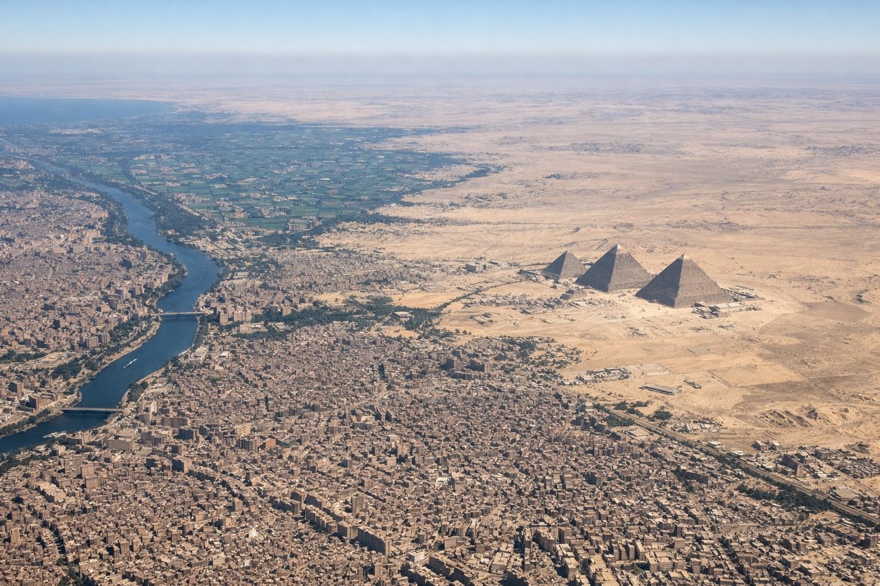
Takeoff from CAI
LEFTLeft side captures Cairo's urban sprawl and the Nile Delta during initial climb. The Nile's distinctive green ribbon and Cairo's dense cityscape provide immediate visual interest as the aircraft banks southward. Right side faces the Eastern Desert plateau—flat, featureless terrain with minimal landmarks.
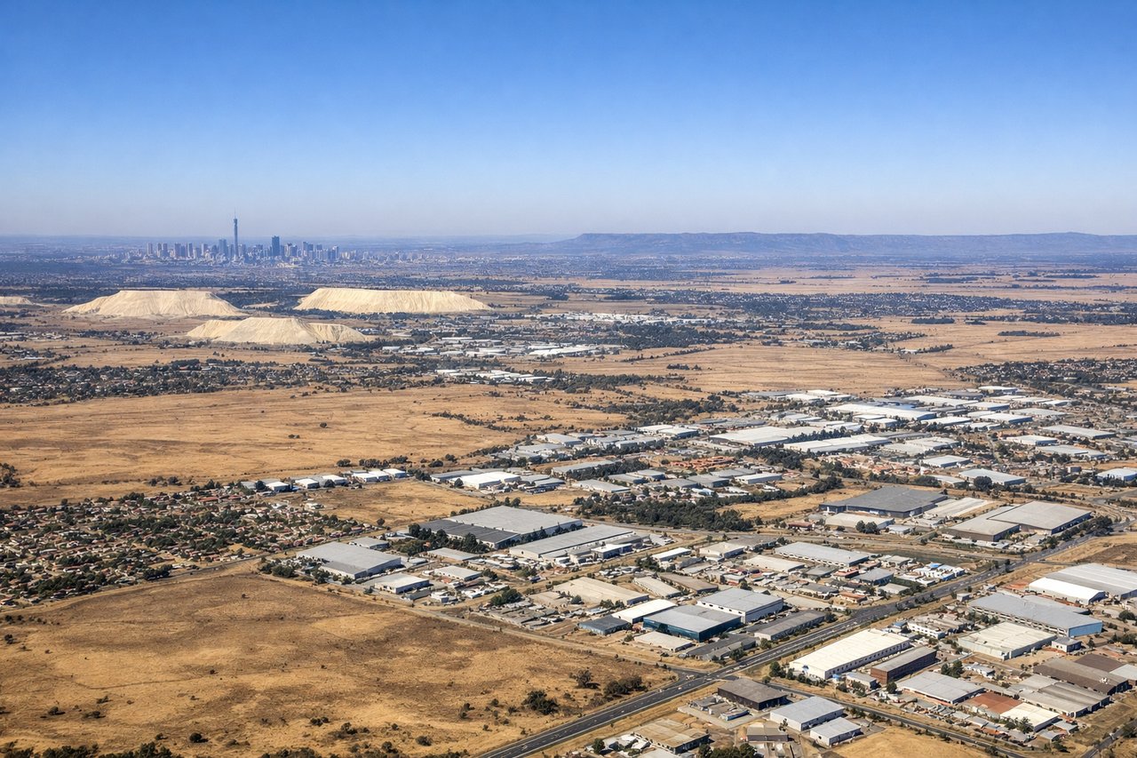
Landing at JNB
LEFTLeft side offers superior approach scenery into Johannesburg. The descent path crosses the Witwatersrand ridge and the city's northern suburbs, providing views of urban development, mining remnants (visible as geometric scars), and the transition from highveld grassland to metropolitan sprawl. Right side faces open highveld plateau with minimal visual variation.
Will your flight be in sunlight?
Pick a date and time in the Sun Map to watch the sun move across your whole flight.
About This Route
Which side of the plane should I sit on flying from Cairo International (CAI) to O.R. Tambo International Airport (JNB)?
Sit on the Left side of the plane for the best views on flights from Cairo to Johannesburg. Left side scores higher due to superior scenery at both takeoff and landing. Cairo's Nile Delta and urban landscape provide engaging departure views, while Johannesburg's approach over the Witwatersrand ridge, mining landscape, and city skyline delivers more visual drama than the featureless highveld visible from the right. The cruise phase over central Africa favors neither side significantly, but the bookend sequences strongly favor left.
What can I see during takeoff from Cairo International in Cairo?
During takeoff from Cairo International (CAI), sit on the Left side for the best views. Left side captures Cairo's urban sprawl and the Nile Delta during initial climb. The Nile's distinctive green ribbon and Cairo's dense cityscape provide immediate visual interest as the aircraft banks southward. Right side faces the Eastern Desert plateau—flat, featureless terrain with minimal landmarks. Notable sights include: Nile River Delta with its branching channels, Cairo metropolitan area, Suez Canal corridor (visible in distance on clear days), Eastern Desert plateau.
What can I see when landing at O.R. Tambo International Airport in Johannesburg?
When landing at O.R. Tambo International Airport (JNB), sit on the Left side for the best views. Left side offers superior approach scenery into Johannesburg. The descent path crosses the Witwatersrand ridge and the city's northern suburbs, providing views of urban development, mining remnants (visible as geometric scars), and the transition from highveld grassland to metropolitan sprawl. Right side faces open highveld plateau with minimal visual variation. Notable sights include: Witwatersrand ridge, Johannesburg northern suburbs and CBD skyline, mining tailings and excavation patterns, highveld grassland plateau.
How long is the flight from Cairo to Johannesburg?
The flight from Cairo International (CAI) to O.R. Tambo International Airport (JNB) takes about 7 hours 15 minutes. The shortest flight path between them is 3,892 miles (6,264 km); winds and air traffic control usually add a few percent.
What does the Cairo to Johannesburg flight path pass over?
Zambezi River valley (northern Zimbabwe/Zambia border region), Victoria Falls area (visible on clear days), Kalahari semi-arid transition zone, Limpopo River valley, central African savanna and woodland plateau