While takeoff offers the unique spectacle of the Nile Delta, the landing approach into Seattle provides more dramatic and iconic scenery with Mount Rainier and the Cascade Range. The left side captures these snow-capped peaks during descent, which is the more visually striking portion of this long transoceanic flight.
Flown CAI to SEA? Did we get it right?
Flight Path
Cairo to Seattle is 6,834 miles (10,998 km), a flight of about 13 hours 10 minutes.
This route typically routes northwest over the Mediterranean, then across southern Europe (Alps visible on clear days), over the Atlantic, and approaches North America over Greenland or northern Canada. Notable features along the path include the Alps (if routed through Europe), the Atlantic Ocean, and the Canadian Rockies or northern US mountain ranges before descent into Seattle. The actual routing depends on prevailing winds and air traffic control; northerly routes may pass over Greenland's ice sheet.
Great circle distance and headings ›


Phase by phase
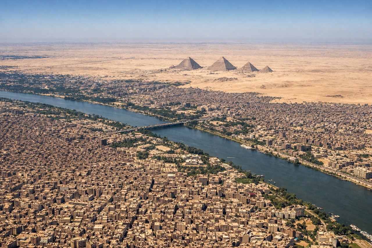
Takeoff from CAI
RIGHTRight-side seats offer views of the Nile Delta's intricate waterway network and agricultural fields immediately after departure. The delta's distinctive fan-shaped pattern of canals and green cultivated land contrasts sharply with the surrounding desert.
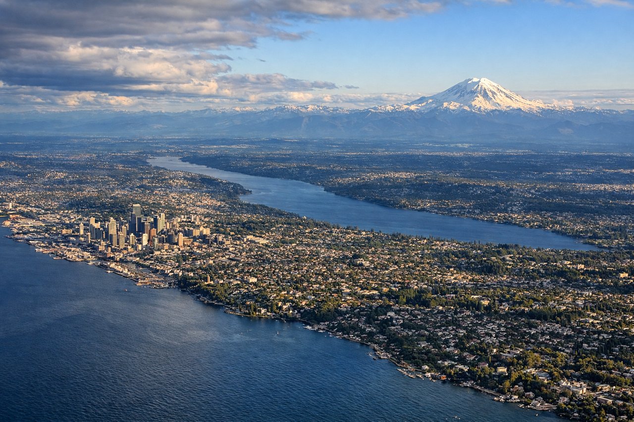
Landing at SEA
LEFTLeft-side seats provide excellent views of the Cascade Range and Mount Rainier during the descent into Seattle. These snow-capped peaks dominate the landscape southeast of the airport and are visible during final approach from most angles.
Will your flight be in sunlight?
Pick a date and time in the Sun Map to watch the sun move across your whole flight.
About This Route
Which side of the plane should I sit on flying from Cairo International (CAI) to Seattle Tacoma International (SEA)?
Sit on the Left side of the plane for the best views on flights from Cairo to Seattle. While takeoff offers the unique spectacle of the Nile Delta, the landing approach into Seattle provides more dramatic and iconic scenery with Mount Rainier and the Cascade Range. The left side captures these snow-capped peaks during descent, which is the more visually striking portion of this long transoceanic flight.
What can I see during takeoff from Cairo International in Cairo?
During takeoff from Cairo International (CAI), sit on the Right side for the best views. Right-side seats offer views of the Nile Delta's intricate waterway network and agricultural fields immediately after departure. The delta's distinctive fan-shaped pattern of canals and green cultivated land contrasts sharply with the surrounding desert. Notable sights include: Nile Delta irrigation channels, Cairo urban sprawl to the west, Mediterranean Sea coastline (northern horizon), desert plateau to the east.
What can I see when landing at Seattle Tacoma International in Seattle?
When landing at Seattle Tacoma International (SEA), sit on the Left side for the best views. Left-side seats provide excellent views of the Cascade Range and Mount Rainier during the descent into Seattle. These snow-capped peaks dominate the landscape southeast of the airport and are visible during final approach from most angles. Notable sights include: Mount Rainier (14,410 ft, snow-capped), Cascade Range peaks, Puget Sound waterway, Seattle urban area.
How long is the flight from Cairo to Seattle?
The flight from Cairo International (CAI) to Seattle Tacoma International (SEA) takes about 13 hours 10 minutes. The shortest flight path between them is 6,834 miles (10,998 km); winds and air traffic control usually add a few percent.
What does the Cairo to Seattle flight path pass over?
This route typically routes northwest over the Mediterranean, then across southern Europe (Alps visible on clear days), over the Atlantic, and approaches North America over Greenland or northern Canada. Notable features along the path include the Alps (if routed through Europe), the Atlantic Ocean, and the Canadian Rockies or northern US mountain ranges before descent into Seattle. The actual routing depends on prevailing winds and air traffic control; northerly routes may pass over Greenland's ice sheet.