The right side offers more terrain variety across the flight — the Pearl River Delta and Guangzhou skyline at departure, glimpses of Myanmar's highlands during cruise, and Sri Lanka's central hill country on arrival — while the left side is dominated by long stretches of open water over the Gulf of Thailand, Andaman Sea, and Bay of Bengal.
Flown CAN to CMB? Did we get it right?
Flight Path
Guangzhou to Colombo is 2,483 miles (3,995 km), a flight of about 6 hours 5 minutes.
Gulf of Tonkin, northern Vietnam highlands, Andaman Sea, Bay of Bengal, and the southern tip of India near the Palk Strait
Great circle distance and headings ›

Phase by phase
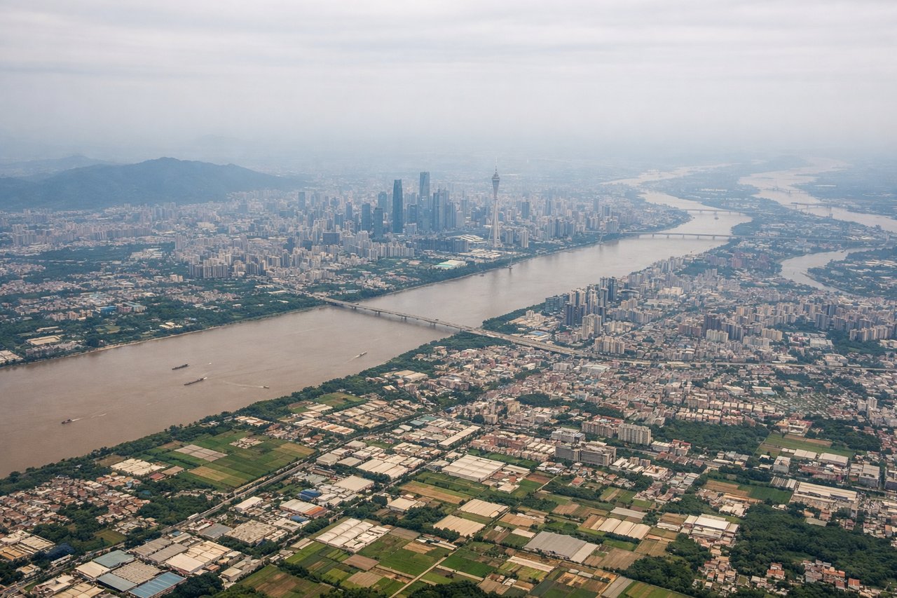
Takeoff from CAN
RIGHTDeparting CAN to the south before turning west, the right side gives a clear look back at Guangzhou's dense skyline, the Pearl River Delta, and Baiyun Mountain, while the left side mostly shows flatter agricultural land toward the coast.
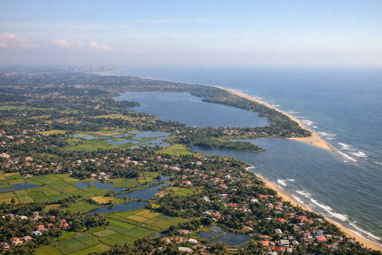
Landing at CMB
RIGHTOn approach into CMB, the right side typically overlooks Sri Lanka's interior, offering glimpses of the central highlands including the silhouette of Adam's Peak on clearer days, before the turn onto final over flatter coastal plain.
Will your flight be in sunlight?
Pick a date and time in the Sun Map to watch the sun move across your whole flight.
About This Route
Which side of the plane should I sit on flying from Guangzhou Baiyun International Airport (CAN) to Bandaranaike International (CMB)?
Sit on the Right side of the plane for the best views on flights from Guangzhou to Colombo. The right side offers more terrain variety across the flight — the Pearl River Delta and Guangzhou skyline at departure, glimpses of Myanmar's highlands during cruise, and Sri Lanka's central hill country on arrival — while the left side is dominated by long stretches of open water over the Gulf of Thailand, Andaman Sea, and Bay of Bengal.
What can I see during takeoff from Guangzhou Baiyun International Airport in Guangzhou?
During takeoff from Guangzhou Baiyun International Airport (CAN), sit on the Right side for the best views. Departing CAN to the south before turning west, the right side gives a clear look back at Guangzhou's dense skyline, the Pearl River Delta, and Baiyun Mountain, while the left side mostly shows flatter agricultural land toward the coast. Notable sights include: Guangzhou skyline, Pearl River Delta, Baiyun Mountain, Foshan urban sprawl.
What can I see when landing at Bandaranaike International in Colombo?
When landing at Bandaranaike International (CMB), sit on the Right side for the best views. On approach into CMB, the right side typically overlooks Sri Lanka's interior, offering glimpses of the central highlands including the silhouette of Adam's Peak on clearer days, before the turn onto final over flatter coastal plain. Notable sights include: Sri Lankan central highlands, Adam's Peak silhouette, Kelani River valley, Colombo's coastal plain.
How long is the flight from Guangzhou to Colombo?
The flight from Guangzhou Baiyun International Airport (CAN) to Bandaranaike International (CMB) takes about 6 hours 5 minutes. The shortest flight path between them is 2,483 miles (3,995 km); winds and air traffic control usually add a few percent.
What does the Guangzhou to Colombo flight path pass over?
Gulf of Tonkin, northern Vietnam highlands, Andaman Sea, Bay of Bengal, and the southern tip of India near the Palk Strait