Right-side seats capture the more dramatic geography: the Hooghly estuary and Sundarbans on departure are visually distinctive, while the Mahanadi delta on approach is also well-positioned. The right side provides better continuity of river and delta features across the flight.
Flown CCU to BBI? Did we get it right?
Flight Path
Calcutta to Bhubaneswar is 237 miles (382 km), a flight of about 50 minutes.
The flight path crosses the Odisha coastal plains and passes near or over Balasore district. The terrain transitions from the Hooghly delta region through flat alluvial plains with scattered lakes and water bodies. Chilika Lake (India's largest coastal lagoon) lies to the south of the direct flight path but may be visible from altitude on clear days. The landscape is predominantly agricultural with sparse urban development until approach to Bhubaneswar.
Great circle distance and headings ›Phase by phase
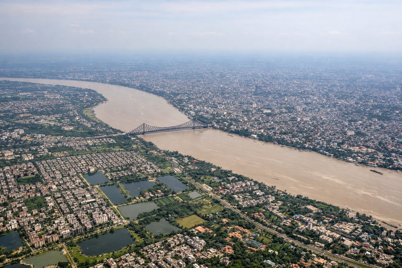
Takeoff from CCU
RIGHTCCU typically departs eastbound (Runway 10/28 favors eastbound operations). Right-side seats face the Hooghly River estuary and the Sundarbans delta region immediately after climb-out, offering clear views of the river's braided channels and wetlands.
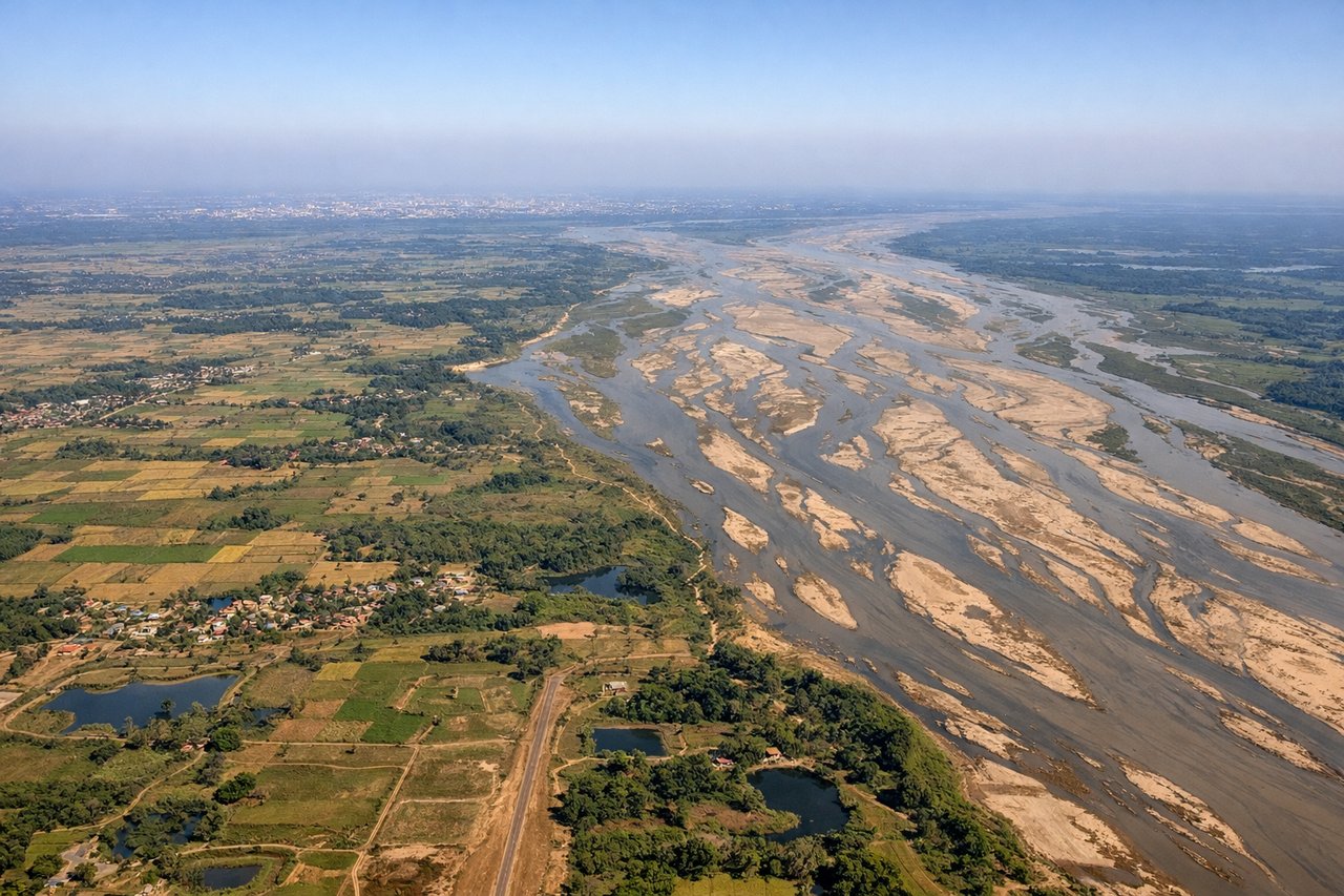
Landing at BBI
LEFTBBI typically uses Runway 10/28 with approaches from the west. Left-side seats during descent offer views of the Mahanadi River delta and the coastal plains approaching Bhubaneswar. The river's distinctive wide delta and surrounding agricultural landscape are prominent on final approach.
Will your flight be in sunlight?
Pick a date and time in the Sun Map to watch the sun move across your whole flight.
About This Route
Which side of the plane should I sit on flying from Netaji Subhash Chandra Bose International (CCU) to Bhubaneshwar (BBI)?
Sit on the Right side of the plane for the best views on flights from Calcutta to Bhubaneswar. Right-side seats capture the more dramatic geography: the Hooghly estuary and Sundarbans on departure are visually distinctive, while the Mahanadi delta on approach is also well-positioned. The right side provides better continuity of river and delta features across the flight.
What can I see during takeoff from Netaji Subhash Chandra Bose International in Calcutta?
During takeoff from Netaji Subhash Chandra Bose International (CCU), sit on the Right side for the best views. CCU typically departs eastbound (Runway 10/28 favors eastbound operations). Right-side seats face the Hooghly River estuary and the Sundarbans delta region immediately after climb-out, offering clear views of the river's braided channels and wetlands. Notable sights include: Hooghly River estuary, Sundarbans mangrove delta, Kolkata urban sprawl to the west, Hooghly Point industrial zone.
What can I see when landing at Bhubaneshwar in Bhubaneswar?
When landing at Bhubaneshwar (BBI), sit on the Left side for the best views. BBI typically uses Runway 10/28 with approaches from the west. Left-side seats during descent offer views of the Mahanadi River delta and the coastal plains approaching Bhubaneswar. The river's distinctive wide delta and surrounding agricultural landscape are prominent on final approach. Notable sights include: Mahanadi River delta, Chilika Lake (partially visible to the south), Bhubaneswar city grid, coastal Odisha plains.
How long is the flight from Calcutta to Bhubaneswar?
The flight from Netaji Subhash Chandra Bose International (CCU) to Bhubaneshwar (BBI) takes about 50 minutes. The shortest flight path between them is 237 miles (382 km); winds and air traffic control usually add a few percent.
What does the Calcutta to Bhubaneswar flight path pass over?
The flight path crosses the Odisha coastal plains and passes near or over Balasore district. The terrain transitions from the Hooghly delta region through flat alluvial plains with scattered lakes and water bodies. Chilika Lake (India's largest coastal lagoon) lies to the south of the direct flight path but may be visible from altitude on clear days. The landscape is predominantly agricultural with sparse urban development until approach to Bhubaneswar.