Right-side seats capture the superior views at both ends: Kolkata's river delta and urban geography during departure, and the approach to Bali's volcanic interior and strait during descent. The midpoint crossing over the Bay of Bengal and Java Sea offers less distinctive features from either side, making the endpoint advantages decisive.
Flown CCU to DPS? Did we get it right?
Flight Path
Calcutta to Denpasar is 2,824 miles (4,545 km), a flight of about 5 hours 55 minutes.
Bay of Bengal (open water, few landmarks), Java Sea (open water with scattered shipping lanes), northern coast of Java visible as a distant low landmass with occasional river deltas, Sunda Strait region (between Java and Sumatra) may be visible on southerly routing, scattered islands of the Java archipelago appearing as small dark specks against blue water
Great circle distance and headings ›

Phase by phase
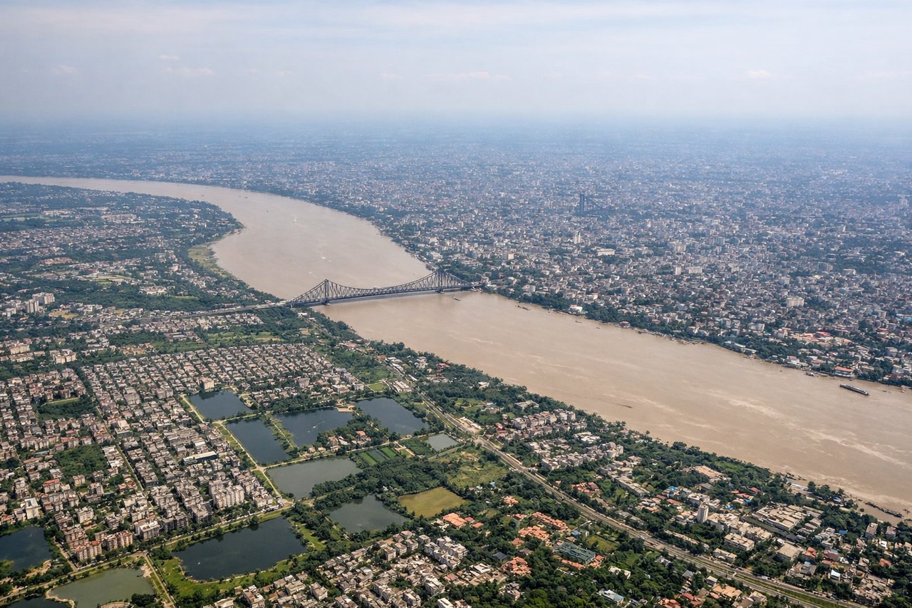
Takeoff from CCU
RIGHTCCU typically departs eastbound (Runway 09) or westbound (Runway 27). Right-side seats offer views of the Hooghly River delta and the sprawling urban grid of Kolkata during initial climb. The river's meandering channels and wetland complexes are distinctive from altitude.
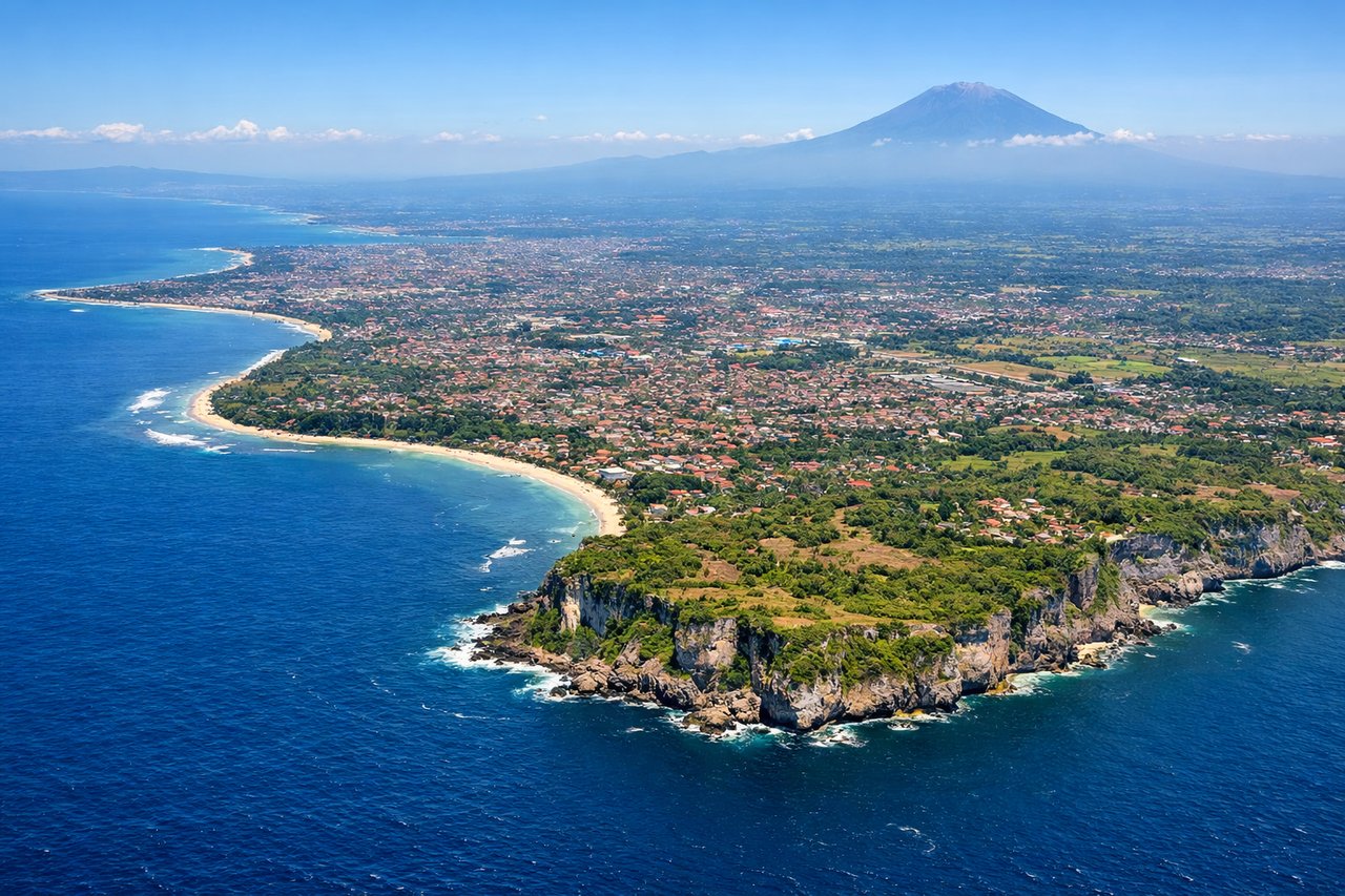
Landing at DPS
LEFTDPS typically lands westbound (Runway 09) or eastbound (Runway 27). Left-side seats during descent offer views of the Lombok Strait, the volcanic peaks of Bali's interior (Mount Agung and Mount Batur), and the island's distinctive north-south ridge topography. The strait separates Bali from Lombok and is a striking geographic feature.
Will your flight be in sunlight?
Pick a date and time in the Sun Map to watch the sun move across your whole flight.
About This Route
Which side of the plane should I sit on flying from Netaji Subhash Chandra Bose International (CCU) to Denpasar I Gusti Ngurah Rai International Airport (DPS)?
Sit on the Right side of the plane for the best views on flights from Calcutta to Denpasar. Right-side seats capture the superior views at both ends: Kolkata's river delta and urban geography during departure, and the approach to Bali's volcanic interior and strait during descent. The midpoint crossing over the Bay of Bengal and Java Sea offers less distinctive features from either side, making the endpoint advantages decisive.
What can I see during takeoff from Netaji Subhash Chandra Bose International in Calcutta?
During takeoff from Netaji Subhash Chandra Bose International (CCU), sit on the Right side for the best views. CCU typically departs eastbound (Runway 09) or westbound (Runway 27). Right-side seats offer views of the Hooghly River delta and the sprawling urban grid of Kolkata during initial climb. The river's meandering channels and wetland complexes are distinctive from altitude. Notable sights include: Hooghly River delta with its braided channels, Kolkata urban sprawl extending south and east, Salt Lake City district (rectilinear layout visible from above), Eastern Bypass corridor.
What can I see when landing at Denpasar I Gusti Ngurah Rai International Airport in Denpasar?
When landing at Denpasar I Gusti Ngurah Rai International Airport (DPS), sit on the Left side for the best views. DPS typically lands westbound (Runway 09) or eastbound (Runway 27). Left-side seats during descent offer views of the Lombok Strait, the volcanic peaks of Bali's interior (Mount Agung and Mount Batur), and the island's distinctive north-south ridge topography. The strait separates Bali from Lombok and is a striking geographic feature. Notable sights include: Mount Agung (3,142 m, Bali's highest volcano), Mount Batur (1,717 m, active volcano with caldera lake), Lombok Strait (deep water channel between islands), Bali's terraced agricultural landscape on slopes.
How long is the flight from Calcutta to Denpasar?
The flight from Netaji Subhash Chandra Bose International (CCU) to Denpasar I Gusti Ngurah Rai International Airport (DPS) takes about 5 hours 55 minutes. The shortest flight path between them is 2,824 miles (4,545 km); winds and air traffic control usually add a few percent.
What does the Calcutta to Denpasar flight path pass over?
Bay of Bengal (open water, few landmarks), Java Sea (open water with scattered shipping lanes), northern coast of Java visible as a distant low landmass with occasional river deltas, Sunda Strait region (between Java and Sumatra) may be visible on southerly routing, scattered islands of the Java archipelago appearing as small dark specks against blue water