The left side offers the only real variety on this route: a river-and-city view during the Kolkata departure, a stretch over the Eastern Ghats hills near the Odisha-Andhra border mid-flight, and lake and fort scenery on the Hyderabad approach. The right side stays over flat interior plains for nearly the entire flight.
Flown CCU to HYD? Did we get it right?
Flight Path
Calcutta to Hyderabad is 750 miles (1,208 km), a flight of about 1 hour 55 minutes.
The route crosses southern Odisha and the Eastern Ghats hill country near Koraput before descending toward the Godavari River basin and the Telangana plateau approaching Hyderabad.
Great circle distance and headings ›Phase by phase

Takeoff from CCU
LEFTDeparting CCU on runway 19 the aircraft climbs south over Kolkata before banking west toward Hyderabad, giving left-side passengers a good look at the Hooghly River, its bridges, and the dense city grid before the turn. The right side shows only the flatter eastern suburbs and rural Bengal delta with no comparable landmarks.
Landing at HYD
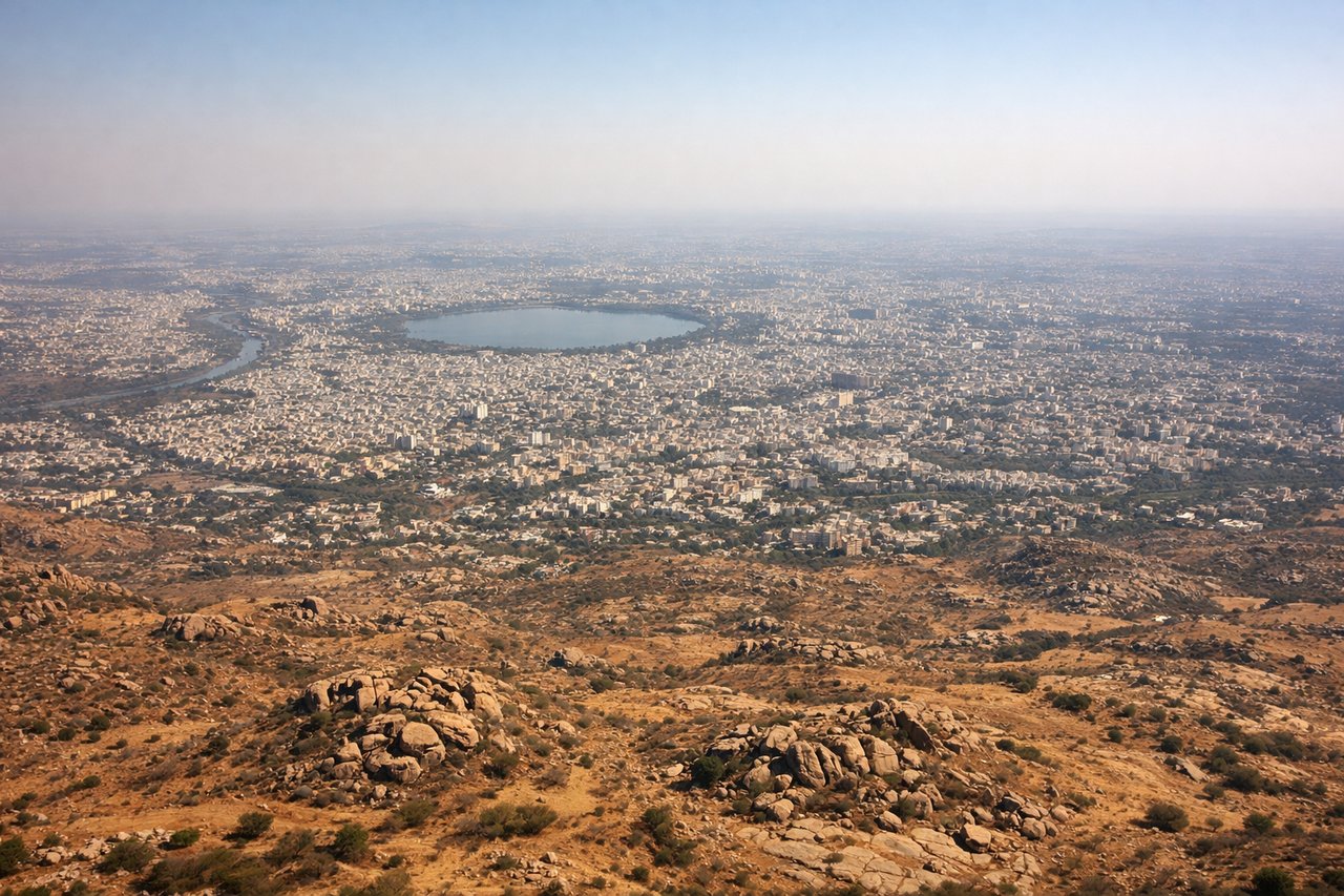
LEFTOn approach into Hyderabad, the flight path typically arcs south of the city core before lining up with the runway, giving left-side passengers views of Hussain Sagar Lake, the HITEC City skyline, and the historic Golconda Fort area. The right side mostly overlooks the flatter Deccan plateau farmland with fewer identifiable features.
Will your flight be in sunlight?
Pick a date and time in the Sun Map to watch the sun move across your whole flight.
About This Route
Which side of the plane should I sit on flying from Netaji Subhash Chandra Bose International (CCU) to Rajiv Gandhi International Airport (HYD)?
Sit on the Left side of the plane for the best views on flights from Calcutta to Hyderabad. The left side offers the only real variety on this route: a river-and-city view during the Kolkata departure, a stretch over the Eastern Ghats hills near the Odisha-Andhra border mid-flight, and lake and fort scenery on the Hyderabad approach. The right side stays over flat interior plains for nearly the entire flight.
What can I see during takeoff from Netaji Subhash Chandra Bose International in Calcutta?
During takeoff from Netaji Subhash Chandra Bose International (CCU), sit on the Left side for the best views. Departing CCU on runway 19 the aircraft climbs south over Kolkata before banking west toward Hyderabad, giving left-side passengers a good look at the Hooghly River, its bridges, and the dense city grid before the turn. The right side shows only the flatter eastern suburbs and rural Bengal delta with no comparable landmarks. Notable sights include: Hooghly River bends, Vidyasagar Setu bridge, Kolkata's high-rise core, distant Sundarbans delta haze to the south.
What can I see when landing at Rajiv Gandhi International Airport in Hyderabad?
When landing at Rajiv Gandhi International Airport (HYD), sit on the Left side for the best views. On approach into Hyderabad, the flight path typically arcs south of the city core before lining up with the runway, giving left-side passengers views of Hussain Sagar Lake, the HITEC City skyline, and the historic Golconda Fort area. The right side mostly overlooks the flatter Deccan plateau farmland with fewer identifiable features. Notable sights include: Hussain Sagar Lake, Golconda Fort ridge, HITEC City towers, Osman Sagar reservoir.
How long is the flight from Calcutta to Hyderabad?
The flight from Netaji Subhash Chandra Bose International (CCU) to Rajiv Gandhi International Airport (HYD) takes about 1 hour 55 minutes. The shortest flight path between them is 750 miles (1,208 km); winds and air traffic control usually add a few percent.
What does the Calcutta to Hyderabad flight path pass over?
The route crosses southern Odisha and the Eastern Ghats hill country near Koraput before descending toward the Godavari River basin and the Telangana plateau approaching Hyderabad.