While takeoff from Calcutta offers urban interest, the landing approach into Bagdogra provides the flight's most dramatic scenery—the Teesta River valley and Himalayan foothills create genuine terrain variety and visual interest that outweighs the flat plains on the left side during descent. Both sides score equally for the cruise segment over monotonous agricultural terrain, but the landing experience tips the advantage to the right.
Flown CCU to IXB? Did we get it right?
Flight Path
Calcutta to Baghdogra is 278 miles (448 km), a flight of about 1 hour 15 minutes.
Flat Gangetic plains and agricultural fields dominate the entire cruise segment. The Brahmaputra River system lies to the east (left) but remains largely obscured by haze and distance. No significant mountains or dramatic terrain features are visible during the middle portion of the flight. The landscape gradually transitions from the Calcutta delta region to the foothills as the aircraft approaches Bagdogra from the south.
Great circle distance and headings ›Phase by phase

Takeoff from CCU
LEFTCalcutta departure offers urban scenery of India's third-largest city and the Hooghly River delta, with visible industrial areas and water channels. Right side shows only flat agricultural plains immediately after takeoff.
Landing at IXB
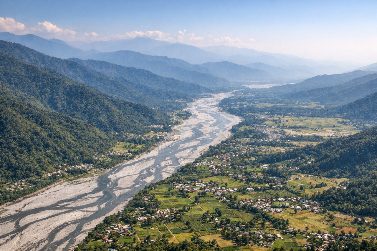
RIGHTBagdogra's approach from the south offers dramatic views of the Himalayan foothills and the Teesta River valley, with the snow-capped Kanchenjunga massif visible on clear days. Left side shows only flat plains and scattered settlements with no significant terrain.
Will your flight be in sunlight?
Pick a date and time in the Sun Map to watch the sun move across your whole flight.
About This Route
Which side of the plane should I sit on flying from Netaji Subhash Chandra Bose International (CCU) to Bagdogra (IXB)?
Sit on the Right side of the plane for the best views on flights from Calcutta to Baghdogra. While takeoff from Calcutta offers urban interest, the landing approach into Bagdogra provides the flight's most dramatic scenery—the Teesta River valley and Himalayan foothills create genuine terrain variety and visual interest that outweighs the flat plains on the left side during descent. Both sides score equally for the cruise segment over monotonous agricultural terrain, but the landing experience tips the advantage to the right.
What can I see during takeoff from Netaji Subhash Chandra Bose International in Calcutta?
During takeoff from Netaji Subhash Chandra Bose International (CCU), sit on the Left side for the best views. Calcutta departure offers urban scenery of India's third-largest city and the Hooghly River delta, with visible industrial areas and water channels. Right side shows only flat agricultural plains immediately after takeoff. Notable sights include: Hooghly River estuary, Calcutta urban sprawl, industrial zones along the river, flat Gangetic delta plains.
What can I see when landing at Bagdogra in Baghdogra?
When landing at Bagdogra (IXB), sit on the Right side for the best views. Bagdogra's approach from the south offers dramatic views of the Himalayan foothills and the Teesta River valley, with the snow-capped Kanchenjunga massif visible on clear days. Left side shows only flat plains and scattered settlements with no significant terrain. Notable sights include: Teesta River valley, Himalayan foothills, Kanchenjunga range (distant), Darjeeling hills.
How long is the flight from Calcutta to Baghdogra?
The flight from Netaji Subhash Chandra Bose International (CCU) to Bagdogra (IXB) takes about 1 hour 15 minutes. The shortest flight path between them is 278 miles (448 km); winds and air traffic control usually add a few percent.
What does the Calcutta to Baghdogra flight path pass over?
Flat Gangetic plains and agricultural fields dominate the entire cruise segment. The Brahmaputra River system lies to the east (left) but remains largely obscured by haze and distance. No significant mountains or dramatic terrain features are visible during the middle portion of the flight. The landscape gradually transitions from the Calcutta delta region to the foothills as the aircraft approaches Bagdogra from the south.