Right seats capture the dramatic Cantareira Mountains and São Paulo's geography during takeoff, while left seats dominate the landing with the Río de la Plata estuary. However, the takeoff scenery is more visually striking and sustained, making right the overall choice for this route.
Flown CGH to AEP? Did we get it right?
Flight Path
Sao Paulo to Buenos Aires is 1,035 miles (1,666 km), a flight of about 2 hours.
The flight path crosses the Paraná Plateau region between São Paulo and Buenos Aires. Notable features include the Paraná River valley (visible from altitude as a major drainage system), agricultural plains of interior São Paulo and Paraná state, and the transition to the flatter Mesopotamia region of Argentina. The Paraná River itself may be visible as a dark ribbon if flying at lower cruise altitudes or during clear conditions, particularly where it forms the border between Argentina and Paraguay/Brazil.
Great circle distance and headings ›

Phase by phase
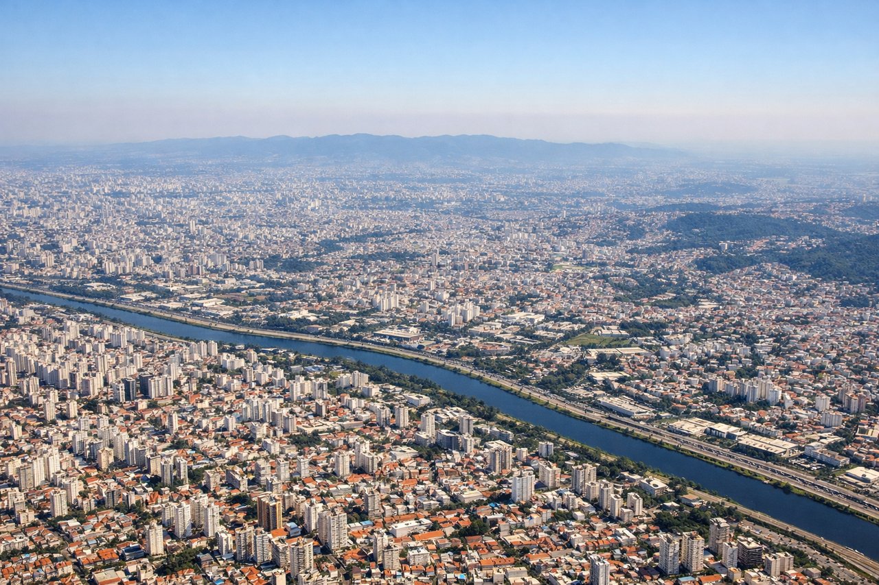
Takeoff from CGH
RIGHTRight-side seats offer views of São Paulo's urban sprawl and the Cantareira Mountains to the north as the aircraft climbs northwestward from Congonhas. Left seats face the industrial southern suburbs with less dramatic scenery.
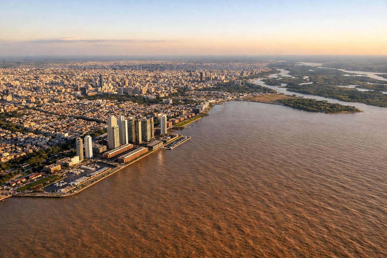
Landing at AEP
LEFTLeft-side seats provide excellent views of the Río de la Plata estuary and Buenos Aires' waterfront districts as the aircraft descends toward Aeroparque from the north. The river's wide expanse and the city's coastal layout are most visible from the left.
Will your flight be in sunlight?
Pick a date and time in the Sun Map to watch the sun move across your whole flight.
About This Route
Which side of the plane should I sit on flying from Congonhas (CGH) to Aeroparque Jorge Newbery (AEP)?
Sit on the Right side of the plane for the best views on flights from Sao Paulo to Buenos Aires. Right seats capture the dramatic Cantareira Mountains and São Paulo's geography during takeoff, while left seats dominate the landing with the Río de la Plata estuary. However, the takeoff scenery is more visually striking and sustained, making right the overall choice for this route.
What can I see during takeoff from Congonhas in Sao Paulo?
During takeoff from Congonhas (CGH), sit on the Right side for the best views. Right-side seats offer views of São Paulo's urban sprawl and the Cantareira Mountains to the north as the aircraft climbs northwestward from Congonhas. Left seats face the industrial southern suburbs with less dramatic scenery. Notable sights include: Cantareira Mountains (northern range), Pinheiros River valley, São Paulo city grid extending south, Serra da Mantiqueira (distant eastern horizon).
What can I see when landing at Aeroparque Jorge Newbery in Buenos Aires?
When landing at Aeroparque Jorge Newbery (AEP), sit on the Left side for the best views. Left-side seats provide excellent views of the Río de la Plata estuary and Buenos Aires' waterfront districts as the aircraft descends toward Aeroparque from the north. The river's wide expanse and the city's coastal layout are most visible from the left. Notable sights include: Río de la Plata estuary (wide muddy-brown water), Puerto Madero district (modern waterfront), Paraná River delta (upstream to the northwest), Buenos Aires city grid.
How long is the flight from Sao Paulo to Buenos Aires?
The flight from Congonhas (CGH) to Aeroparque Jorge Newbery (AEP) takes about 2 hours. The shortest flight path between them is 1,035 miles (1,666 km); winds and air traffic control usually add a few percent.
What does the Sao Paulo to Buenos Aires flight path pass over?
The flight path crosses the Paraná Plateau region between São Paulo and Buenos Aires. Notable features include the Paraná River valley (visible from altitude as a major drainage system), agricultural plains of interior São Paulo and Paraná state, and the transition to the flatter Mesopotamia region of Argentina. The Paraná River itself may be visible as a dark ribbon if flying at lower cruise altitudes or during clear conditions, particularly where it forms the border between Argentina and Paraguay/Brazil.