While takeoff favors the right with mountain and city views near Cagayan de Oro, the left side delivers a stronger overall experience thanks to island coastlines during cruise and the dramatic Manila Bay approach with Corregidor and the city skyline.
Flown CGY to MNL? Did we get it right?
Flight Path
Ladag to Manila is 469 miles (755 km), a flight of about 1 hour 25 minutes.
Panay Gulf, Sibuyan Sea, Tablas Strait, Mindoro Strait, scattered Visayan islands
Great circle distance and headings ›Phase by phase
Takeoff from CGY
RIGHTDeparting Laguindingan, the aircraft climbs out over Macajalar Bay with Cagayan de Oro's coastal sprawl and the forested ridgeline of Mt. Kitanglad visible on the right as the plane turns north toward Luzon.
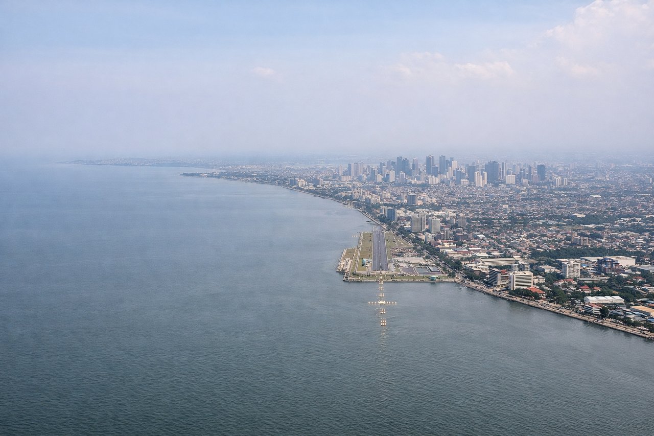
Landing at MNL
LEFTOn approach into NAIA from the south, the left side offers views over Manila Bay with Corregidor Island and the Bataan Peninsula visible before the final turn reveals the Makati and Manila skyline hugging the bay's edge.
Will your flight be in sunlight?
Pick a date and time in the Sun Map to watch the sun move across your whole flight.
About This Route
Which side of the plane should I sit on flying from Laguindingan International Airport (CGY) to Ninoy Aquino International (MNL)?
Sit on the Left side of the plane for the best views on flights from Ladag to Manila. While takeoff favors the right with mountain and city views near Cagayan de Oro, the left side delivers a stronger overall experience thanks to island coastlines during cruise and the dramatic Manila Bay approach with Corregidor and the city skyline.
What can I see during takeoff from Laguindingan International Airport in Ladag?
During takeoff from Laguindingan International Airport (CGY), sit on the Right side for the best views. Departing Laguindingan, the aircraft climbs out over Macajalar Bay with Cagayan de Oro's coastal sprawl and the forested ridgeline of Mt. Kitanglad visible on the right as the plane turns north toward Luzon. Notable sights include: Macajalar Bay, Cagayan de Oro city, Mt. Kitanglad range, Bukidnon highlands.
What can I see when landing at Ninoy Aquino International in Manila?
When landing at Ninoy Aquino International (MNL), sit on the Left side for the best views. On approach into NAIA from the south, the left side offers views over Manila Bay with Corregidor Island and the Bataan Peninsula visible before the final turn reveals the Makati and Manila skyline hugging the bay's edge. Notable sights include: Manila Bay, Corregidor Island, Bataan Peninsula, Makati/Manila skyline.
How long is the flight from Ladag to Manila?
The flight from Laguindingan International Airport (CGY) to Ninoy Aquino International (MNL) takes about 1 hour 25 minutes. The shortest flight path between them is 469 miles (755 km); winds and air traffic control usually add a few percent.
What does the Ladag to Manila flight path pass over?
Panay Gulf, Sibuyan Sea, Tablas Strait, Mindoro Strait, scattered Visayan islands