While the takeoff offers Southern Alps views on the left, the landing approach provides more sustained and dramatic scenery over the Charleston coastal region. Right-side seats capture both the approach descent over the Low Country marshlands and the harbor geography that defines Charleston's setting.
Flown CHC to CHS? Did we get it right?
Flight Path
Christchurch to Charleston is 8,554 miles (13,766 km), a flight of about 16 hours 30 minutes.
This ultra-long-haul route crosses the Pacific Ocean for roughly 8,000+ nautical miles. Midpoint scenery includes the International Date Line region, Hawaiian Islands (if routed via Honolulu), and the continental United States interior. Typical routing may include views of the Sierra Nevada mountains, Great Plains, or Mississippi River valley depending on the specific flight path chosen by the airline. The vast majority of the flight crosses open ocean with no visible landmarks.
Great circle distance and headings ›


Phase by phase

Takeoff from CHC
LEFTLeft-side seats offer views of the Southern Alps and Canterbury Plains during the initial climb-out. The aircraft departs to the north and west, so left-facing windows capture the dramatic mountain backdrop and braided river systems that define the Christchurch region.
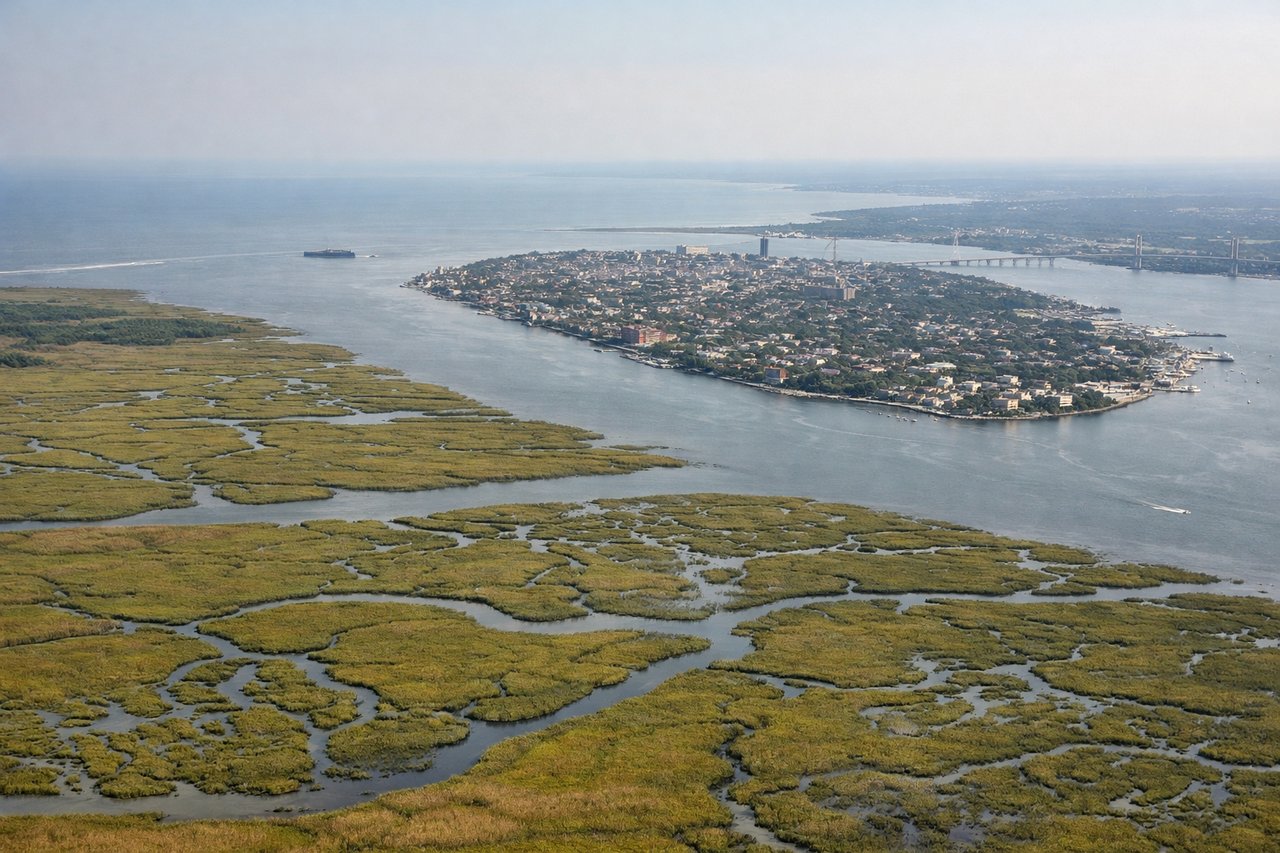
Landing at CHS
RIGHTRight-side seats provide excellent views during the approach to Charleston. The aircraft descends from the northwest over the Atlantic coastal region, and right-facing windows capture the Charleston Harbor, Cooper River, and the distinctive coastal geography of the Low Country.
Will your flight be in sunlight?
Pick a date and time in the Sun Map to watch the sun move across your whole flight.
About This Route
Which side of the plane should I sit on flying from Christchurch International (CHC) to Charleston Afb International (CHS)?
Sit on the Right side of the plane for the best views on flights from Christchurch to Charleston. While the takeoff offers Southern Alps views on the left, the landing approach provides more sustained and dramatic scenery over the Charleston coastal region. Right-side seats capture both the approach descent over the Low Country marshlands and the harbor geography that defines Charleston's setting.
What can I see during takeoff from Christchurch International in Christchurch?
During takeoff from Christchurch International (CHC), sit on the Left side for the best views. Left-side seats offer views of the Southern Alps and Canterbury Plains during the initial climb-out. The aircraft departs to the north and west, so left-facing windows capture the dramatic mountain backdrop and braided river systems that define the Christchurch region. Notable sights include: Southern Alps (Mount Cook visible on clear days ~100 miles southwest), Canterbury Plains (flat agricultural expanse), Waimakariri River braided channels, Banks Peninsula (distinctive peninsula landform to the southeast).
What can I see when landing at Charleston Afb International in Charleston?
When landing at Charleston Afb International (CHS), sit on the Right side for the best views. Right-side seats provide excellent views during the approach to Charleston. The aircraft descends from the northwest over the Atlantic coastal region, and right-facing windows capture the Charleston Harbor, Cooper River, and the distinctive coastal geography of the Low Country. Notable sights include: Charleston Harbor (natural harbor with Fort Sumter visible), Cooper River (tidal river running inland), Atlantic coastline with barrier islands, Charleston peninsula and downtown district.
How long is the flight from Christchurch to Charleston?
The flight from Christchurch International (CHC) to Charleston Afb International (CHS) takes about 16 hours 30 minutes. The shortest flight path between them is 8,554 miles (13,766 km); winds and air traffic control usually add a few percent.
What does the Christchurch to Charleston flight path pass over?
This ultra-long-haul route crosses the Pacific Ocean for roughly 8,000+ nautical miles. Midpoint scenery includes the International Date Line region, Hawaiian Islands (if routed via Honolulu), and the continental United States interior. Typical routing may include views of the Sierra Nevada mountains, Great Plains, or Mississippi River valley depending on the specific flight path chosen by the airline. The vast majority of the flight crosses open ocean with no visible landmarks.