Calama to Santiago is 761 miles (1,225 km), a flight of about 2 hours 15 minutes.
While takeoff offers desert and volcanic views on the right, the landing approach provides more dramatic and sustained scenery—the Andes descent, river valley, and approach to a major city basin are visually superior to the relatively flat Atacama departure.
Flight Path
The flight path crosses the Andes cordillera roughly midway. Passengers will see the transition from the high Atacama plateau (around 7,500 feet elevation) over the main Andes ridge (peaks 13,000–16,000 feet, some snow-capped), then descend into the Central Valley of Chile. The Maipo and Cachapoal river systems become visible as the aircraft descends toward Santiago. On clear days, the contrast between the arid, barren mountains and the green agricultural valleys of central Chile is striking.
Great circle distance and headings ›


Phase by phase
Takeoff from CJC
RIGHTCJC typically departs to the north or northeast. Right-side seats capture the dramatic transition from the Atacama Desert floor toward the Andes foothills, with the salt flats and mining infrastructure visible below before climbing into the mountains.
Landing at SCL
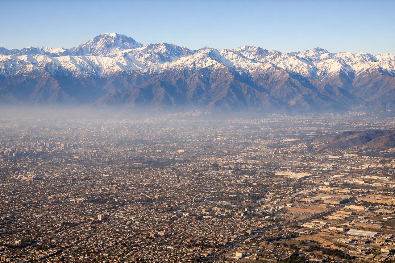
LEFTSCL approaches from the north or northeast, typically landing on runways 34L/R. Left-side seats offer views of the Andes cordillera descending toward Santiago, the Maipo River valley, and the city sprawl in the basin below. The approach path crosses directly over the mountain range.
Landmarks on this routeAll landmarks →
Will your flight be in sunlight?
Pick a date and time in the Sun Map to watch the sun move across your whole flight.
About This Route
Which side of the plane should I sit on flying from El Loa (CJC) to Arturo Merino Benitez International (SCL)?
Sit on the Left side of the plane for the best views on flights from Calama to Santiago. While takeoff offers desert and volcanic views on the right, the landing approach provides more dramatic and sustained scenery—the Andes descent, river valley, and approach to a major city basin are visually superior to the relatively flat Atacama departure.
What can I see during takeoff from El Loa in Calama?
During takeoff from El Loa (CJC), sit on the Right side for the best views. CJC typically departs to the north or northeast. Right-side seats capture the dramatic transition from the Atacama Desert floor toward the Andes foothills, with the salt flats and mining infrastructure visible below before climbing into the mountains. Notable sights include: Atacama salt flats (white geometric patterns directly below), Sierra de Lascar volcanic peaks (northeast), mining operations and tailings ponds (scattered across desert floor), foothills of the Andes rising toward the east.
What can I see when landing at Arturo Merino Benitez International in Santiago?
When landing at Arturo Merino Benitez International (SCL), sit on the Left side for the best views. SCL approaches from the north or northeast, typically landing on runways 34L/R. Left-side seats offer views of the Andes cordillera descending toward Santiago, the Maipo River valley, and the city sprawl in the basin below. The approach path crosses directly over the mountain range. Notable sights include: Andes cordillera (snow-capped peaks in winter/spring, bare rock in summer), Maipo River valley (green ribbon cutting through foothills), Santiago city sprawl (urban grid visible in the basin), pre-Andean foothills transitioning to flat central valley.
How long is the flight from Calama to Santiago?
The flight from El Loa (CJC) to Arturo Merino Benitez International (SCL) takes about 2 hours 15 minutes. The shortest flight path between them is 761 miles (1,225 km); winds and air traffic control usually add a few percent.
What does the Calama to Santiago flight path pass over?
The flight path crosses the Andes cordillera roughly midway. Passengers will see the transition from the high Atacama plateau (around 7,500 feet elevation) over the main Andes ridge (peaks 13,000–16,000 feet, some snow-capped), then descend into the Central Valley of Chile. The Maipo and Cachapoal river systems become visible as the aircraft descends toward Santiago. On clear days, the contrast between the arid, barren mountains and the green agricultural valleys of central Chile is striking.