Santiago to Calama is 761 miles (1,225 km), a flight of about 1 hour 50 minutes.
Throughout the flight, the Andean cordillera with its volcanic peaks stays visible on the right side, from Santiago's front range at takeoff to Licancabur and Lascar near Calama at landing, while the left side offers only the flat Atacama pampa and inland valleys with no coastline in view on this route.
Flight Path
Atacama desert plains, high Andean volcanic peaks including the Ojos del Salado massif visible to the east, and the arid Andean foothills paralleling the flight path
Great circle distance and headings ›


Phase by phase
Takeoff from SCL
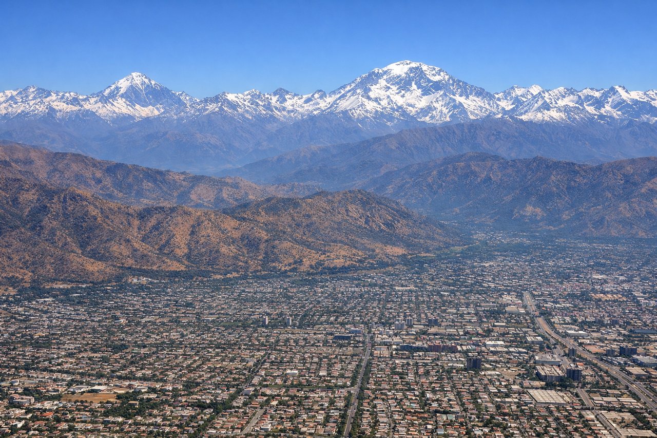
RIGHTDeparting SCL, the initial climb and turn north give right-side passengers a clear view of the Andean front range rising abruptly east of Santiago, including the snow-capped peaks near Cerro El Plomo. The left side only shows the flatter central valley and coastal hills with no ocean visible from Santiago's inland location.
Landing at CJC
RIGHTOn approach into Calama, the descent path passes south of the volcanic cordillera, putting the iconic cone of Licancabur and the Lascar volcano complex in view to the right, contrasting sharply with the flat Atacama plateau below. The left side shows only featureless desert pampa stretching toward the coastal range.
Landmarks on this routeAll landmarks →
Will your flight be in sunlight?
Pick a date and time in the Sun Map to watch the sun move across your whole flight.
About This Route
Which side of the plane should I sit on flying from Arturo Merino Benitez International (SCL) to El Loa (CJC)?
Sit on the Right side of the plane for the best views on flights from Santiago to Calama. Throughout the flight, the Andean cordillera with its volcanic peaks stays visible on the right side, from Santiago's front range at takeoff to Licancabur and Lascar near Calama at landing, while the left side offers only the flat Atacama pampa and inland valleys with no coastline in view on this route.
What can I see during takeoff from Arturo Merino Benitez International in Santiago?
During takeoff from Arturo Merino Benitez International (SCL), sit on the Right side for the best views. Departing SCL, the initial climb and turn north give right-side passengers a clear view of the Andean front range rising abruptly east of Santiago, including the snow-capped peaks near Cerro El Plomo. The left side only shows the flatter central valley and coastal hills with no ocean visible from Santiago's inland location. Notable sights include: Andean front range, Cerro El Plomo area, San Ramón foothills, Santiago's eastern suburbs.
What can I see when landing at El Loa in Calama?
When landing at El Loa (CJC), sit on the Right side for the best views. On approach into Calama, the descent path passes south of the volcanic cordillera, putting the iconic cone of Licancabur and the Lascar volcano complex in view to the right, contrasting sharply with the flat Atacama plateau below. The left side shows only featureless desert pampa stretching toward the coastal range. Notable sights include: Licancabur volcano, Lascar volcano, Atacama desert plateau, Andean altiplano.
How long is the flight from Santiago to Calama?
The flight from Arturo Merino Benitez International (SCL) to El Loa (CJC) takes about 1 hour 50 minutes. The shortest flight path between them is 761 miles (1,225 km); winds and air traffic control usually add a few percent.
What does the Santiago to Calama flight path pass over?
Atacama desert plains, high Andean volcanic peaks including the Ojos del Salado massif visible to the east, and the arid Andean foothills paralleling the flight path