While the takeoff offers Carpathian views on the left, the landing approach provides more dramatic and sustained scenery with the Tagus estuary, Lisbon's iconic hills, and Atlantic coastline all concentrated on the right side during descent. The landing experience outweighs the takeoff advantage.
Flown CLJ to LIS? Did we get it right?
Flight Path
Cluj-Napoca to Lisbon is 1,739 miles (2,799 km), a flight of about 3 hours 15 minutes.
The flight path crosses the Pyrenees (visible as a distant ridge on the left during the cruise phase over central France), then proceeds over the Massif Central and the Aquitaine Basin. The Iberian Plateau becomes visible as the aircraft approaches Spanish airspace. The Douro River valley in northern Portugal marks the approach to the final descent phase. No single dramatic midpoint landmark dominates; the flight is characterized by gradual transitions across European geography rather than concentrated scenic features.
Great circle distance and headings ›


Phase by phase
Takeoff from CLJ
LEFTLeft side offers views of the Southern Carpathians as the aircraft climbs westward out of Cluj-Napoca. The mountain range rises prominently to the south and southwest, creating a dramatic backdrop during the initial climb phase.
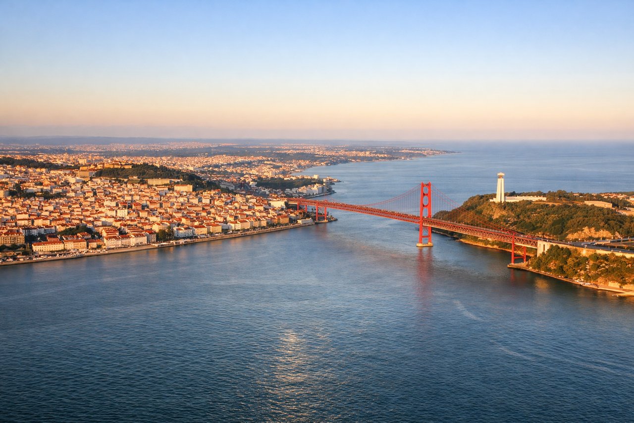
Landing at LIS
RIGHTRight side provides views of the Tagus River estuary and Lisbon's geography as the aircraft descends toward Humberto Delgado Airport. The river's wide mouth, the city's hills, and the Atlantic coastline are all visible on the right side during the final approach from the east.
Will your flight be in sunlight?
Pick a date and time in the Sun Map to watch the sun move across your whole flight.
About This Route
Which side of the plane should I sit on flying from Someseni (CLJ) to Lisboa (LIS)?
Sit on the Right side of the plane for the best views on flights from Cluj-Napoca to Lisbon. While the takeoff offers Carpathian views on the left, the landing approach provides more dramatic and sustained scenery with the Tagus estuary, Lisbon's iconic hills, and Atlantic coastline all concentrated on the right side during descent. The landing experience outweighs the takeoff advantage.
What can I see during takeoff from Someseni in Cluj-Napoca?
During takeoff from Someseni (CLJ), sit on the Left side for the best views. Left side offers views of the Southern Carpathians as the aircraft climbs westward out of Cluj-Napoca. The mountain range rises prominently to the south and southwest, creating a dramatic backdrop during the initial climb phase. Notable sights include: Southern Carpathians, Transylvanian Plateau, Someș River valley, Cluj-Napoca urban area.
What can I see when landing at Lisboa in Lisbon?
When landing at Lisboa (LIS), sit on the Right side for the best views. Right side provides views of the Tagus River estuary and Lisbon's geography as the aircraft descends toward Humberto Delgado Airport. The river's wide mouth, the city's hills, and the Atlantic coastline are all visible on the right side during the final approach from the east. Notable sights include: Tagus River estuary, Atlantic coastline, Lisbon hills and urban districts, Cristo Rei monument area.
How long is the flight from Cluj-Napoca to Lisbon?
The flight from Someseni (CLJ) to Lisboa (LIS) takes about 3 hours 15 minutes. The shortest flight path between them is 1,739 miles (2,799 km); winds and air traffic control usually add a few percent.
What does the Cluj-Napoca to Lisbon flight path pass over?
The flight path crosses the Pyrenees (visible as a distant ridge on the left during the cruise phase over central France), then proceeds over the Massif Central and the Aquitaine Basin. The Iberian Plateau becomes visible as the aircraft approaches Spanish airspace. The Douro River valley in northern Portugal marks the approach to the final descent phase. No single dramatic midpoint landmark dominates; the flight is characterized by gradual transitions across European geography rather than concentrated scenic features.