Charlotte to Bush Field is 140 miles (225 km), a flight of about 50 minutes.
The right side captures the Charlotte skyline on departure, which is the most visually distinctive moment of this short flight. The landing view advantage on the left is real but modest — the Savannah River floodplain is interesting but not dramatic. For the full experience, right side wins on takeoff scenery.
Flight Path
The flight crosses the South Carolina Piedmont, passing over the rolling forested terrain between Rock Hill and Aiken. You'll see the transition from the Piedmont's red-clay farmland and pine forests to the sandhill region of central South Carolina. No major water bodies or mountain features along this corridor — it's a relatively flat, heavily forested route with scattered small towns visible below.
Great circle distance and headings ›Phase by phase
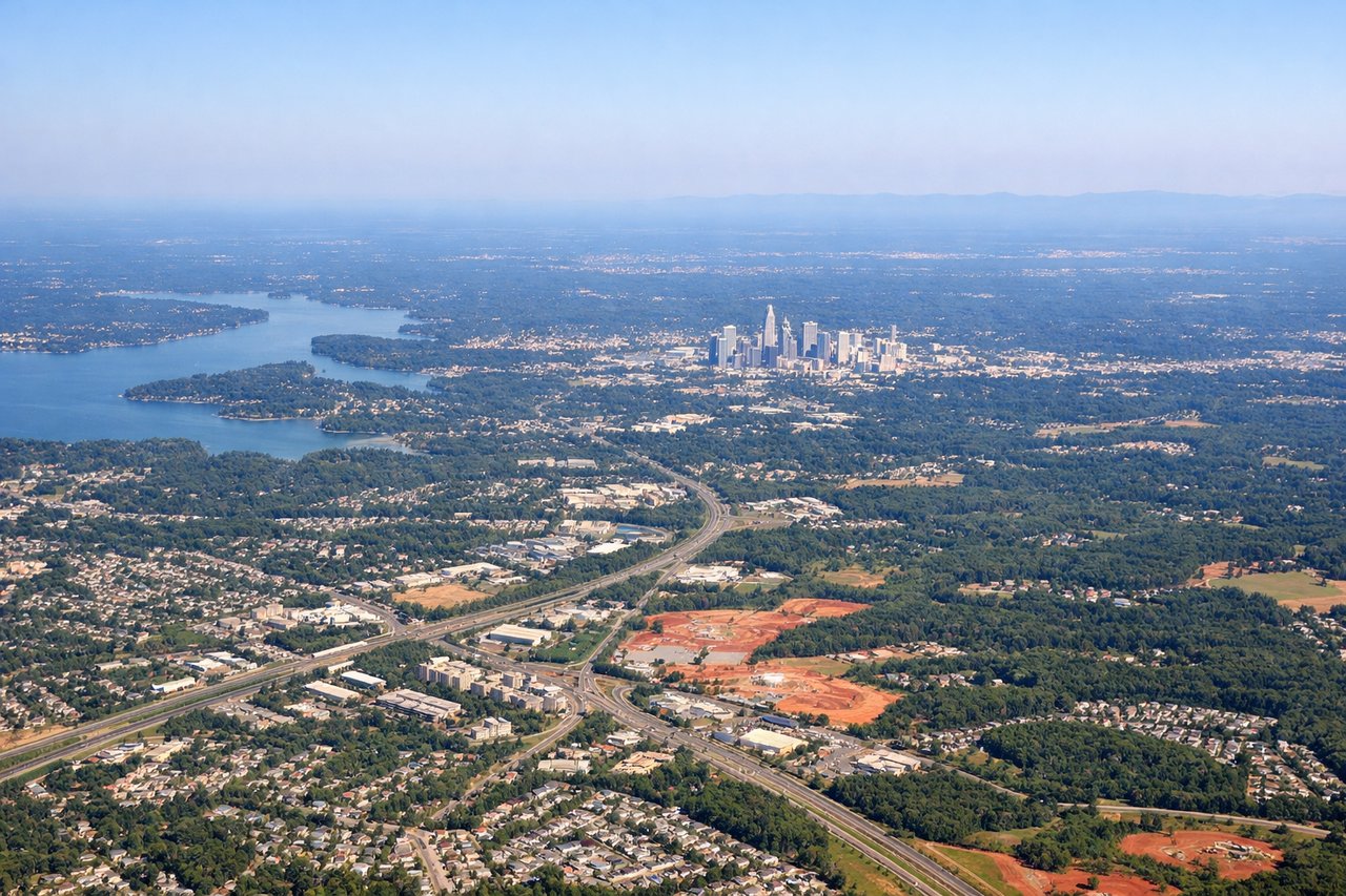
Takeoff from CLT
RIGHTCLT's primary departure runways (18C/36C and 18L/36L) mean southwestbound departures toward AGS typically head south-southeast. A right-side seat gives you a view back over Charlotte's uptown skyline and the Catawba River corridor as you climb out. The left side faces mostly suburban sprawl toward the airport's west side.
Landing at AGS
LEFTAugusta Regional typically uses runway 17/35, with arrivals from the north coming in on a southbound heading. A left-side seat gives you a view of the Savannah River valley and the broad floodplain that defines the Georgia-South Carolina border as you descend. The right side looks mostly over pine flatlands with little visual interest.
Will your flight be in sunlight?
Pick a date and time in the Sun Map to watch the sun move across your whole flight.
About This Route
Which side of the plane should I sit on flying from Charlotte Douglas International (CLT) to Augusta Rgnl At Bush Fld (AGS)?
Sit on the Right side of the plane for the best views on flights from Charlotte to Bush Field. The right side captures the Charlotte skyline on departure, which is the most visually distinctive moment of this short flight. The landing view advantage on the left is real but modest — the Savannah River floodplain is interesting but not dramatic. For the full experience, right side wins on takeoff scenery.
What can I see during takeoff from Charlotte Douglas International in Charlotte?
During takeoff from Charlotte Douglas International (CLT), sit on the Right side for the best views. CLT's primary departure runways (18C/36C and 18L/36L) mean southwestbound departures toward AGS typically head south-southeast. A right-side seat gives you a view back over Charlotte's uptown skyline and the Catawba River corridor as you climb out. The left side faces mostly suburban sprawl toward the airport's west side. Notable sights include: Uptown Charlotte skyline, Catawba River/Lake Wylie to the south, I-485 beltway arc, South Carolina state line piedmont terrain.
What can I see when landing at Augusta Rgnl At Bush Fld in Bush Field?
When landing at Augusta Rgnl At Bush Fld (AGS), sit on the Left side for the best views. Augusta Regional typically uses runway 17/35, with arrivals from the north coming in on a southbound heading. A left-side seat gives you a view of the Savannah River valley and the broad floodplain that defines the Georgia-South Carolina border as you descend. The right side looks mostly over pine flatlands with little visual interest. Notable sights include: Savannah River and its floodplain, Lake Thurmond (Clarks Hill Lake) reservoir to the northwest, downtown Augusta grid along the river, South Carolina sandhills across the river.
How long is the flight from Charlotte to Bush Field?
The flight from Charlotte Douglas International (CLT) to Augusta Rgnl At Bush Fld (AGS) takes about 50 minutes. The shortest flight path between them is 140 miles (225 km); winds and air traffic control usually add a few percent.
What does the Charlotte to Bush Field flight path pass over?
The flight crosses the South Carolina Piedmont, passing over the rolling forested terrain between Rock Hill and Aiken. You'll see the transition from the Piedmont's red-clay farmland and pine forests to the sandhill region of central South Carolina. No major water bodies or mountain features along this corridor — it's a relatively flat, heavily forested route with scattered small towns visible below.