The left side wins on the strength of two urban highlights bookending an otherwise flat, unremarkable cruise: a skyline glimpse of Charlotte at departure and a much stronger view of the Mississippi River bend and downtown New Orleans during the approach into MSY, while the right side mainly offers Lake Pontchartrain and featureless farmland.
Flown CLT to MSY? Did we get it right?
Flight Path
Charlotte to New Orleans is 651 miles (1,048 km), a flight of about 2 hours 5 minutes.
The route crosses the Piedmont of South Carolina and Georgia, passes near the Chattahoochee River basin south of Atlanta, continues over Alabama's Black Belt farmland and the Tombigbee River, then crosses into Mississippi's pine forests before descending over the bayous and wetlands of southeastern Louisiana.
Great circle distance and headings ›

Phase by phase

Takeoff from CLT
LEFTOn the more common south-flow departure from CLT, the aircraft climbs south before banking toward the southwest course to MSY, giving left-side passengers a brief look back at Uptown Charlotte's skyline and the Piedmont hills before the city recedes behind rural farmland.
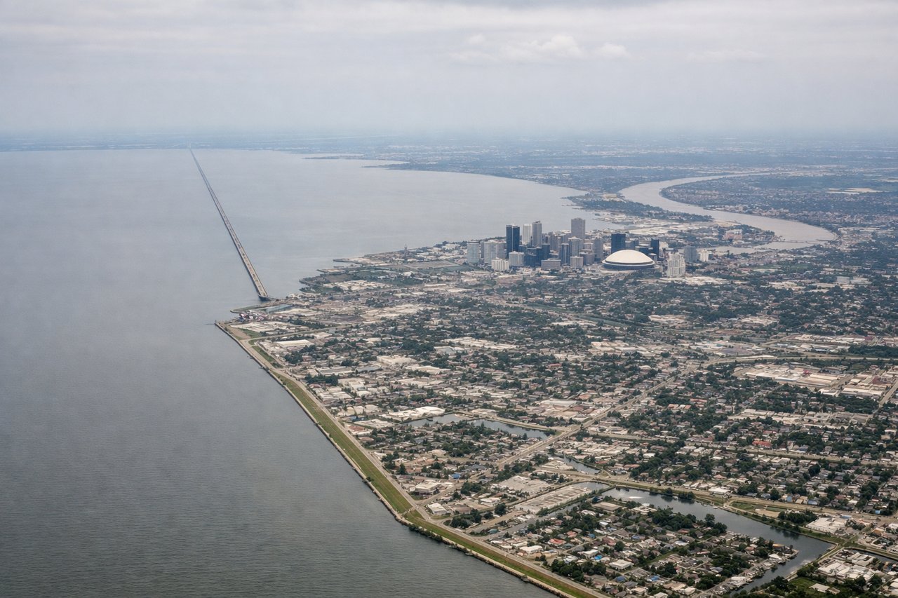
Landing at MSY
LEFTArrivals into MSY commonly line up on runway 29, approaching from the east over New Orleans itself, putting the Mississippi River's crescent bend, the French Quarter, and the downtown skyline on the left side just before touchdown.
Will your flight be in sunlight?
Pick a date and time in the Sun Map to watch the sun move across your whole flight.
About This Route
Which side of the plane should I sit on flying from Charlotte Douglas International (CLT) to Louis Armstrong New Orleans International (MSY)?
Sit on the Left side of the plane for the best views on flights from Charlotte to New Orleans. The left side wins on the strength of two urban highlights bookending an otherwise flat, unremarkable cruise: a skyline glimpse of Charlotte at departure and a much stronger view of the Mississippi River bend and downtown New Orleans during the approach into MSY, while the right side mainly offers Lake Pontchartrain and featureless farmland.
What can I see during takeoff from Charlotte Douglas International in Charlotte?
During takeoff from Charlotte Douglas International (CLT), sit on the Left side for the best views. On the more common south-flow departure from CLT, the aircraft climbs south before banking toward the southwest course to MSY, giving left-side passengers a brief look back at Uptown Charlotte's skyline and the Piedmont hills before the city recedes behind rural farmland. Notable sights include: Uptown Charlotte skyline, Catawba River valley, Piedmont rolling hills, Charlotte suburban sprawl.
What can I see when landing at Louis Armstrong New Orleans International in New Orleans?
When landing at Louis Armstrong New Orleans International (MSY), sit on the Left side for the best views. Arrivals into MSY commonly line up on runway 29, approaching from the east over New Orleans itself, putting the Mississippi River's crescent bend, the French Quarter, and the downtown skyline on the left side just before touchdown. Notable sights include: Mississippi River crescent bend, French Quarter and downtown New Orleans skyline, Superdome, Louisiana wetlands.
How long is the flight from Charlotte to New Orleans?
The flight from Charlotte Douglas International (CLT) to Louis Armstrong New Orleans International (MSY) takes about 2 hours 5 minutes. The shortest flight path between them is 651 miles (1,048 km); winds and air traffic control usually add a few percent.
What does the Charlotte to New Orleans flight path pass over?
The route crosses the Piedmont of South Carolina and Georgia, passes near the Chattahoochee River basin south of Atlanta, continues over Alabama's Black Belt farmland and the Tombigbee River, then crosses into Mississippi's pine forests before descending over the bayous and wetlands of southeastern Louisiana.