The left side offers the more dynamic visual arc: Atlantic coastline and Bahamian shallows during the climb and cruise, followed by Saint Lucia's iconic Piton peaks on final approach, while the right side spends most of the flight over featureless open water.
Flown CLT to UVF? Did we get it right?
Flight Path
Charlotte to Hewandorra is 1,937 miles (3,116 km), a flight of about 4 hours 10 minutes.
Great Bahama Bank's shallow turquoise waters, open Atlantic and Caribbean Sea crossing east of Puerto Rico, and the northern Lesser Antilles island chain (Guadeloupe, Dominica, Martinique) visible in the distance before descent into Saint Lucia
Great circle distance and headings ›Phase by phase
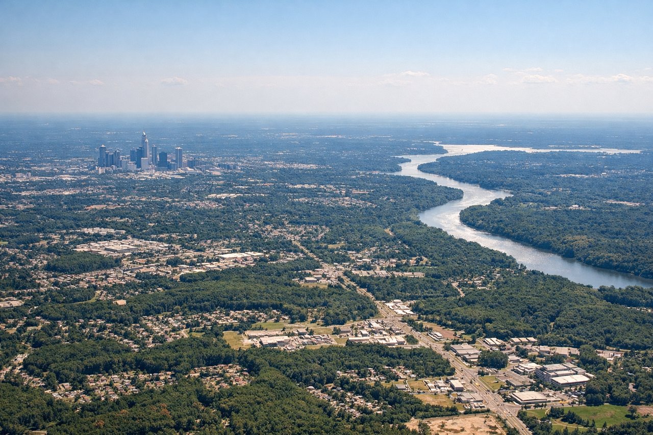
Takeoff from CLT
LEFTDeparting CLT in south flow, the aircraft climbs south then curves southeast toward the Caribbean, putting the Carolina coastal plain and eventually the Atlantic shoreline on the left. Passengers get a brief look at Charlotte's outskirts before the turn establishes the long over-water routing.
Landing at UVF
LEFTOn approach to UVF's runway 10, the aircraft comes in from the west over the Caribbean Sea before landing eastbound, and passengers on the left face north toward Saint Lucia's dramatic interior, including the volcanic Piton peaks near Soufriere. The right side mostly sees open sea until touchdown.
Will your flight be in sunlight?
Pick a date and time in the Sun Map to watch the sun move across your whole flight.
About This Route
Which side of the plane should I sit on flying from Charlotte Douglas International (CLT) to Hewanorra International (UVF)?
Sit on the Left side of the plane for the best views on flights from Charlotte to Hewandorra. The left side offers the more dynamic visual arc: Atlantic coastline and Bahamian shallows during the climb and cruise, followed by Saint Lucia's iconic Piton peaks on final approach, while the right side spends most of the flight over featureless open water.
What can I see during takeoff from Charlotte Douglas International in Charlotte?
During takeoff from Charlotte Douglas International (CLT), sit on the Left side for the best views. Departing CLT in south flow, the aircraft climbs south then curves southeast toward the Caribbean, putting the Carolina coastal plain and eventually the Atlantic shoreline on the left. Passengers get a brief look at Charlotte's outskirts before the turn establishes the long over-water routing. Notable sights include: Charlotte suburbs and Uptown skyline, Catawba River, rolling Piedmont farmland, distant Atlantic coastline as the turn develops.
What can I see when landing at Hewanorra International in Hewandorra?
When landing at Hewanorra International (UVF), sit on the Left side for the best views. On approach to UVF's runway 10, the aircraft comes in from the west over the Caribbean Sea before landing eastbound, and passengers on the left face north toward Saint Lucia's dramatic interior, including the volcanic Piton peaks near Soufriere. The right side mostly sees open sea until touchdown. Notable sights include: Gros Piton and Petit Piton volcanic spires, Saint Lucia's forested mountain interior, the southern coastline near Vieux Fort, turquoise shallows of the Caribbean Sea.
How long is the flight from Charlotte to Hewandorra?
The flight from Charlotte Douglas International (CLT) to Hewanorra International (UVF) takes about 4 hours 10 minutes. The shortest flight path between them is 1,937 miles (3,116 km); winds and air traffic control usually add a few percent.
What does the Charlotte to Hewandorra flight path pass over?
Great Bahama Bank's shallow turquoise waters, open Atlantic and Caribbean Sea crossing east of Puerto Rico, and the northern Lesser Antilles island chain (Guadeloupe, Dominica, Martinique) visible in the distance before descent into Saint Lucia