Kannur to Delhi is 1,154 miles (1,857 km), a flight of about 3 hours 15 minutes.
While the takeoff from Kannur offers coastal and mountain scenery, the landing approach into Delhi provides more dramatic and sustained visual interest with the Yamuna River's distinctive meanders, extensive urban geography, and the Aravalli Hills backdrop. The Delhi approach captures more varied and recognizable landmarks.
Flight Path
The flight path crosses the Deccan Plateau interior, passing over the states of Karnataka and Telangana. Notable features include the Tungabhadra River valley, the Godavari River basin, and the transition from the Western Ghats to the Deccan plateau. The Chota Nagpur Plateau becomes visible in the latter portion of the flight, followed by the Indo-Gangetic Plain as the aircraft approaches Delhi from the south. The Vindhya Range forms a subtle ridge line in the northern midpoint section.
Great circle distance and headings ›Phase by phase
Takeoff from CNN
RIGHTRight side seats offer views of the Arabian Sea coastline and the Western Ghats escarpment as the aircraft climbs northwestward from Kannur. The terrain rises dramatically inland, creating a striking contrast between coastal plains and mountain ridges.
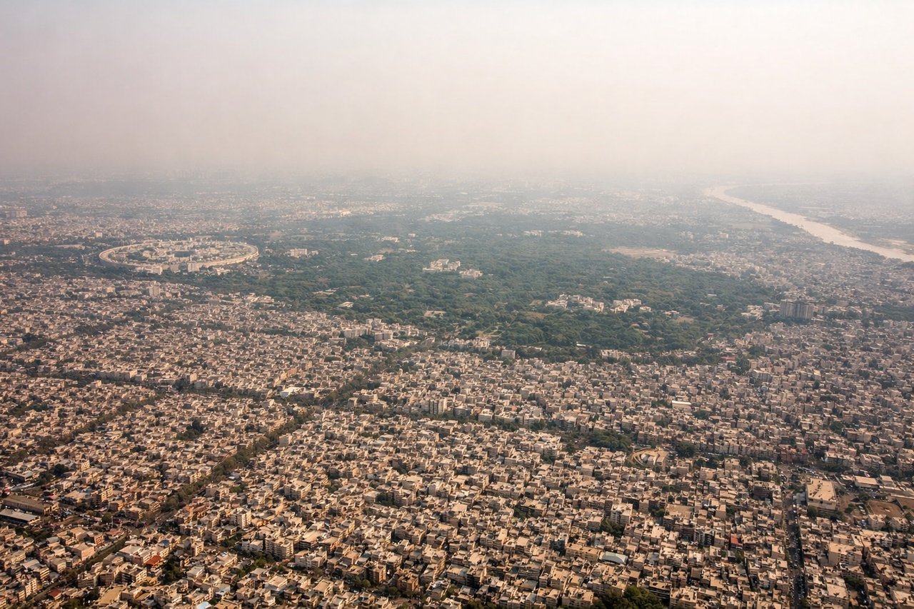
Landing at DEL
LEFTLeft side seats provide excellent views of the Yamuna River, Delhi's urban sprawl, and the approach into Indira Gandhi International Airport from the southwest. The river's meandering path and the city's distinctive layout are clearly visible during descent.
Landmarks on this routeAll landmarks →
Will your flight be in sunlight?
Pick a date and time in the Sun Map to watch the sun move across your whole flight.
About This Route
Which side of the plane should I sit on flying from Kannur International Airport (CNN) to Indira Gandhi International (DEL)?
Sit on the Left side of the plane for the best views on flights from Kannur to Delhi. While the takeoff from Kannur offers coastal and mountain scenery, the landing approach into Delhi provides more dramatic and sustained visual interest with the Yamuna River's distinctive meanders, extensive urban geography, and the Aravalli Hills backdrop. The Delhi approach captures more varied and recognizable landmarks.
What can I see during takeoff from Kannur International Airport in Kannur?
During takeoff from Kannur International Airport (CNN), sit on the Right side for the best views. Right side seats offer views of the Arabian Sea coastline and the Western Ghats escarpment as the aircraft climbs northwestward from Kannur. The terrain rises dramatically inland, creating a striking contrast between coastal plains and mountain ridges. Notable sights include: Arabian Sea coastline, Western Ghats mountain range, Kannur city and port facilities, Thalassery backwaters.
What can I see when landing at Indira Gandhi International in Delhi?
When landing at Indira Gandhi International (DEL), sit on the Left side for the best views. Left side seats provide excellent views of the Yamuna River, Delhi's urban sprawl, and the approach into Indira Gandhi International Airport from the southwest. The river's meandering path and the city's distinctive layout are clearly visible during descent. Notable sights include: Yamuna River, Delhi metropolitan area and city districts, Aravalli Hills to the south, agricultural fields of Haryana plains.
How long is the flight from Kannur to Delhi?
The flight from Kannur International Airport (CNN) to Indira Gandhi International (DEL) takes about 3 hours 15 minutes. The shortest flight path between them is 1,154 miles (1,857 km); winds and air traffic control usually add a few percent.
What does the Kannur to Delhi flight path pass over?
The flight path crosses the Deccan Plateau interior, passing over the states of Karnataka and Telangana. Notable features include the Tungabhadra River valley, the Godavari River basin, and the transition from the Western Ghats to the Deccan plateau. The Chota Nagpur Plateau becomes visible in the latter portion of the flight, followed by the Indo-Gangetic Plain as the aircraft approaches Delhi from the south. The Vindhya Range forms a subtle ridge line in the northern midpoint section.