While takeoff offers mountain views on the right, the landing approach on the left provides more dramatic and extensive scenery—the Serra da Mantiqueira, river valley, and the sprawling São Paulo metropolitan area create a more visually engaging final descent than the relatively modest Córdoba mountains at departure.
Flown COR to GRU? Did we get it right?
Flight Path
Cordoba to Sao Paulo is 1,215 miles (1,955 km), a flight of about 2 hours 15 minutes.
The flight path crosses the Paraná River (visible as a major linear feature and natural border between Argentina and Paraguay/Brazil), passes over the subtropical forests and agricultural lands of Misiones Province (Argentina) and southern Paraguay, and enters the Brazilian plateau region. The terrain transitions from the flat Pampas of Córdoba through rolling hills and river valleys to the more elevated terrain approaching São Paulo. The Paraná River is the most distinctive midpoint landmark, appearing as a wide, meandering waterway with visible islands and vegetation patterns.
Great circle distance and headings ›Phase by phase
Takeoff from COR
RIGHTRight-side seats offer views of the Sierras de Córdoba mountain range as the aircraft climbs northeastward from the airport. These low mountains are the most visually distinctive feature during the initial climb-out phase.
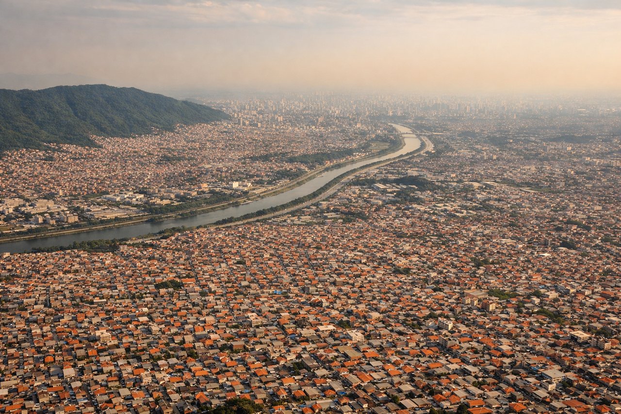
Landing at GRU
LEFTLeft-side seats provide excellent views during descent into São Paulo. The approach path typically brings the aircraft over the Paraíba River valley and the Serra da Mantiqueira foothills, with views of the densely urbanized São Paulo metropolitan area sprawling across the terrain.
Will your flight be in sunlight?
Pick a date and time in the Sun Map to watch the sun move across your whole flight.
About This Route
Which side of the plane should I sit on flying from Ambrosio L V Taravella (COR) to Guarulhos (GRU)?
Sit on the Left side of the plane for the best views on flights from Cordoba to Sao Paulo. While takeoff offers mountain views on the right, the landing approach on the left provides more dramatic and extensive scenery—the Serra da Mantiqueira, river valley, and the sprawling São Paulo metropolitan area create a more visually engaging final descent than the relatively modest Córdoba mountains at departure.
What can I see during takeoff from Ambrosio L V Taravella in Cordoba?
During takeoff from Ambrosio L V Taravella (COR), sit on the Right side for the best views. Right-side seats offer views of the Sierras de Córdoba mountain range as the aircraft climbs northeastward from the airport. These low mountains are the most visually distinctive feature during the initial climb-out phase. Notable sights include: Sierras de Córdoba (low mountain range to the west and northwest), Río Primero (visible as a linear feature in the agricultural plains), Córdoba city sprawl (urban grid visible briefly before climb), flat Pampas terrain extending eastward.
What can I see when landing at Guarulhos in Sao Paulo?
When landing at Guarulhos (GRU), sit on the Left side for the best views. Left-side seats provide excellent views during descent into São Paulo. The approach path typically brings the aircraft over the Paraíba River valley and the Serra da Mantiqueira foothills, with views of the densely urbanized São Paulo metropolitan area sprawling across the terrain. Notable sights include: Serra da Mantiqueira (mountain range visible on approach from the southwest), Paraíba River valley (linear feature cutting through the landscape), São Paulo metropolitan urban sprawl (extensive built-up area), Guarulhos airport industrial zone and surrounding suburbs.
How long is the flight from Cordoba to Sao Paulo?
The flight from Ambrosio L V Taravella (COR) to Guarulhos (GRU) takes about 2 hours 15 minutes. The shortest flight path between them is 1,215 miles (1,955 km); winds and air traffic control usually add a few percent.
What does the Cordoba to Sao Paulo flight path pass over?
The flight path crosses the Paraná River (visible as a major linear feature and natural border between Argentina and Paraguay/Brazil), passes over the subtropical forests and agricultural lands of Misiones Province (Argentina) and southern Paraguay, and enters the Brazilian plateau region. The terrain transitions from the flat Pampas of Córdoba through rolling hills and river valleys to the more elevated terrain approaching São Paulo. The Paraná River is the most distinctive midpoint landmark, appearing as a wide, meandering waterway with visible islands and vegetation patterns.