While the left side offers good views of the Sierras de Córdoba during takeoff, the right side delivers superior scenery during the longer descent phase and provides unobstructed views of the Andes, which are the flight's most dramatic geographical feature. The right side also captures Santiago's urban landscape and valley setting.
Flown COR to SCL? Did we get it right?
Flight Path
Cordoba to Santiago is 410 miles (660 km), a flight of about 2 hours 10 minutes.
The flight crosses the high desert plateau of central Argentina (Pampas de altura), with sparse vegetation and scattered salt lakes visible. The Río Desaguadero marks the Argentina-Chile border region. As the aircraft approaches Chilean airspace, the terrain transitions from arid plateau to the foothills of the Andes, with increasing elevation and the first appearance of snow-capped peaks on the horizon approximately 80 miles east of Santiago.
Great circle distance and headings ›


Phase by phase
Takeoff from COR
LEFTLeft side offers immediate views of the Sierras de Córdoba mountain range rising directly west of the airport. As the aircraft climbs on westbound departure, these peaks become increasingly prominent against the clear sky.
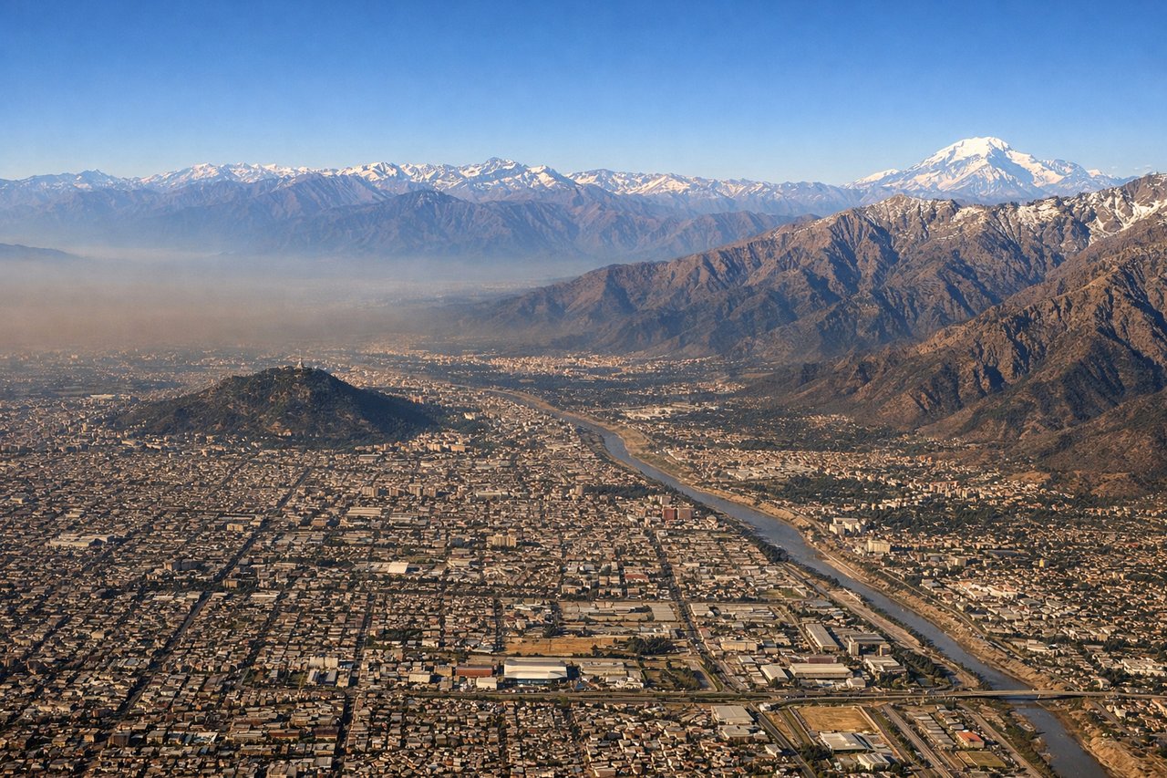
Landing at SCL
RIGHTRight side provides excellent views of the Andes foothills and the approach corridor over the central Chilean valley. As descent begins east of Santiago, the right side captures the dramatic rise of the Cordillera de los Andes and the city's urban sprawl in the valley floor.
Will your flight be in sunlight?
Pick a date and time in the Sun Map to watch the sun move across your whole flight.
About This Route
Which side of the plane should I sit on flying from Ambrosio L V Taravella (COR) to Arturo Merino Benitez International (SCL)?
Sit on the Right side of the plane for the best views on flights from Cordoba to Santiago. While the left side offers good views of the Sierras de Córdoba during takeoff, the right side delivers superior scenery during the longer descent phase and provides unobstructed views of the Andes, which are the flight's most dramatic geographical feature. The right side also captures Santiago's urban landscape and valley setting.
What can I see during takeoff from Ambrosio L V Taravella in Cordoba?
During takeoff from Ambrosio L V Taravella (COR), sit on the Left side for the best views. Left side offers immediate views of the Sierras de Córdoba mountain range rising directly west of the airport. As the aircraft climbs on westbound departure, these peaks become increasingly prominent against the clear sky. Notable sights include: Sierras de Córdoba (mountain range), Río Primero valley (visible as linear depression), Laguna Mar Chiquita (shallow salt lake to the northeast, visible as bright reflective surface), Córdoba city grid (receding eastward).
What can I see when landing at Arturo Merino Benitez International in Santiago?
When landing at Arturo Merino Benitez International (SCL), sit on the Right side for the best views. Right side provides excellent views of the Andes foothills and the approach corridor over the central Chilean valley. As descent begins east of Santiago, the right side captures the dramatic rise of the Cordillera de los Andes and the city's urban sprawl in the valley floor. Notable sights include: Cordillera de los Andes (main mountain range with snow-capped peaks), Santiago metropolitan area (sprawling urban grid in the valley), Mapocho River valley (linear feature threading through the city), Cerro San Cristóbal (prominent hill within Santiago).
How long is the flight from Cordoba to Santiago?
The flight from Ambrosio L V Taravella (COR) to Arturo Merino Benitez International (SCL) takes about 2 hours 10 minutes. The shortest flight path between them is 410 miles (660 km); winds and air traffic control usually add a few percent.
What does the Cordoba to Santiago flight path pass over?
The flight crosses the high desert plateau of central Argentina (Pampas de altura), with sparse vegetation and scattered salt lakes visible. The Río Desaguadero marks the Argentina-Chile border region. As the aircraft approaches Chilean airspace, the terrain transitions from arid plateau to the foothills of the Andes, with increasing elevation and the first appearance of snow-capped peaks on the horizon approximately 80 miles east of Santiago.