The takeoff experience from COS is significantly more scenic, with Pikes Peak and the Front Range providing dramatic mountain views that score 3.5+. The landing at SAL is moderately scenic (2.5) with volcanic terrain, but the cruise phase over central Mexico and Guatemala offers limited distinctive landmarks—mostly forested highlands and open terrain. Left side benefits from the superior COS departure; right side's SAL landing advantage is modest. Overall, left edges ahead due to the strong takeoff experience.
Flown COS to SAL? Did we get it right?
Flight Path
Colorado Springs to San Salvador is 1,996 miles (3,212 km), a flight of about 4 hours 15 minutes.
Sierra Madre Occidental (Mexico), Mexican plateau and volcanic highlands, Guatemala highlands, Lake Atitlán region, Central American volcanic chain including Volcán Tajumulco and Volcán Santa María
Great circle distance and headings ›Phase by phase
Takeoff from COS
LEFTLeft side captures the dramatic eastern face of Pikes Peak and the Front Range during initial climb-out. Most COS departures use runway 17L/35R; northbound departures (35R) turn left over the peak, while southbound (17L) also bank left initially. Right side faces the flat eastern plains with minimal terrain.
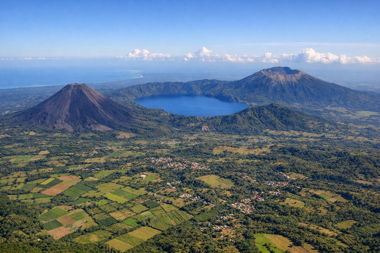
Landing at SAL
RIGHTRight side offers views of El Salvador's Pacific coastal approach and volcanic landscape during descent into SAL. The airport sits inland, but descent paths typically reveal the Central American highlands, volcanic peaks, and the approach to the San Salvador valley. Left side faces open ocean and lacks distinctive landmarks during the approach phase.
Will your flight be in sunlight?
Pick a date and time in the Sun Map to watch the sun move across your whole flight.
About This Route
Which side of the plane should I sit on flying from City Of Colorado Springs Muni (COS) to El Salvador International (SAL)?
Sit on the Left side of the plane for the best views on flights from Colorado Springs to San Salvador. The takeoff experience from COS is significantly more scenic, with Pikes Peak and the Front Range providing dramatic mountain views that score 3.5+. The landing at SAL is moderately scenic (2.5) with volcanic terrain, but the cruise phase over central Mexico and Guatemala offers limited distinctive landmarks—mostly forested highlands and open terrain. Left side benefits from the superior COS departure; right side's SAL landing advantage is modest. Overall, left edges ahead due to the strong takeoff experience.
What can I see during takeoff from City Of Colorado Springs Muni in Colorado Springs?
During takeoff from City Of Colorado Springs Muni (COS), sit on the Left side for the best views. Left side captures the dramatic eastern face of Pikes Peak and the Front Range during initial climb-out. Most COS departures use runway 17L/35R; northbound departures (35R) turn left over the peak, while southbound (17L) also bank left initially. Right side faces the flat eastern plains with minimal terrain. Notable sights include: Pikes Peak (14,115 ft), Garden of the Gods red rock formations, Cheyenne Mountain, Front Range foothills.
What can I see when landing at El Salvador International in San Salvador?
When landing at El Salvador International (SAL), sit on the Right side for the best views. Right side offers views of El Salvador's Pacific coastal approach and volcanic landscape during descent into SAL. The airport sits inland, but descent paths typically reveal the Central American highlands, volcanic peaks, and the approach to the San Salvador valley. Left side faces open ocean and lacks distinctive landmarks during the approach phase. Notable sights include: San Salvador volcano (Volcán de San Salvador), Lake Ilopango, Central American highlands, San Salvador city sprawl.
How long is the flight from Colorado Springs to San Salvador?
The flight from City Of Colorado Springs Muni (COS) to El Salvador International (SAL) takes about 4 hours 15 minutes. The shortest flight path between them is 1,996 miles (3,212 km); winds and air traffic control usually add a few percent.
What does the Colorado Springs to San Salvador flight path pass over?
Sierra Madre Occidental (Mexico), Mexican plateau and volcanic highlands, Guatemala highlands, Lake Atitlán region, Central American volcanic chain including Volcán Tajumulco and Volcán Santa María