Corpus Christi to Houston is 201 miles (324 km), a flight of about 50 minutes.
The right side captures the most distinctive scenery: Corpus Christi Bay and Padre Island during departure are more visually striking than the relatively flat Houston approach. The takeoff views offer better contrast and geographic interest.
Flight Path
During cruise between CRP and IAH, the flight passes over the coastal prairie and marshlands of southeast Texas. The Brazos River delta and associated wetlands are visible from altitude, appearing as a network of waterways and shallow bays. The landscape transitions from coastal barrier islands and bays near Corpus Christi to increasingly flat, developed terrain as you approach the Houston area. No significant mountains or dramatic elevation changes occur along this route—the entire corridor is coastal plain with maximum elevations under 100 feet.
Great circle distance and headings ›Phase by phase
Takeoff from CRP
RIGHTRight-side seats offer views of Corpus Christi Bay and the barrier islands as you climb out northwestward. The contrast between the shallow bay waters and the Gulf of Mexico is visually distinctive during the initial climb.
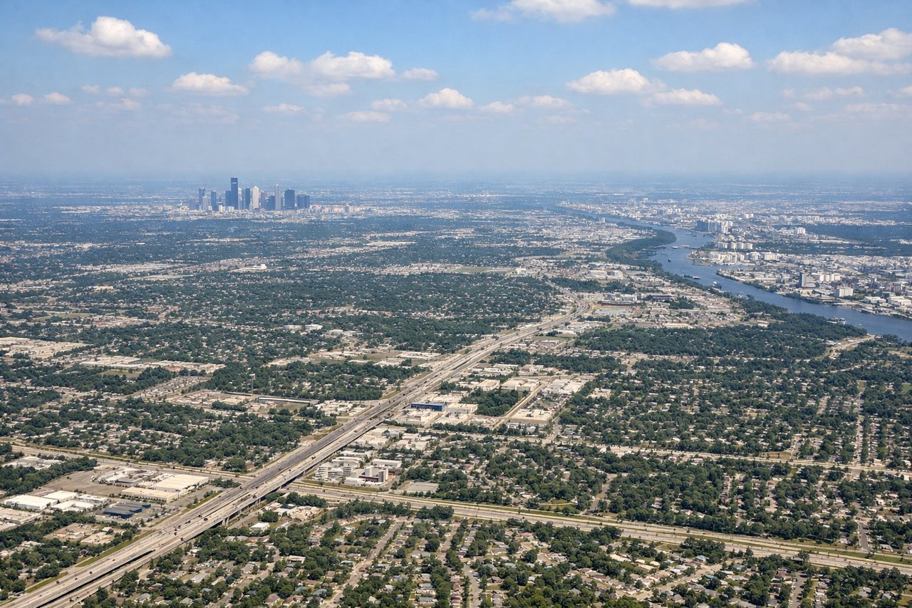
Landing at IAH
LEFTLeft-side seats provide views of the Houston metropolitan area and Buffalo Bayou as you descend from the southwest. You'll see the city's urban grid and industrial areas along the bayou corridor approaching IAH.
Will your flight be in sunlight?
Pick a date and time in the Sun Map to watch the sun move across your whole flight.
About This Route
Which side of the plane should I sit on flying from Corpus Christi International (CRP) to George Bush Intcntl Houston (IAH)?
Sit on the Right side of the plane for the best views on flights from Corpus Christi to Houston. The right side captures the most distinctive scenery: Corpus Christi Bay and Padre Island during departure are more visually striking than the relatively flat Houston approach. The takeoff views offer better contrast and geographic interest.
What can I see during takeoff from Corpus Christi International in Corpus Christi?
During takeoff from Corpus Christi International (CRP), sit on the Right side for the best views. Right-side seats offer views of Corpus Christi Bay and the barrier islands as you climb out northwestward. The contrast between the shallow bay waters and the Gulf of Mexico is visually distinctive during the initial climb. Notable sights include: Corpus Christi Bay, Padre Island (northern section), Laguna Madre, Gulf of Mexico coastline.
What can I see when landing at George Bush Intcntl Houston in Houston?
When landing at George Bush Intcntl Houston (IAH), sit on the Left side for the best views. Left-side seats provide views of the Houston metropolitan area and Buffalo Bayou as you descend from the southwest. You'll see the city's urban grid and industrial areas along the bayou corridor approaching IAH. Notable sights include: Buffalo Bayou, Houston downtown skyline, San Jacinto River, Galveston Bay (distant).
How long is the flight from Corpus Christi to Houston?
The flight from Corpus Christi International (CRP) to George Bush Intcntl Houston (IAH) takes about 50 minutes. The shortest flight path between them is 201 miles (324 km); winds and air traffic control usually add a few percent.
What does the Corpus Christi to Houston flight path pass over?
During cruise between CRP and IAH, the flight passes over the coastal prairie and marshlands of southeast Texas. The Brazos River delta and associated wetlands are visible from altitude, appearing as a network of waterways and shallow bays. The landscape transitions from coastal barrier islands and bays near Corpus Christi to increasingly flat, developed terrain as you approach the Houston area. No significant mountains or dramatic elevation changes occur along this route—the entire corridor is coastal plain with maximum elevations under 100 feet.