Houston to Corpus Christi is 201 miles (324 km), a flight of about 1 hour 5 minutes.
While the left side offers the Houston skyline on departure, the right side wins overall. During the flight southwest, the right side tracks along the Gulf coastal plain and picks up views of the bays and estuaries approaching Corpus Christi, culminating in the outstanding water and harbor views on final approach. The left side sees mostly flat South Texas brush country for most of the cruise.
Flight Path
The flight crosses the flat Gulf Coastal Plain of South Texas, passing over the Victoria area and the Guadalupe River valley. The terrain is uniformly flat agricultural and ranch land with scattered small towns. San Antonio Bay and the Aransas National Wildlife Refuge coastline may be visible to the right in the final third of the flight, along with the shallow bays and barrier islands of the Texas coast approaching Corpus Christi.
Great circle distance and headings ›Phase by phase
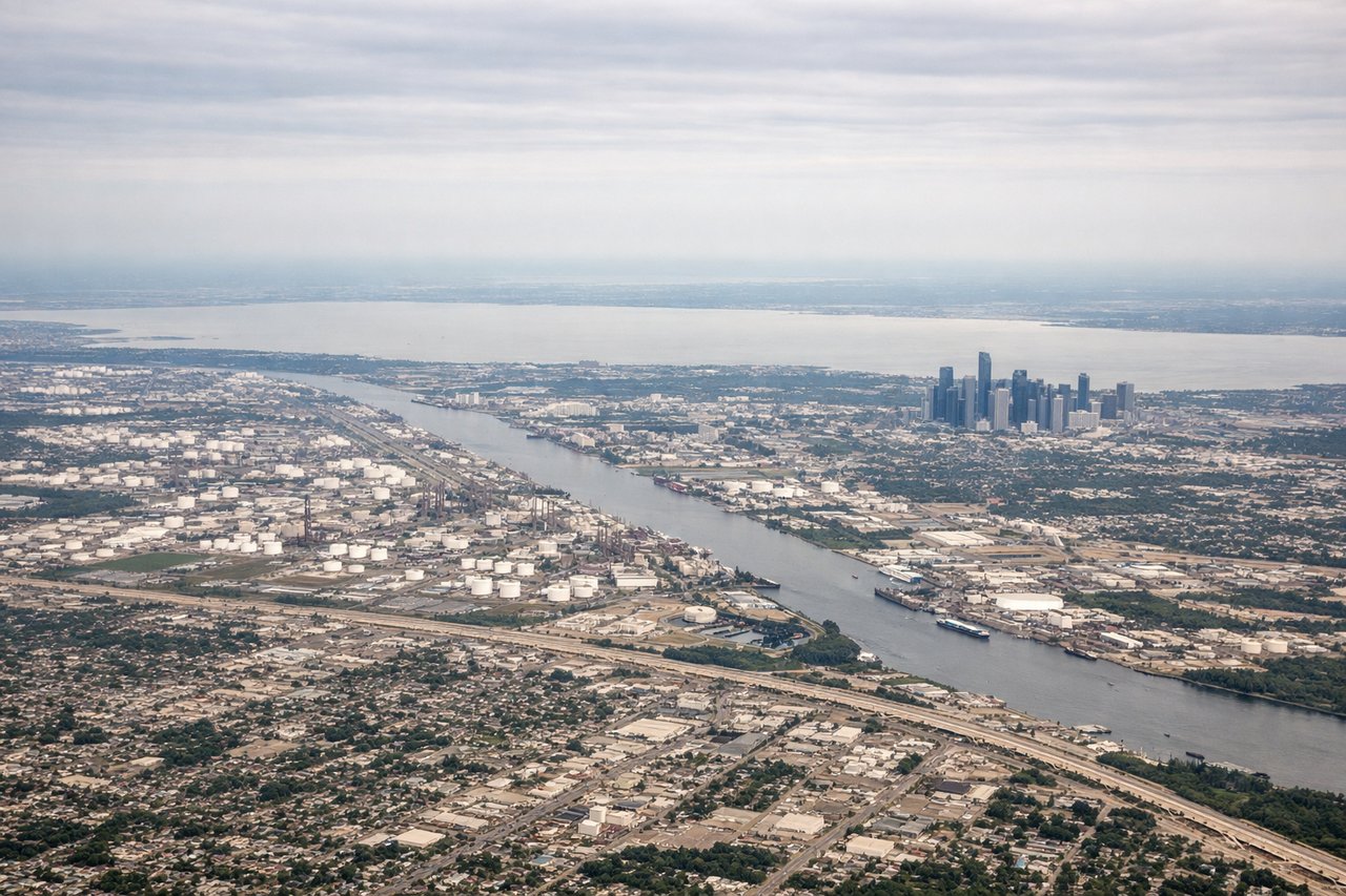
Takeoff from IAH
LEFTIAH primarily departs south on runways 15L/15R or north on 33L/33R. On a southbound departure toward Corpus Christi, the left (east) side gives you a clear view over downtown Houston's skyline as the aircraft climbs and turns southwest. The right side faces west toward flat suburban sprawl with little of interest.
Landing at CRP
RIGHTCRP typically lands on runway 13 (southeast) or runway 31 (northwest). On a runway 13 approach from the northwest, the right (west/southwest) side looks directly over Corpus Christi Bay, the Harbor Bridge, and the downtown waterfront as the aircraft descends over the water. The left side faces inland toward flat South Texas brush country.
Will your flight be in sunlight?
Pick a date and time in the Sun Map to watch the sun move across your whole flight.
About This Route
Which side of the plane should I sit on flying from George Bush Intcntl Houston (IAH) to Corpus Christi International (CRP)?
Sit on the Right side of the plane for the best views on flights from Houston to Corpus Christi. While the left side offers the Houston skyline on departure, the right side wins overall. During the flight southwest, the right side tracks along the Gulf coastal plain and picks up views of the bays and estuaries approaching Corpus Christi, culminating in the outstanding water and harbor views on final approach. The left side sees mostly flat South Texas brush country for most of the cruise.
What can I see during takeoff from George Bush Intcntl Houston in Houston?
During takeoff from George Bush Intcntl Houston (IAH), sit on the Left side for the best views. IAH primarily departs south on runways 15L/15R or north on 33L/33R. On a southbound departure toward Corpus Christi, the left (east) side gives you a clear view over downtown Houston's skyline as the aircraft climbs and turns southwest. The right side faces west toward flat suburban sprawl with little of interest. Notable sights include: Downtown Houston skyline, Houston Ship Channel and turning basin, Galveston Bay in the distance, Lake Houston to the northeast.
What can I see when landing at Corpus Christi International in Corpus Christi?
When landing at Corpus Christi International (CRP), sit on the Right side for the best views. CRP typically lands on runway 13 (southeast) or runway 31 (northwest). On a runway 13 approach from the northwest, the right (west/southwest) side looks directly over Corpus Christi Bay, the Harbor Bridge, and the downtown waterfront as the aircraft descends over the water. The left side faces inland toward flat South Texas brush country. Notable sights include: Corpus Christi Bay, Harbor Bridge, downtown Corpus Christi waterfront, Nueces Bay.
How long is the flight from Houston to Corpus Christi?
The flight from George Bush Intcntl Houston (IAH) to Corpus Christi International (CRP) takes about 1 hour 5 minutes. The shortest flight path between them is 201 miles (324 km); winds and air traffic control usually add a few percent.
What does the Houston to Corpus Christi flight path pass over?
The flight crosses the flat Gulf Coastal Plain of South Texas, passing over the Victoria area and the Guadalupe River valley. The terrain is uniformly flat agricultural and ranch land with scattered small towns. San Antonio Bay and the Aransas National Wildlife Refuge coastline may be visible to the right in the final third of the flight, along with the shallow bays and barrier islands of the Texas coast approaching Corpus Christi.