Right side wins overall because takeoff views of the Caribbean coast and islands are more visually distinctive than landing views, and the flight path itself (southwestbound at altitude) doesn't offer dramatic lateral features. The Caribbean departure is the flight's highlight.
Flight Path
During cruise at 25,000–30,000 feet, the flight path crosses the Magdalena River valley and the foothills of the Central Cordillera. The Magdalena River itself is visible as a winding brown ribbon in the valley below, particularly in the first 30 minutes after departure. The terrain transitions from coastal lowlands to increasingly mountainous terrain as you approach Bogotá. The Central Cordillera's peaks appear as a distant ridge line on the left (east) side during mid-flight. Cloud cover is common over the interior valleys, especially in the afternoon, which may obscure ground features. No major cities are directly on the flight path between CTG and BOG.
Great circle distance and headings ›

.jpg?width=600)
Phase by phase
Takeoff from CTG
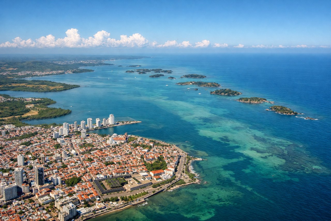
RIGHTRight side captures the Caribbean coast and Cartagena Bay as you climb out. CTG typically departs eastbound (Runway 13/31 depending on wind, but prevailing eastbound departures), so right seats face toward the water and coastal features immediately after liftoff.
Landing at BOG
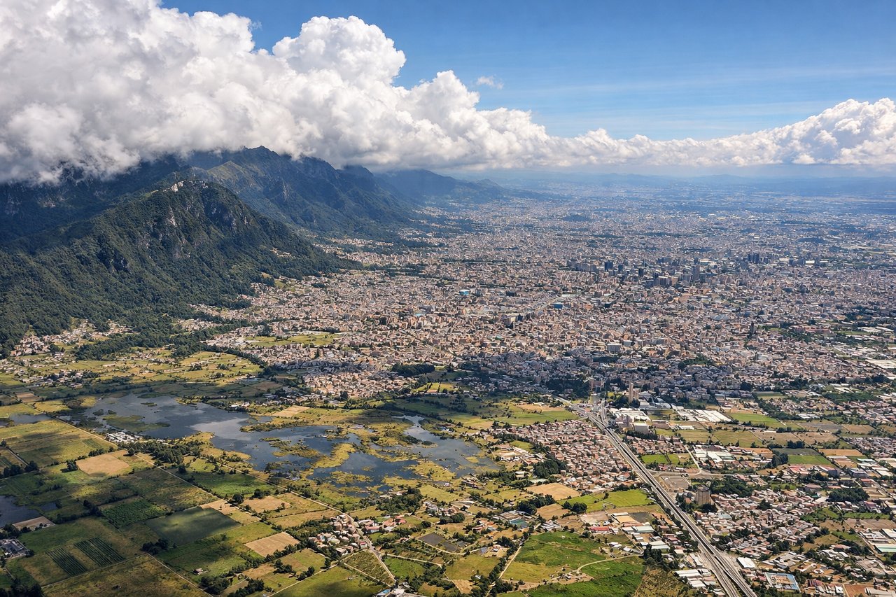
LEFTLeft side offers views of the Bogotá savanna and the approach corridor as you descend into Eldorado. BOG typically lands westbound (Runway 13L/31R), and left seats face toward the high-altitude plateau and the Andes' eastern cordillera as you descend through 15,000–8,000 feet.
Landmarks on this routeAll landmarks →
Will your flight be in sunlight?
See exactly which side of the plane gets sun and shade at your departure time.
About This Route
Which side of the plane should I sit on flying from Rafael Nunez (CTG) to Eldorado International (BOG)?
Sit on the Right side of the plane for the best views on flights from Cartagena to Bogota. Right side wins overall because takeoff views of the Caribbean coast and islands are more visually distinctive than landing views, and the flight path itself (southwestbound at altitude) doesn't offer dramatic lateral features. The Caribbean departure is the flight's highlight.
What can I see during takeoff from Rafael Nunez in Cartagena?
During takeoff from Rafael Nunez (CTG), sit on the Right side for the best views. Right side captures the Caribbean coast and Cartagena Bay as you climb out. CTG typically departs eastbound (Runway 13/31 depending on wind, but prevailing eastbound departures), so right seats face toward the water and coastal features immediately after liftoff. Notable sights include: Cartagena Bay (Bahía de Cartagena) with its distinctive irregular shoreline, the Rosario Islands (Islas del Rosario) archipelago scattered across turquoise water to the south, Cartagena's old walled city visible as a dense urban cluster on the peninsula, Caribbean Sea stretching to the horizon.
What can I see when landing at Eldorado International in Bogota?
When landing at Eldorado International (BOG), sit on the Left side for the best views. Left side offers views of the Bogotá savanna and the approach corridor as you descend into Eldorado. BOG typically lands westbound (Runway 13L/31R), and left seats face toward the high-altitude plateau and the Andes' eastern cordillera as you descend through 15,000–8,000 feet. Notable sights include: Eastern Cordillera of the Colombian Andes rising steeply to the left and ahead, Bogotá savanna (Altiplano Cundiboyacense) spreading below as a high-altitude plateau at ~2,600 m elevation with patchwork agricultural fields, Monserrate peak (3,152 m) visible as a distinctive forested ridge east of the city, Bogotá's urban sprawl filling the valley floor with a dense grid of buildings and streets.
How long is the flight from Cartagena to Bogota?
The flight from Rafael Nunez (CTG) to Eldorado International (BOG) takes Approximately 1 hour 15 minutes.
What does the Cartagena to Bogota flight path pass over?
During cruise at 25,000–30,000 feet, the flight path crosses the Magdalena River valley and the foothills of the Central Cordillera. The Magdalena River itself is visible as a winding brown ribbon in the valley below, particularly in the first 30 minutes after departure. The terrain transitions from coastal lowlands to increasingly mountainous terrain as you approach Bogotá. The Central Cordillera's peaks appear as a distant ridge line on the left (east) side during mid-flight. Cloud cover is common over the interior valleys, especially in the afternoon, which may obscure ground features. No major cities are directly on the flight path between CTG and BOG.