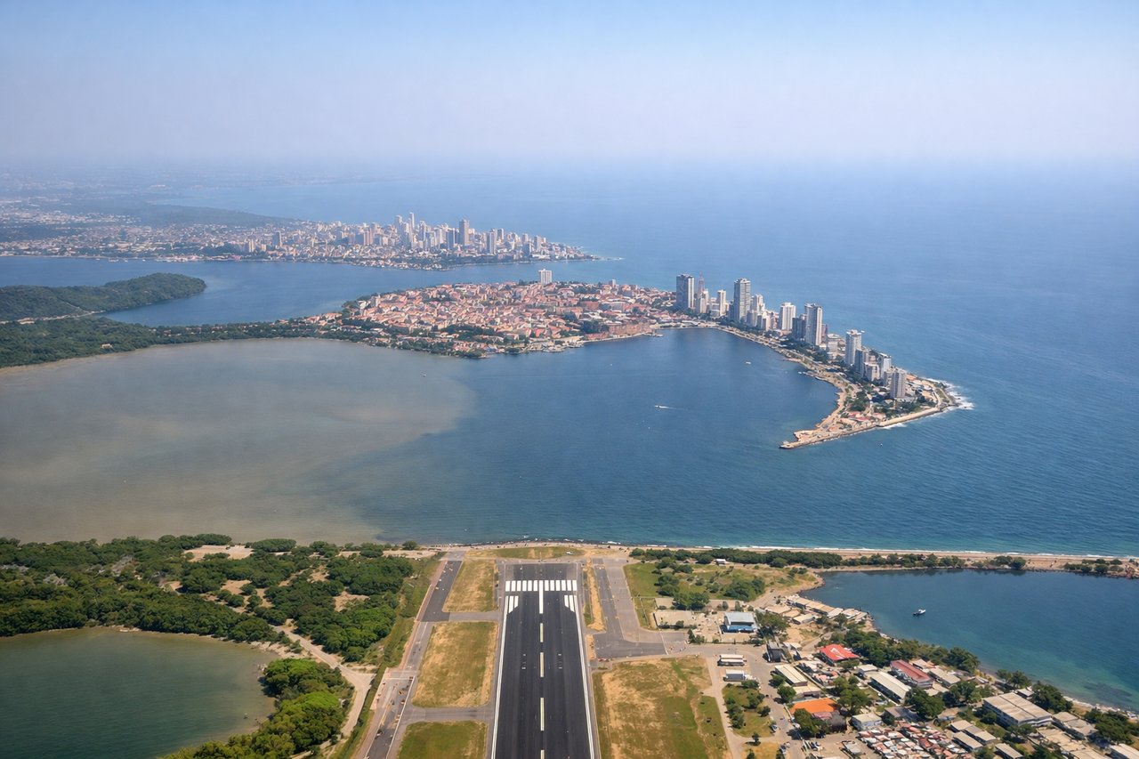
The left side captures the spectacular Cartagena bay and old city on departure, then tracks the Colombian and Central American coastline, the Gulf of Mexico approach, and still offers reasonable views of the Georgia landscape on descent. The takeoff view over Cartagena's bay and historic peninsula is the single most visually distinctive moment of the flight.
Flight Path
After leaving the Colombian coast the route crosses the western Caribbean Sea, passing over or near the Yucatán Peninsula and the Gulf of Mexico. On clear days the turquoise shallow waters of the Yucatán shelf are visible. The route then crosses Cuba or the Gulf of Mexico depending on the day's routing, followed by the Gulf Coast of the southeastern United States, and then the heavily forested Appalachian foothills of northern Georgia before descending into Atlanta.
Great circle distance and headings ›


.jpeg?width=600)
Phase by phase
Takeoff from CTG
LEFTCTG's primary departure runway 01 heads north, putting the left (west) side over the Bay of Cartagena and the historic walled city peninsula. You get a clear view of the old city grid, the bay, and the barrier islands of Bocagrande as the aircraft climbs and banks northeast.

Landing at ATL
RIGHTATL's primary arrival from the south typically uses runways 26L/26R or 27L/27R, with aircraft approaching from the southeast. The right side faces north and gives a clear view of downtown Atlanta's skyline — Midtown and the downtown cluster — as the aircraft descends over the southern suburbs.
Landmarks on this routeAll landmarks →
Will your flight be in sunlight?
See exactly which side of the plane gets sun and shade at your departure time.
About This Route
Which side of the plane should I sit on flying from Rafael Nunez (CTG) to The William B Hartsfield Atlanta International (ATL)?
Sit on the Left side of the plane for the best views on flights from Cartagena to Atlanta. The left side captures the spectacular Cartagena bay and old city on departure, then tracks the Colombian and Central American coastline, the Gulf of Mexico approach, and still offers reasonable views of the Georgia landscape on descent. The takeoff view over Cartagena's bay and historic peninsula is the single most visually distinctive moment of the flight.
What can I see during takeoff from Rafael Nunez in Cartagena?
During takeoff from Rafael Nunez (CTG), sit on the Left side for the best views. CTG's primary departure runway 01 heads north, putting the left (west) side over the Bay of Cartagena and the historic walled city peninsula. You get a clear view of the old city grid, the bay, and the barrier islands of Bocagrande as the aircraft climbs and banks northeast. Notable sights include: Bahía de Cartagena, the walled old city peninsula (Ciudad Amurallada), Bocagrande barrier spit, Isla Barú to the south.
What can I see when landing at The William B Hartsfield Atlanta International in Atlanta?
When landing at The William B Hartsfield Atlanta International (ATL), sit on the Right side for the best views. ATL's primary arrival from the south typically uses runways 26L/26R or 27L/27R, with aircraft approaching from the southeast. The right side faces north and gives a clear view of downtown Atlanta's skyline — Midtown and the downtown cluster — as the aircraft descends over the southern suburbs. Notable sights include: Downtown Atlanta skyline, Midtown Atlanta towers, Stone Mountain (visible to the northeast on clear days), I-285 perimeter highway loop.
How long is the flight from Cartagena to Atlanta?
The flight from Rafael Nunez (CTG) to The William B Hartsfield Atlanta International (ATL) takes Approximately 4 hours 15 minutes to 4 hours 45 minutes.
What does the Cartagena to Atlanta flight path pass over?
After leaving the Colombian coast the route crosses the western Caribbean Sea, passing over or near the Yucatán Peninsula and the Gulf of Mexico. On clear days the turquoise shallow waters of the Yucatán shelf are visible. The route then crosses Cuba or the Gulf of Mexico depending on the day's routing, followed by the Gulf Coast of the southeastern United States, and then the heavily forested Appalachian foothills of northern Georgia before descending into Atlanta.