While takeoff favors the right for coastal views, the landing approach dominates this short flight. Left seats provide superior views of the Aburrá Valley's dramatic geography and Medellin's mountain-enclosed setting during descent, which is the more visually compelling segment of this 1-hour flight.
Flight Path
The flight path crosses inland from the Caribbean coast through the Magdalena River valley region, then climbs gradually toward the Cordillera Central. The central mountain range becomes increasingly prominent as you approach Medellin. The Cauca River valley lies to the west of the direct route. Terrain rises from near sea level at Cartagena to approximately 4,900 feet at Medellin's airport elevation. Scattered cumulus clouds typically form over the interior highlands by mid-morning.
Great circle distance and headings ›Phase by phase
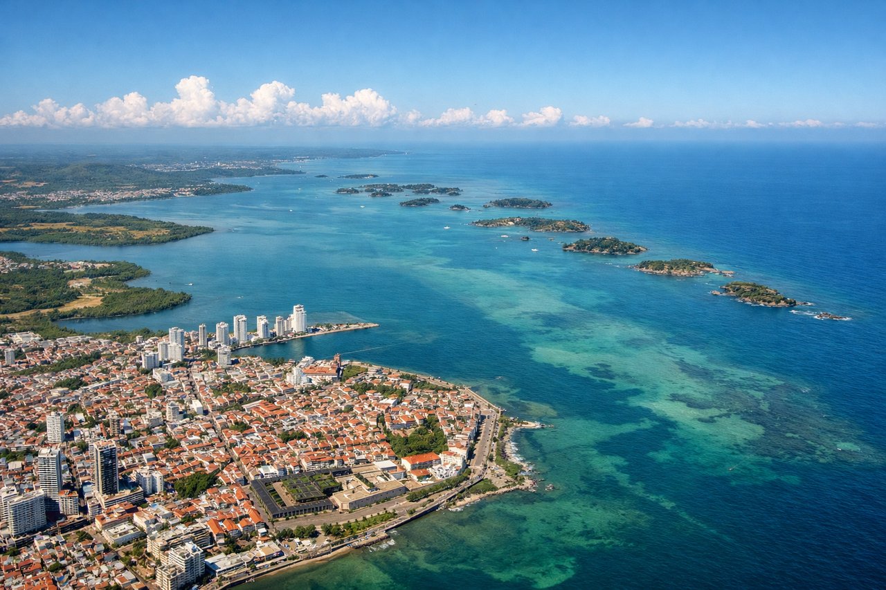
Takeoff from CTG
RIGHTRafael Nunez typically departs to the north or northeast. Right-side seats offer immediate views of the Caribbean coastline, Cartagena Bay, and the transition from coastal wetlands to the interior plateau as you climb southbound toward Medellin.
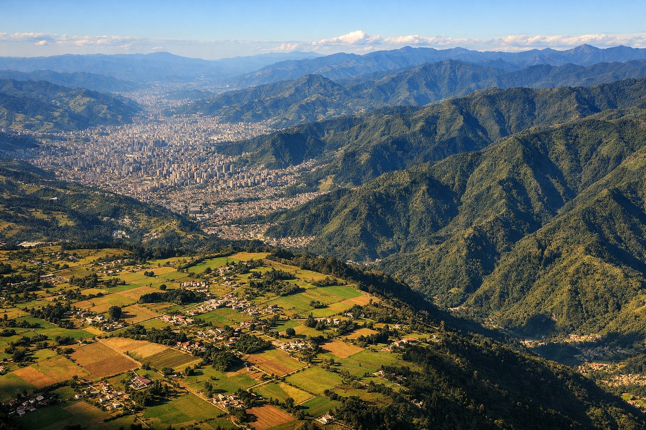
Landing at MDE
LEFTJose Maria Cordova typically receives aircraft from the north on runway 01. Left-side seats during descent provide excellent views of the Aburrá Valley, Medellin city sprawl, and the surrounding Cordillera Central peaks that frame the approach corridor.
Landmarks on this routeAll landmarks →
Will your flight be in sunlight?
See exactly which side of the plane gets sun and shade at your departure time.
About This Route
Which side of the plane should I sit on flying from Rafael Nunez (CTG) to Jose Maria Cordova (MDE)?
Sit on the Left side of the plane for the best views on flights from Cartagena to Rio Negro. While takeoff favors the right for coastal views, the landing approach dominates this short flight. Left seats provide superior views of the Aburrá Valley's dramatic geography and Medellin's mountain-enclosed setting during descent, which is the more visually compelling segment of this 1-hour flight.
What can I see during takeoff from Rafael Nunez in Cartagena?
During takeoff from Rafael Nunez (CTG), sit on the Right side for the best views. Rafael Nunez typically departs to the north or northeast. Right-side seats offer immediate views of the Caribbean coastline, Cartagena Bay, and the transition from coastal wetlands to the interior plateau as you climb southbound toward Medellin. Notable sights include: Caribbean Sea (north), Cartagena Bay and Rosario Islands (northeast), Magdalena River delta region (south), coastal mangrove wetlands (immediate vicinity).
What can I see when landing at Jose Maria Cordova in Rio Negro?
When landing at Jose Maria Cordova (MDE), sit on the Left side for the best views. Jose Maria Cordova typically receives aircraft from the north on runway 01. Left-side seats during descent provide excellent views of the Aburrá Valley, Medellin city sprawl, and the surrounding Cordillera Central peaks that frame the approach corridor. Notable sights include: Aburrá Valley (central feature), Medellin city and surrounding municipalities (dense urban grid), Cordillera Central peaks (east and west valley walls), Rio Medellin (visible as linear feature through valley floor).
How long is the flight from Cartagena to Rio Negro?
The flight from Rafael Nunez (CTG) to Jose Maria Cordova (MDE) takes Approximately 50-60 minutes.
What does the Cartagena to Rio Negro flight path pass over?
The flight path crosses inland from the Caribbean coast through the Magdalena River valley region, then climbs gradually toward the Cordillera Central. The central mountain range becomes increasingly prominent as you approach Medellin. The Cauca River valley lies to the west of the direct route. Terrain rises from near sea level at Cartagena to approximately 4,900 feet at Medellin's airport elevation. Scattered cumulus clouds typically form over the interior highlands by mid-morning.