The right side wins on both ends of the flight: Hokkaido's volcanic caldera lake and peaks during departure, and Lantau Island's mountains and the Big Buddha area during the Hong Kong approach, while the left side offers mostly flat coastline and open water during these same phases.
Flown CTS to HKG? Did we get it right?
Flight Path
Sapporo to Hong Kong is 2,130 miles (3,429 km), a flight of about 4 hours 50 minutes.
The route crosses the Sea of Japan west of Honshu and Kyushu, then continues over the East China Sea south of Kyushu, passing near the northern Okinawa island chain before reaching the Taiwan Strait and the Guangdong coastline approaching Hong Kong.
Great circle distance and headings ›

Phase by phase
Takeoff from CTS
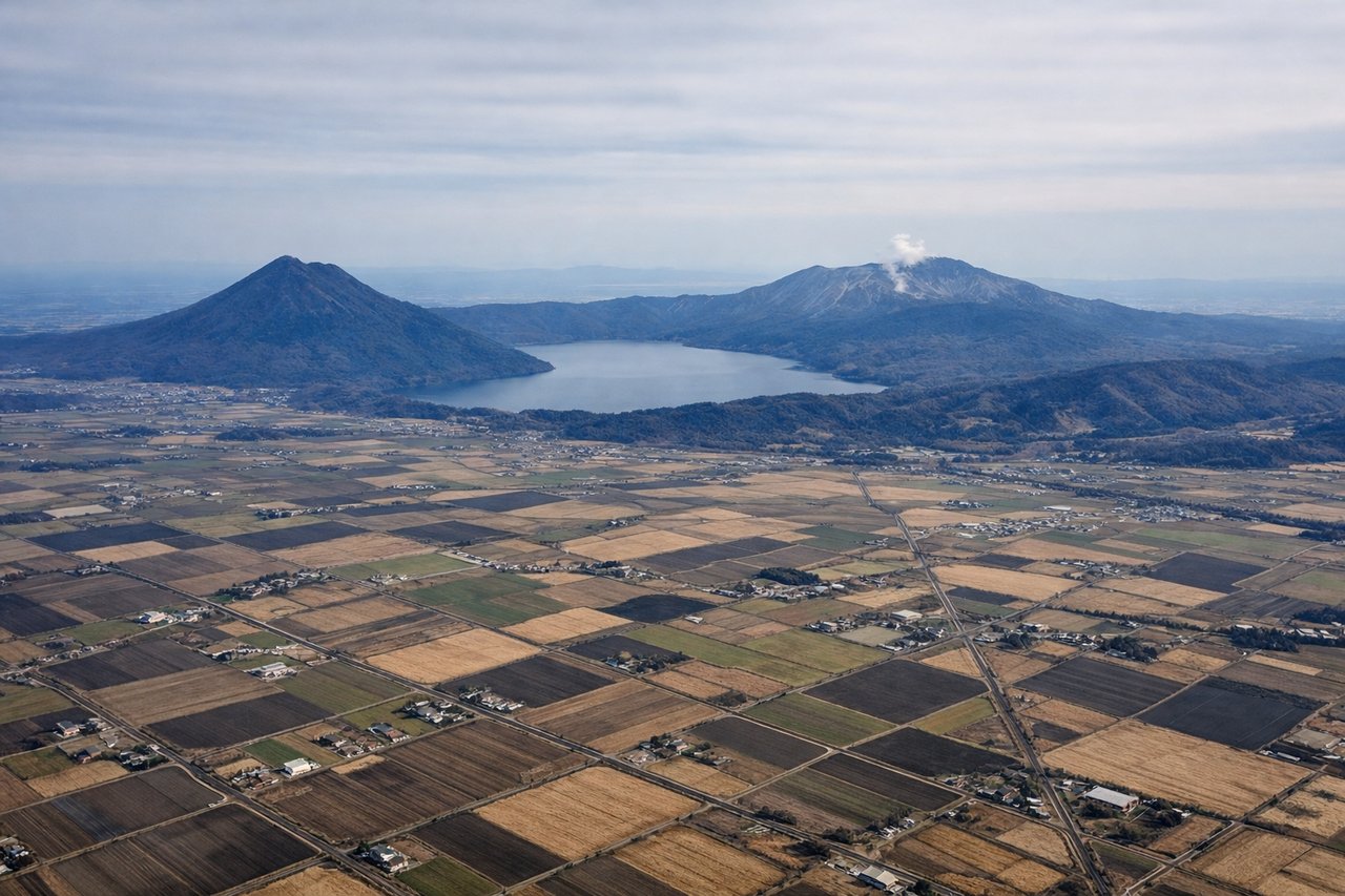
RIGHTClimbing out of Chitose, the right side looks west toward the volcanic heart of Shikotsu-Toya National Park, including caldera Lake Shikotsu and the active cone of Mt. Tarumae, with the distinctive symmetrical Mt. Yotei further on the horizon. The left side only shows the flatter industrial Pacific coast near Tomakomai.

Landing at HKG
RIGHTOn the common runway 07 approach into Hong Kong, the aircraft turns in from the south over the South China Sea, putting Lantau Island's mountains on the right side, including Lantau Peak and the Po Lin Monastery area near the Big Buddha. The left side mainly faces open water and distant, often hazy views toward the mainland.
Will your flight be in sunlight?
Pick a date and time in the Sun Map to watch the sun move across your whole flight.
About This Route
Which side of the plane should I sit on flying from Chitose International Airport (CTS) to Hong Kong International (HKG)?
Sit on the Right side of the plane for the best views on flights from Sapporo to Hong Kong. The right side wins on both ends of the flight: Hokkaido's volcanic caldera lake and peaks during departure, and Lantau Island's mountains and the Big Buddha area during the Hong Kong approach, while the left side offers mostly flat coastline and open water during these same phases.
What can I see during takeoff from Chitose International Airport in Sapporo?
During takeoff from Chitose International Airport (CTS), sit on the Right side for the best views. Climbing out of Chitose, the right side looks west toward the volcanic heart of Shikotsu-Toya National Park, including caldera Lake Shikotsu and the active cone of Mt. Tarumae, with the distinctive symmetrical Mt. Yotei further on the horizon. The left side only shows the flatter industrial Pacific coast near Tomakomai. Notable sights include: Lake Shikotsu, Mt. Tarumae, Mt. Yotei, Shikotsu-Toya National Park ridgelines.
What can I see when landing at Hong Kong International in Hong Kong?
When landing at Hong Kong International (HKG), sit on the Right side for the best views. On the common runway 07 approach into Hong Kong, the aircraft turns in from the south over the South China Sea, putting Lantau Island's mountains on the right side, including Lantau Peak and the Po Lin Monastery area near the Big Buddha. The left side mainly faces open water and distant, often hazy views toward the mainland. Notable sights include: Lantau Peak, Po Lin Monastery and Tian Tan Buddha area, South China Sea islands, Hong Kong International Airport's Chek Lap Kok reclamation.
How long is the flight from Sapporo to Hong Kong?
The flight from Chitose International Airport (CTS) to Hong Kong International (HKG) takes about 4 hours 50 minutes. The shortest flight path between them is 2,130 miles (3,429 km); winds and air traffic control usually add a few percent.
What does the Sapporo to Hong Kong flight path pass over?
The route crosses the Sea of Japan west of Honshu and Kyushu, then continues over the East China Sea south of Kyushu, passing near the northern Okinawa island chain before reaching the Taiwan Strait and the Guangdong coastline approaching Hong Kong.