Sapporo to Tokyo is 509 miles (820 km), a flight of about 1 hour 30 minutes.
The left side wins throughout: volcanic peaks and lakes during departure from Hokkaido, and a dramatic bay-and-skyline approach into Tokyo. The right side mostly shows open Pacific Ocean or featureless inland terrain during cruise.
Flight Path
The flight crosses northern Honshu, passing over the mountainous Tohoku region including parts of the Ou Mountains, before descending toward the Kanto Plain and Tokyo Bay.
Great circle distance and headings ›Phase by phase
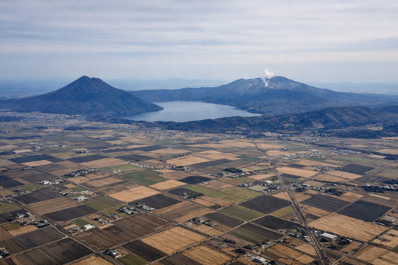
Takeoff from CTS
LEFTDeparting CTS southbound, the left side offers views of the volcanic peaks around Shikotsu-Toya National Park, including Mount Yotei and the caldera lakes, before the coastline of Hokkaido's Pacific side falls away. It's a dramatic, mountainous start to the flight.
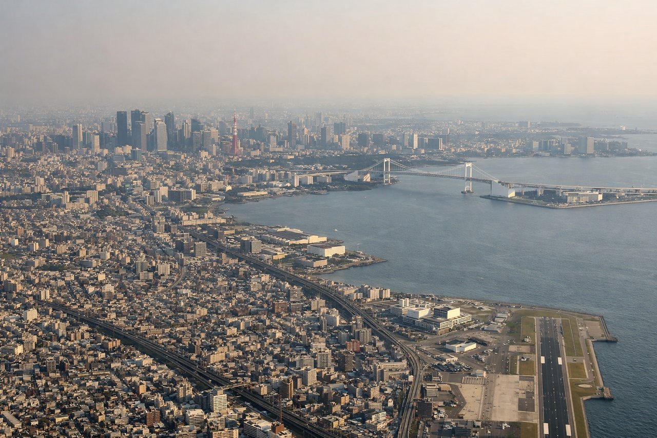
Landing at HND
LEFTOn approach to HND from the north, the left side reveals Tokyo Bay, the city's dense skyline including the Tokyo Tower and Rainbow Bridge area, and the industrial waterfront of Kawasaki and Yokohama. It's a striking urban approach over one of the world's largest metropolitan areas.
Landmarks on this routeAll landmarks →
Will your flight be in sunlight?
Pick a date and time in the Sun Map to watch the sun move across your whole flight.
About This Route
Which side of the plane should I sit on flying from Chitose International Airport (CTS) to Tokyo International (HND)?
Sit on the Left side of the plane for the best views on flights from Sapporo to Tokyo. The left side wins throughout: volcanic peaks and lakes during departure from Hokkaido, and a dramatic bay-and-skyline approach into Tokyo. The right side mostly shows open Pacific Ocean or featureless inland terrain during cruise.
What can I see during takeoff from Chitose International Airport in Sapporo?
During takeoff from Chitose International Airport (CTS), sit on the Left side for the best views. Departing CTS southbound, the left side offers views of the volcanic peaks around Shikotsu-Toya National Park, including Mount Yotei and the caldera lakes, before the coastline of Hokkaido's Pacific side falls away. It's a dramatic, mountainous start to the flight. Notable sights include: Mount Yotei, Lake Shikotsu, Tomakomai coastline, Hokkaido mountains.
What can I see when landing at Tokyo International in Tokyo?
When landing at Tokyo International (HND), sit on the Left side for the best views. On approach to HND from the north, the left side reveals Tokyo Bay, the city's dense skyline including the Tokyo Tower and Rainbow Bridge area, and the industrial waterfront of Kawasaki and Yokohama. It's a striking urban approach over one of the world's largest metropolitan areas. Notable sights include: Tokyo Bay, Tokyo skyline, Rainbow Bridge, Yokohama waterfront.
How long is the flight from Sapporo to Tokyo?
The flight from Chitose International Airport (CTS) to Tokyo International (HND) takes about 1 hour 30 minutes. The shortest flight path between them is 509 miles (820 km); winds and air traffic control usually add a few percent.
What does the Sapporo to Tokyo flight path pass over?
The flight crosses northern Honshu, passing over the mountainous Tohoku region including parts of the Ou Mountains, before descending toward the Kanto Plain and Tokyo Bay.