The right side delivers the standout volcanic scenery at takeoff near CTS and the best skyline and possible Fuji view on landing at NRT, while the left side is dominated by long stretches of Pacific coastline and open ocean with less variety.
Flight Path
The route parallels the Tohoku Pacific coast, passing near Sendai Bay and the Ou Mountains inland to the west, before crossing into the Kanto plain near Ibaraki and Chiba.
Great circle distance and headings ›Phase by phase
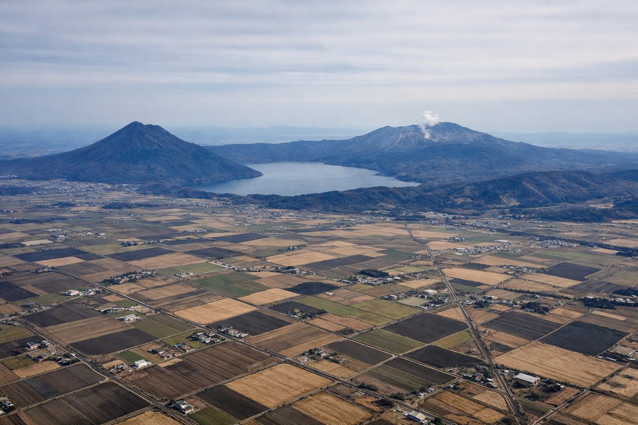
Takeoff from CTS
RIGHTDeparting CTS southbound, the right (west) side looks straight into the Shikotsu-Toya volcanic zone, with Lake Shikotsu's caldera and the active cone of Mt. Tarumae rising right beside the climb-out path. The left side over the Pacific coast near Tomakomai is comparatively flat and industrial.
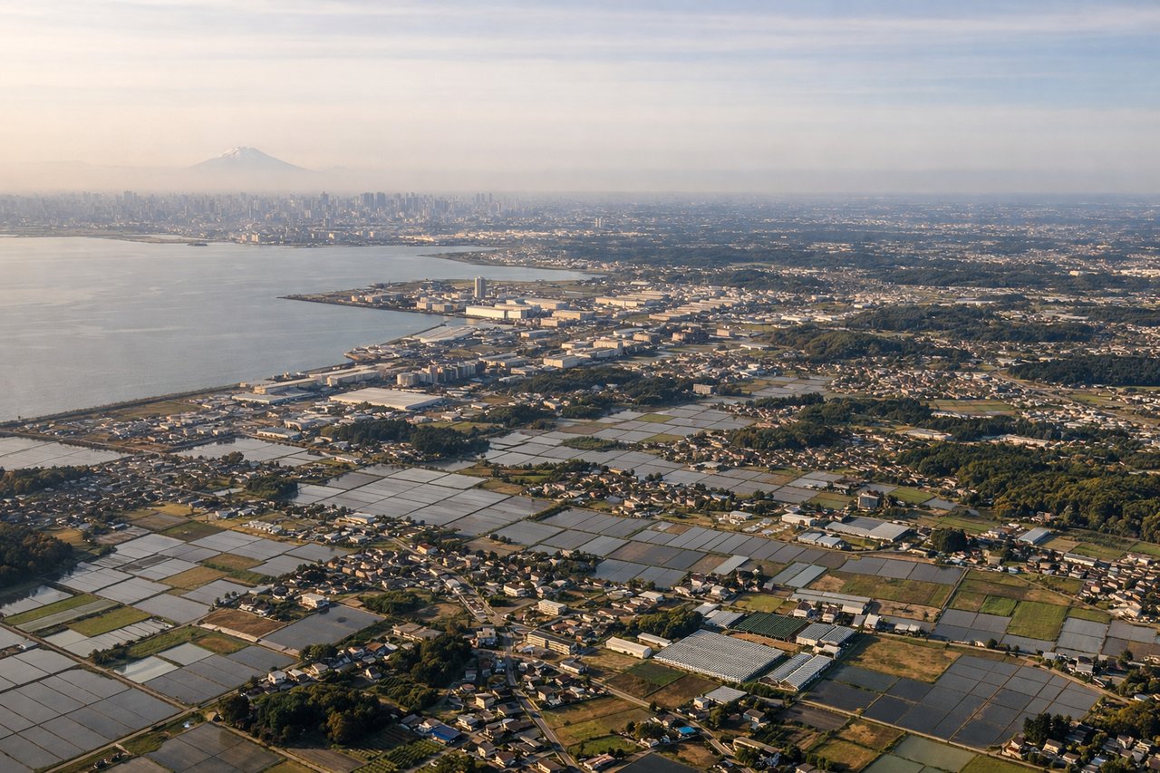
Landing at NRT
RIGHTOn approach into Narita from the north, the right (west) side reveals the sprawl of the Tokyo metropolitan area and Tokyo Bay in the distance, with Mt. Fuji's silhouette sometimes visible on clear days beyond the Kanto plain. The left side mostly shows the flatter Kashima industrial coast and open Pacific.
Landmarks on this routeAll landmarks →
Will your flight be in sunlight?
See exactly which side of the plane gets sun and shade at your departure time.
About This Route
Which side of the plane should I sit on flying from Chitose International Airport (CTS) to New Tokyo International (NRT)?
Sit on the Right side of the plane for the best views on flights from Sapporo to Tokyo. The right side delivers the standout volcanic scenery at takeoff near CTS and the best skyline and possible Fuji view on landing at NRT, while the left side is dominated by long stretches of Pacific coastline and open ocean with less variety.
What can I see during takeoff from Chitose International Airport in Sapporo?
During takeoff from Chitose International Airport (CTS), sit on the Right side for the best views. Departing CTS southbound, the right (west) side looks straight into the Shikotsu-Toya volcanic zone, with Lake Shikotsu's caldera and the active cone of Mt. Tarumae rising right beside the climb-out path. The left side over the Pacific coast near Tomakomai is comparatively flat and industrial. Notable sights include: Lake Shikotsu caldera, Mt. Tarumae volcano, Mt. Yotei (Ezo Fuji) on the horizon, Tomakomai coastline.
What can I see when landing at New Tokyo International in Tokyo?
When landing at New Tokyo International (NRT), sit on the Right side for the best views. On approach into Narita from the north, the right (west) side reveals the sprawl of the Tokyo metropolitan area and Tokyo Bay in the distance, with Mt. Fuji's silhouette sometimes visible on clear days beyond the Kanto plain. The left side mostly shows the flatter Kashima industrial coast and open Pacific. Notable sights include: Tokyo Bay, Tokyo skyline (Shinjuku/Minato towers), Mt. Fuji silhouette (clear days), Chiba farmland patchwork.
How long is the flight from Sapporo to Tokyo?
The flight from Chitose International Airport (CTS) to New Tokyo International (NRT) takes 1h 50m.
What does the Sapporo to Tokyo flight path pass over?
The route parallels the Tohoku Pacific coast, passing near Sendai Bay and the Ou Mountains inland to the west, before crossing into the Kanto plain near Ibaraki and Chiba.