Sapporo to Los Angeles is 5,118 miles (8,236 km), a flight of about 9 hours 30 minutes.
Right side wins both ends of the flight. At takeoff you get Hokkaido's volcanic lakes and peaks; on approach you get the Santa Monica Mountains and the LA Basin. Over the Pacific the views are largely ocean regardless of side, but the right side also offers slightly better angles on the Aleutian Island chain if the routing passes near it.
Flight Path
The great circle route from CTS to LAX arcs northeast over the North Pacific, passing south of the Aleutian Islands chain (Alaska), then tracking southeast across open ocean before making landfall near the Northern California or Central California coast. Passengers may see the Aleutian Islands as low dark landmasses on the horizon in the first few hours, then hours of open North Pacific, followed by the California coastline and the Sierra Nevada foothills as the aircraft descends toward Southern California.
Great circle distance and headings ›
.jpg?width=600)
Phase by phase
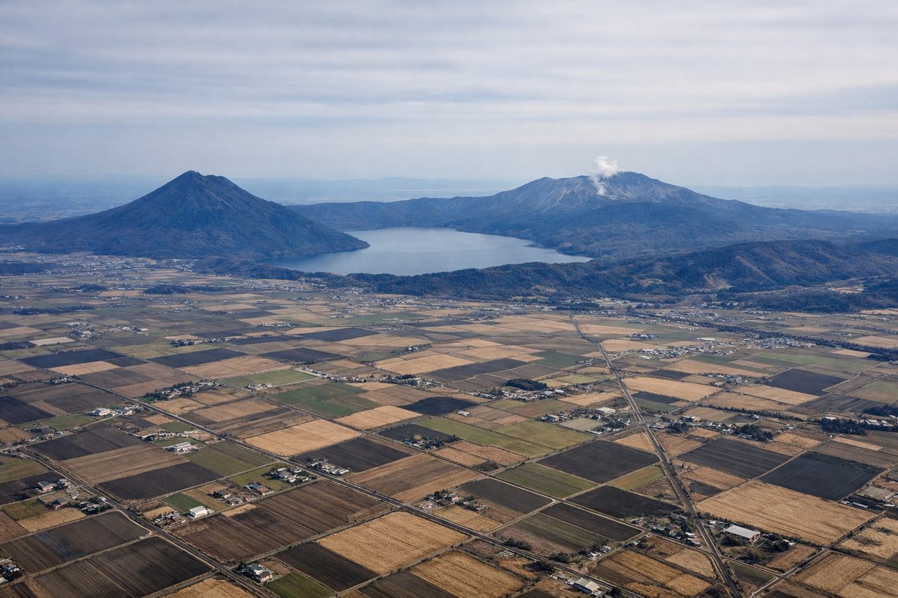
Takeoff from CTS
RIGHTCTS runways 01L/01R point roughly north, so a northbound departure puts the right side facing east toward the Pacific coast and the volcanic peaks of central Hokkaido. You get a clear look at Lake Shikotsu and the surrounding caldera terrain as the aircraft climbs and turns northeast before banking right toward the Pacific.

Landing at LAX
RIGHTLAX's primary arrival runways 24L/24R have aircraft approaching from the east over the Los Angeles Basin, putting the right side facing north over the Santa Monica Mountains, the San Fernando Valley, and the Hollywood Hills. The left side faces south over the South Bay and open ocean, which is far less interesting.
Landmarks on this routeAll landmarks →
Will your flight be in sunlight?
Pick a date and time in the Sun Map to watch the sun move across your whole flight.
About This Route
Which side of the plane should I sit on flying from Chitose International Airport (CTS) to Los Angeles International (LAX)?
Sit on the Right side of the plane for the best views on flights from Sapporo to Los Angeles. Right side wins both ends of the flight. At takeoff you get Hokkaido's volcanic lakes and peaks; on approach you get the Santa Monica Mountains and the LA Basin. Over the Pacific the views are largely ocean regardless of side, but the right side also offers slightly better angles on the Aleutian Island chain if the routing passes near it.
What can I see during takeoff from Chitose International Airport in Sapporo?
During takeoff from Chitose International Airport (CTS), sit on the Right side for the best views. CTS runways 01L/01R point roughly north, so a northbound departure puts the right side facing east toward the Pacific coast and the volcanic peaks of central Hokkaido. You get a clear look at Lake Shikotsu and the surrounding caldera terrain as the aircraft climbs and turns northeast before banking right toward the Pacific. Notable sights include: Lake Shikotsu (caldera lake to the southeast), Mount Tarumae (active stratovolcano on Shikotsu's rim), Uchiura Bay coastline to the south, Sapporo city grid to the northwest.
What can I see when landing at Los Angeles International in Los Angeles?
When landing at Los Angeles International (LAX), sit on the Right side for the best views. LAX's primary arrival runways 24L/24R have aircraft approaching from the east over the Los Angeles Basin, putting the right side facing north over the Santa Monica Mountains, the San Fernando Valley, and the Hollywood Hills. The left side faces south over the South Bay and open ocean, which is far less interesting. Notable sights include: Santa Monica Mountains ridge, San Fernando Valley sprawl to the north, Griffith Observatory area on the Hollywood Hills, Santa Monica Bay coastline.
How long is the flight from Sapporo to Los Angeles?
The flight from Chitose International Airport (CTS) to Los Angeles International (LAX) takes about 9 hours 30 minutes. The shortest flight path between them is 5,118 miles (8,236 km); winds and air traffic control usually add a few percent.
What does the Sapporo to Los Angeles flight path pass over?
The great circle route from CTS to LAX arcs northeast over the North Pacific, passing south of the Aleutian Islands chain (Alaska), then tracking southeast across open ocean before making landfall near the Northern California or Central California coast. Passengers may see the Aleutian Islands as low dark landmasses on the horizon in the first few hours, then hours of open North Pacific, followed by the California coastline and the Sierra Nevada foothills as the aircraft descends toward Southern California.