Sapporo to Seoul is 883 miles (1,421 km), a flight of about 2 hours 10 minutes.
The right side offers a stronger visual bookend with Sapporo's cityscape and Mt. Yotei at departure and Seoul's skyline along the Han River at arrival, while the left side is dominated by flatter coastal terrain and open water during those same phases.
Flight Path
Open Sea of Japan (East Sea) crossing, with a possible distant view of Ulleungdo Island and the mountainous Gangwon-do coastline of Korea as the descent begins
Great circle distance and headings ›Phase by phase
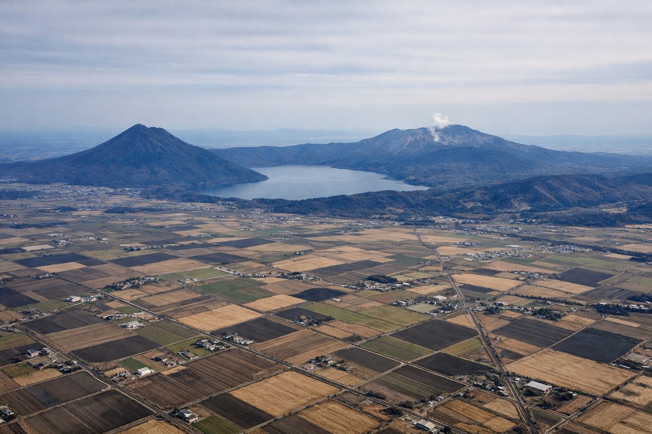
Takeoff from CTS
RIGHTDeparting CTS southbound before turning southwest toward Korea, the right side gives passengers a look back at Sapporo's urban sprawl, Ishikari Bay, and the volcanic cone of Mt. Yotei in the distance. The left side mostly shows the flatter Tomakomai industrial coastline and open Pacific, which is less visually interesting.
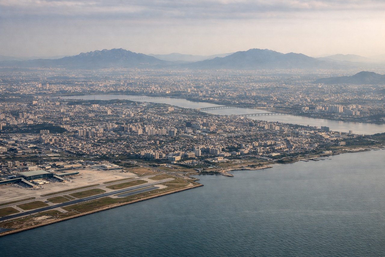
Landing at ICN
RIGHTOn the approach into ICN's northwest-facing runways, the aircraft tracks over the Korean mainland before turning toward Yeongjongdo Island, putting the sprawling Seoul metropolitan area and the Han River on the right side. The left side mainly overlooks the flat tidal mudflats and outlying islands of the Yellow Sea, which are far less dramatic.
Will your flight be in sunlight?
Pick a date and time in the Sun Map to watch the sun move across your whole flight.
About This Route
Which side of the plane should I sit on flying from Chitose International Airport (CTS) to Incheon International (ICN)?
Sit on the Right side of the plane for the best views on flights from Sapporo to Seoul. The right side offers a stronger visual bookend with Sapporo's cityscape and Mt. Yotei at departure and Seoul's skyline along the Han River at arrival, while the left side is dominated by flatter coastal terrain and open water during those same phases.
What can I see during takeoff from Chitose International Airport in Sapporo?
During takeoff from Chitose International Airport (CTS), sit on the Right side for the best views. Departing CTS southbound before turning southwest toward Korea, the right side gives passengers a look back at Sapporo's urban sprawl, Ishikari Bay, and the volcanic cone of Mt. Yotei in the distance. The left side mostly shows the flatter Tomakomai industrial coastline and open Pacific, which is less visually interesting. Notable sights include: Sapporo city, Ishikari Bay, Mt. Yotei, Lake Shikotsu caldera rim.
What can I see when landing at Incheon International in Seoul?
When landing at Incheon International (ICN), sit on the Right side for the best views. On the approach into ICN's northwest-facing runways, the aircraft tracks over the Korean mainland before turning toward Yeongjongdo Island, putting the sprawling Seoul metropolitan area and the Han River on the right side. The left side mainly overlooks the flat tidal mudflats and outlying islands of the Yellow Sea, which are far less dramatic. Notable sights include: Han River, Seoul skyline (Lotte World Tower visible on clear days), Gimpo area, Yellow Sea tidal flats.
How long is the flight from Sapporo to Seoul?
The flight from Chitose International Airport (CTS) to Incheon International (ICN) takes about 2 hours 10 minutes. The shortest flight path between them is 883 miles (1,421 km); winds and air traffic control usually add a few percent.
What does the Sapporo to Seoul flight path pass over?
Open Sea of Japan (East Sea) crossing, with a possible distant view of Ulleungdo Island and the mountainous Gangwon-do coastline of Korea as the descent begins