Chengdu to Guangzhou is 759 miles (1,221 km), a flight of about 2 hours 5 minutes.
The right side combines a mountainous departure from the Sichuan basin, a cruise-phase pass near the karst peaks around Guilin, and an urban, hill-framed approach into Guangzhou, giving it far more visual variety than the left side's plainer plateau and delta views.
Flight Path
Yunnan-Guizhou plateau uplands transitioning into the karst hill country of northern Guangxi near Guilin, visible along the cruise track before the descent into the Pearl River Delta.
Great circle distance and headings ›
.jpg?width=600)
Phase by phase
Takeoff from CTU
RIGHTDeparting CTU southbound, the right side looks west toward the rugged foothills of the Qionglai Mountains and the eastern edge of the Tibetan Plateau, a dramatic contrast to the flat Chengdu basin on the left.
Landing at CAN
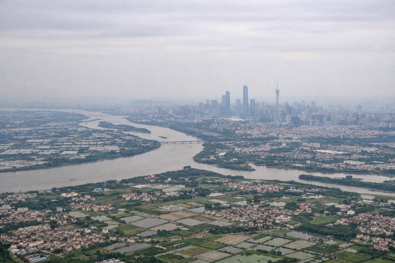
RIGHTOn approach to CAN from the north, the right side offers views over the Pearl River Delta's western flank, including Guangzhou's dense urban core and Baiyun Mountain park just north of the city center.
Landmarks on this routeAll landmarks →
Will your flight be in sunlight?
Pick a date and time in the Sun Map to watch the sun move across your whole flight.
About This Route
Which side of the plane should I sit on flying from Shuangliu (CTU) to Guangzhou Baiyun International Airport (CAN)?
Sit on the Right side of the plane for the best views on flights from Chengdu to Guangzhou. The right side combines a mountainous departure from the Sichuan basin, a cruise-phase pass near the karst peaks around Guilin, and an urban, hill-framed approach into Guangzhou, giving it far more visual variety than the left side's plainer plateau and delta views.
What can I see during takeoff from Shuangliu in Chengdu?
During takeoff from Shuangliu (CTU), sit on the Right side for the best views. Departing CTU southbound, the right side looks west toward the rugged foothills of the Qionglai Mountains and the eastern edge of the Tibetan Plateau, a dramatic contrast to the flat Chengdu basin on the left. Notable sights include: Qionglai Mountains, Min River valley, Chengdu basin farmland.
What can I see when landing at Guangzhou Baiyun International Airport in Guangzhou?
When landing at Guangzhou Baiyun International Airport (CAN), sit on the Right side for the best views. On approach to CAN from the north, the right side offers views over the Pearl River Delta's western flank, including Guangzhou's dense urban core and Baiyun Mountain park just north of the city center. Notable sights include: Guangzhou skyline, Baiyun Mountain, Pearl River bends, Canton Tower.
How long is the flight from Chengdu to Guangzhou?
The flight from Shuangliu (CTU) to Guangzhou Baiyun International Airport (CAN) takes about 2 hours 5 minutes. The shortest flight path between them is 759 miles (1,221 km); winds and air traffic control usually add a few percent.
What does the Chengdu to Guangzhou flight path pass over?
Yunnan-Guizhou plateau uplands transitioning into the karst hill country of northern Guangxi near Guilin, visible along the cruise track before the descent into the Pearl River Delta.