The right side scores higher due to superior landing scenery—the Qiantang River estuary, Hangzhou Bay, and West Lake provide genuine water-based visual variety and landmark density during descent. While Chengdu's takeoff is slightly more interesting than Hangzhou's approach, the landing advantage on the right side outweighs the modest takeoff difference, making the right side the better choice for the full flight.
Flown CTU to HGH? Did we get it right?
Flight Path
Chengdu to Hangzhou is 982 miles (1,580 km), a flight of about 2 hours 35 minutes.
The flight crosses the Sichuan Basin's agricultural plains, then transitions into the Yangtze River valley. The Wuling Mountains and Xuefeng Mountains form a low ridge system in the central portion of the route, visible as a subtle elevation change rather than dramatic peaks. The Yangtze River itself becomes visible in the final 30 minutes of flight, appearing as a meandering brown ribbon through increasingly developed terrain as the aircraft approaches the Yangtze River Delta region.
Great circle distance and headings ›


Phase by phase
Takeoff from CTU
LEFTChengdu's urban sprawl and surrounding Sichuan Basin terrain provide immediate visual interest during climb-out. The city itself is substantial and recognizable from altitude, with the Chengdu Plain extending visibly in multiple directions.
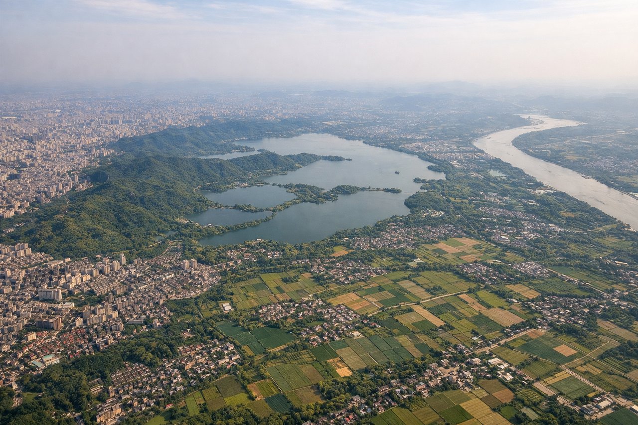
Landing at HGH
RIGHTThe approach to Hangzhou crosses the Qiantang River estuary and Hangzhou Bay, offering water-based scenery and the city's distinctive lakeside setting. Xiaoshan Airport's location near West Lake and the Yangtze River Delta provides more varied terrain during descent than Chengdu's flat basin departure.
Will your flight be in sunlight?
Pick a date and time in the Sun Map to watch the sun move across your whole flight.
About This Route
Which side of the plane should I sit on flying from Shuangliu (CTU) to Xiaoshan (HGH)?
Sit on the Right side of the plane for the best views on flights from Chengdu to Hangzhou. The right side scores higher due to superior landing scenery—the Qiantang River estuary, Hangzhou Bay, and West Lake provide genuine water-based visual variety and landmark density during descent. While Chengdu's takeoff is slightly more interesting than Hangzhou's approach, the landing advantage on the right side outweighs the modest takeoff difference, making the right side the better choice for the full flight.
What can I see during takeoff from Shuangliu in Chengdu?
During takeoff from Shuangliu (CTU), sit on the Left side for the best views. Chengdu's urban sprawl and surrounding Sichuan Basin terrain provide immediate visual interest during climb-out. The city itself is substantial and recognizable from altitude, with the Chengdu Plain extending visibly in multiple directions. Notable sights include: Chengdu urban area, Sichuan Basin agricultural grid, distant Longquan Mountains to the north.
What can I see when landing at Xiaoshan in Hangzhou?
When landing at Xiaoshan (HGH), sit on the Right side for the best views. The approach to Hangzhou crosses the Qiantang River estuary and Hangzhou Bay, offering water-based scenery and the city's distinctive lakeside setting. Xiaoshan Airport's location near West Lake and the Yangtze River Delta provides more varied terrain during descent than Chengdu's flat basin departure. Notable sights include: Hangzhou Bay, Qiantang River estuary, West Lake (Xihu), Hangzhou urban area.
How long is the flight from Chengdu to Hangzhou?
The flight from Shuangliu (CTU) to Xiaoshan (HGH) takes about 2 hours 35 minutes. The shortest flight path between them is 982 miles (1,580 km); winds and air traffic control usually add a few percent.
What does the Chengdu to Hangzhou flight path pass over?
The flight crosses the Sichuan Basin's agricultural plains, then transitions into the Yangtze River valley. The Wuling Mountains and Xuefeng Mountains form a low ridge system in the central portion of the route, visible as a subtle elevation change rather than dramatic peaks. The Yangtze River itself becomes visible in the final 30 minutes of flight, appearing as a meandering brown ribbon through increasingly developed terrain as the aircraft approaches the Yangtze River Delta region.