Cuzco to Puerto Maldonado is 193 miles (311 km), a flight of about 40 minutes.
The right side offers the dramatic Ausangate and Vilcanota peaks during departure from Cusco and better views of the Madre de Dios River system on arrival, while the left side sees comparatively unremarkable terrain during both phases.
Flight Path
Eastern slopes of the Andes transitioning into dense Amazon rainforest, with the Madre de Dios River and its tributaries visible below as the terrain flattens.
Great circle distance and headings ›.jpg?width=600)

Phase by phase
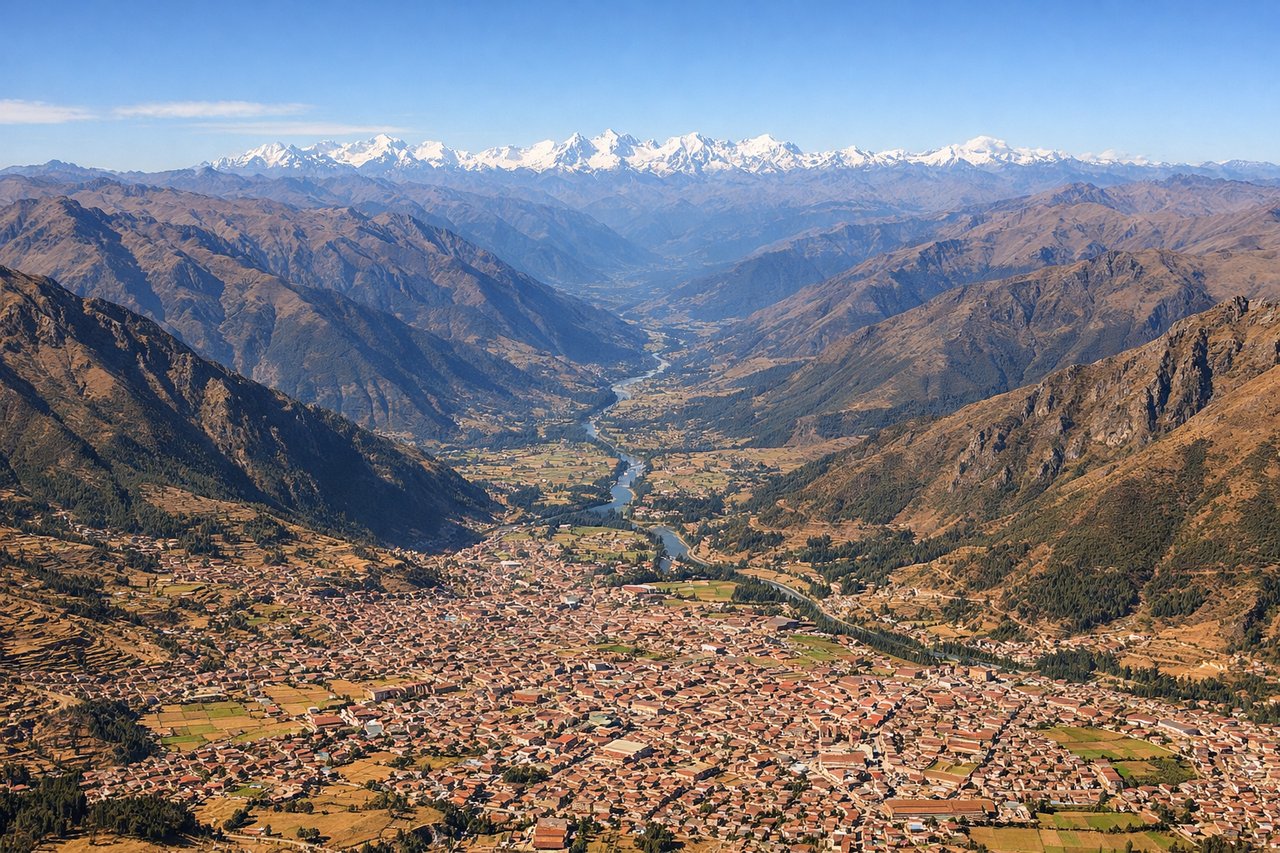
Takeoff from CUZ
RIGHTDeparting CUZ on runway 10, the climb-out swings the aircraft eastward through the high Andean valley, and the right side faces south toward the Vilcanota range, where the glaciated summit of Ausangate (6,384m) dominates the horizon. The left side mostly shows the lower, less dramatic ridgelines north of the Cusco valley.
Landing at PEM
RIGHTOn approach to PEM's runway 19, the aircraft descends from the north over the Amazon lowlands, and the right side keeps the sweeping curves of the Madre de Dios River and its oxbow lakes in view longer as the plane banks toward final. The left side faces unbroken rainforest canopy with fewer distinguishing features.
Landmarks on this routeAll landmarks →
Will your flight be in sunlight?
Pick a date and time in the Sun Map to watch the sun move across your whole flight.
About This Route
Which side of the plane should I sit on flying from Velazco Astete (CUZ) to Padre Aldamiz (PEM)?
Sit on the Right side of the plane for the best views on flights from Cuzco to Puerto Maldonado. The right side offers the dramatic Ausangate and Vilcanota peaks during departure from Cusco and better views of the Madre de Dios River system on arrival, while the left side sees comparatively unremarkable terrain during both phases.
What can I see during takeoff from Velazco Astete in Cuzco?
During takeoff from Velazco Astete (CUZ), sit on the Right side for the best views. Departing CUZ on runway 10, the climb-out swings the aircraft eastward through the high Andean valley, and the right side faces south toward the Vilcanota range, where the glaciated summit of Ausangate (6,384m) dominates the horizon. The left side mostly shows the lower, less dramatic ridgelines north of the Cusco valley. Notable sights include: Ausangate glacier peak, Vilcanota mountain range, Cusco valley terraces, Huatanay river valley.
What can I see when landing at Padre Aldamiz in Puerto Maldonado?
When landing at Padre Aldamiz (PEM), sit on the Right side for the best views. On approach to PEM's runway 19, the aircraft descends from the north over the Amazon lowlands, and the right side keeps the sweeping curves of the Madre de Dios River and its oxbow lakes in view longer as the plane banks toward final. The left side faces unbroken rainforest canopy with fewer distinguishing features. Notable sights include: Madre de Dios River, oxbow lakes, dense Amazon rainforest canopy, Tambopata river confluence area.
How long is the flight from Cuzco to Puerto Maldonado?
The flight from Velazco Astete (CUZ) to Padre Aldamiz (PEM) takes about 40 minutes. The shortest flight path between them is 193 miles (311 km); winds and air traffic control usually add a few percent.
What does the Cuzco to Puerto Maldonado flight path pass over?
Eastern slopes of the Andes transitioning into dense Amazon rainforest, with the Madre de Dios River and its tributaries visible below as the terrain flattens.