While takeoff offers good river views on the right, the landing approach to DCA on the left provides more dramatic and iconic views of Washington D.C.'s monumental core and the Potomac River's distinctive geography. The landing experience outweighs the takeoff advantage.
Flown CVG to DCA? Did we get it right?
Flight Path
Cincinnati to Washington is 410 miles (660 km), a flight of about 1 hour 15 minutes.
The flight path crosses the Appalachian foothills of southeastern Ohio and eastern Kentucky, then transitions into the Ridge and Valley province of West Virginia. The New River Gorge is typically visible to the left (north) of the flight path. As the aircraft approaches Washington airspace, the Shenandoah Valley appears to the left on the horizon, and the Blue Ridge Mountains form a distant ridge line. The Potomac River becomes visible approximately 30 minutes before landing, initially appearing as a thin line winding through forested terrain before widening as it approaches the D.C. area.
Great circle distance and headings ›Phase by phase
Takeoff from CVG
RIGHTRight-side seats capture the Ohio River's northward bend and the Cincinnati skyline receding behind the aircraft during climb-out on typical northeasterly departure headings. The river's distinctive curves are a strong visual reference during the initial climb phase.
Landing at DCA
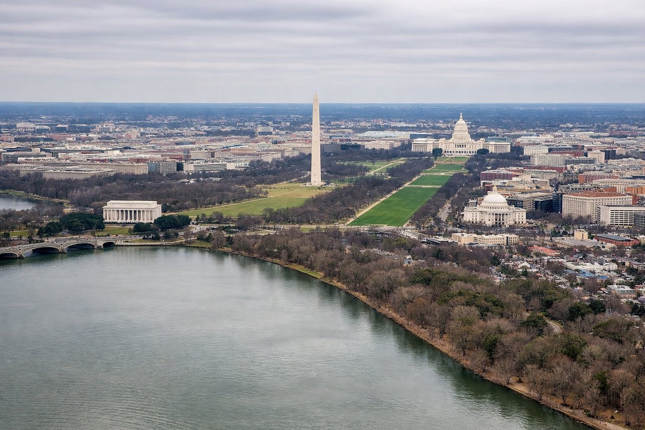
LEFTLeft-side seats offer views of the Potomac River and Washington D.C.'s monumental core during approach to DCA. The river's distinctive S-curve and the city's layout along both banks are prominent visual landmarks during descent.
Will your flight be in sunlight?
Pick a date and time in the Sun Map to watch the sun move across your whole flight.
About This Route
Which side of the plane should I sit on flying from Cincinnati Northern Kentucky International (CVG) to Ronald Reagan Washington National (DCA)?
Sit on the Left side of the plane for the best views on flights from Cincinnati to Washington. While takeoff offers good river views on the right, the landing approach to DCA on the left provides more dramatic and iconic views of Washington D.C.'s monumental core and the Potomac River's distinctive geography. The landing experience outweighs the takeoff advantage.
What can I see during takeoff from Cincinnati Northern Kentucky International in Cincinnati?
During takeoff from Cincinnati Northern Kentucky International (CVG), sit on the Right side for the best views. Right-side seats capture the Ohio River's northward bend and the Cincinnati skyline receding behind the aircraft during climb-out on typical northeasterly departure headings. The river's distinctive curves are a strong visual reference during the initial climb phase. Notable sights include: Ohio River (northward meander), Cincinnati downtown skyline, Northern Kentucky suburbs, Licking River confluence.
What can I see when landing at Ronald Reagan Washington National in Washington?
When landing at Ronald Reagan Washington National (DCA), sit on the Left side for the best views. Left-side seats offer views of the Potomac River and Washington D.C.'s monumental core during approach to DCA. The river's distinctive S-curve and the city's layout along both banks are prominent visual landmarks during descent. Notable sights include: Potomac River (S-curve), Washington Monument and Lincoln Memorial area, Arlington National Cemetery, Theodore Roosevelt Island.
How long is the flight from Cincinnati to Washington?
The flight from Cincinnati Northern Kentucky International (CVG) to Ronald Reagan Washington National (DCA) takes about 1 hour 15 minutes. The shortest flight path between them is 410 miles (660 km); winds and air traffic control usually add a few percent.
What does the Cincinnati to Washington flight path pass over?
The flight path crosses the Appalachian foothills of southeastern Ohio and eastern Kentucky, then transitions into the Ridge and Valley province of West Virginia. The New River Gorge is typically visible to the left (north) of the flight path. As the aircraft approaches Washington airspace, the Shenandoah Valley appears to the left on the horizon, and the Blue Ridge Mountains form a distant ridge line. The Potomac River becomes visible approximately 30 minutes before landing, initially appearing as a thin line winding through forested terrain before widening as it approaches the D.C. area.