The left side wins on both ends of the flight: a sweeping view of the Washington DC monuments during the departure turn, and a scenic look at the Ohio River valley and Kentucky bluffs on arrival. The right side sees mostly flat, unremarkable Appalachian foothill farmland during this short cruise.
Flown DCA to CVG? Did we get it right?
Flight Path
Washington to Cincinnati is 410 miles (660 km), a flight of about 1 hour 25 minutes.
Rolling Appalachian foothills of West Virginia and eastern Ohio, with the Ohio River valley becoming visible as the flight descends toward Cincinnati
Great circle distance and headings ›Phase by phase
Takeoff from DCA
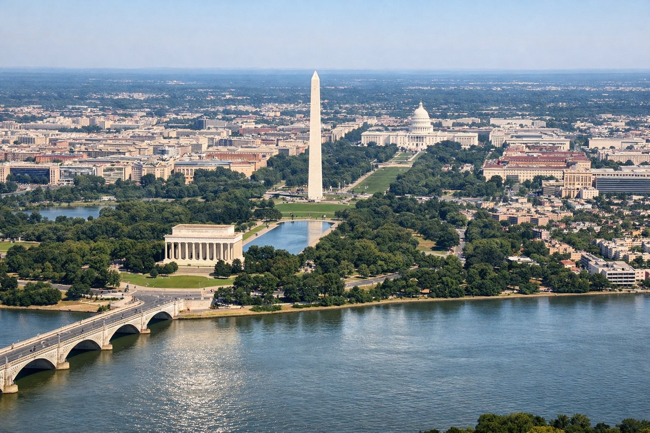
LEFTDeparting DCA to the north, the aircraft banks left to turn southwest toward Cincinnati, swinging directly over downtown Washington. Left-side passengers get a brief but dramatic view of the Mall, the Potomac River bends, and the monuments before the city falls away.
Landing at CVG
LEFTOn approach into CVG from the east, the flight path crosses the wooded hills of northern Kentucky and the winding Ohio River valley just before landing. Left-side seats catch these forested bluffs and river bends, a scenic contrast to the flat farmland dominating the right side.
Will your flight be in sunlight?
Pick a date and time in the Sun Map to watch the sun move across your whole flight.
About This Route
Which side of the plane should I sit on flying from Ronald Reagan Washington National (DCA) to Cincinnati Northern Kentucky International (CVG)?
Sit on the Left side of the plane for the best views on flights from Washington to Cincinnati. The left side wins on both ends of the flight: a sweeping view of the Washington DC monuments during the departure turn, and a scenic look at the Ohio River valley and Kentucky bluffs on arrival. The right side sees mostly flat, unremarkable Appalachian foothill farmland during this short cruise.
What can I see during takeoff from Ronald Reagan Washington National in Washington?
During takeoff from Ronald Reagan Washington National (DCA), sit on the Left side for the best views. Departing DCA to the north, the aircraft banks left to turn southwest toward Cincinnati, swinging directly over downtown Washington. Left-side passengers get a brief but dramatic view of the Mall, the Potomac River bends, and the monuments before the city falls away. Notable sights include: Washington Monument, U.S. Capitol, Potomac River, Tidal Basin.
What can I see when landing at Cincinnati Northern Kentucky International in Cincinnati?
When landing at Cincinnati Northern Kentucky International (CVG), sit on the Left side for the best views. On approach into CVG from the east, the flight path crosses the wooded hills of northern Kentucky and the winding Ohio River valley just before landing. Left-side seats catch these forested bluffs and river bends, a scenic contrast to the flat farmland dominating the right side. Notable sights include: Ohio River, Northern Kentucky bluffs, rural farmland patchwork.
How long is the flight from Washington to Cincinnati?
The flight from Ronald Reagan Washington National (DCA) to Cincinnati Northern Kentucky International (CVG) takes about 1 hour 25 minutes. The shortest flight path between them is 410 miles (660 km); winds and air traffic control usually add a few percent.
What does the Washington to Cincinnati flight path pass over?
Rolling Appalachian foothills of West Virginia and eastern Ohio, with the Ohio River valley becoming visible as the flight descends toward Cincinnati