The right side wins thanks to a stronger combination of departure-city views and a dramatic Cascade volcano lineup on arrival, while the left side's Rockies glimpses during cruise are less consistently visible and the landing view is comparatively flatter.
Flight Path
Great Plains of Nebraska and South Dakota, the Wind River Range and Yellowstone-Teton region of Wyoming, and the Snake River Plain of Idaho before descending toward the Columbia River Gorge.
Great circle distance and headings ›

.jpg?width=600)
.jpg?width=600)
Phase by phase
Takeoff from CVG
RIGHTDeparting CVG and turning westward, the right side offers a good look back at the Ohio River and Cincinnati's downtown skyline before the aircraft climbs over the rolling farmland of southern Indiana and Illinois. The left side mostly shows flat Kentucky countryside with less definition.
Landing at PDX
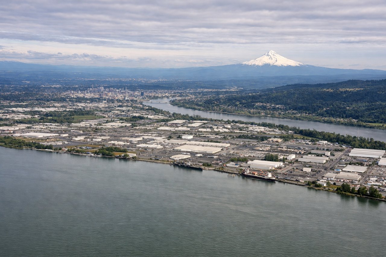
RIGHTOn the descent into PDX from the east, the right side reveals the snow-capped volcanic cones of Mount St. Helens, Mount Adams, and even distant Mount Rainier across the Columbia River basin. The left side mostly shows Portland's flatter suburbs and the Willamette Valley, with Mount Hood visible but as a single feature rather than a cluster.
Landmarks on this routeAll landmarks →
Will your flight be in sunlight?
See exactly which side of the plane gets sun and shade at your departure time.
About This Route
Which side of the plane should I sit on flying from Cincinnati Northern Kentucky International (CVG) to Portland International (PDX)?
Sit on the Right side of the plane for the best views on flights from Cincinnati to Portland. The right side wins thanks to a stronger combination of departure-city views and a dramatic Cascade volcano lineup on arrival, while the left side's Rockies glimpses during cruise are less consistently visible and the landing view is comparatively flatter.
What can I see during takeoff from Cincinnati Northern Kentucky International in Cincinnati?
During takeoff from Cincinnati Northern Kentucky International (CVG), sit on the Right side for the best views. Departing CVG and turning westward, the right side offers a good look back at the Ohio River and Cincinnati's downtown skyline before the aircraft climbs over the rolling farmland of southern Indiana and Illinois. The left side mostly shows flat Kentucky countryside with less definition. Notable sights include: Ohio River, Cincinnati downtown skyline, Kentucky/Ohio river bluffs.
What can I see when landing at Portland International in Portland?
When landing at Portland International (PDX), sit on the Right side for the best views. On the descent into PDX from the east, the right side reveals the snow-capped volcanic cones of Mount St. Helens, Mount Adams, and even distant Mount Rainier across the Columbia River basin. The left side mostly shows Portland's flatter suburbs and the Willamette Valley, with Mount Hood visible but as a single feature rather than a cluster. Notable sights include: Mount St. Helens, Mount Adams, Mount Rainier (distant), Columbia River.
How long is the flight from Cincinnati to Portland?
The flight from Cincinnati Northern Kentucky International (CVG) to Portland International (PDX) takes 4h 30m.
What does the Cincinnati to Portland flight path pass over?
Great Plains of Nebraska and South Dakota, the Wind River Range and Yellowstone-Teton region of Wyoming, and the Snake River Plain of Idaho before descending toward the Columbia River Gorge.