The departure view of Mount Hood and the Cascades is more visually distinctive than the landing view. While the Ohio River approach is geographically interesting, the volcanic peaks of the Pacific Northwest are more dramatic and memorable from altitude.
Flown PDX to CVG? Did we get it right?
Flight Path
Portland to Cincinnati is 1,970 miles (3,171 km), a flight of about 4 hours 15 minutes.
The flight path crosses the Rocky Mountains (visible around 2 hours out, roughly over central Idaho/western Montana), then descends across the Great Plains. Notable features include the Bitterroot Range, Flathead region, and the transition from mountainous terrain to the agricultural plains of the Midwest. The Missouri River basin becomes visible in the latter half of the flight as you approach Ohio.
Great circle distance and headings ›


Phase by phase
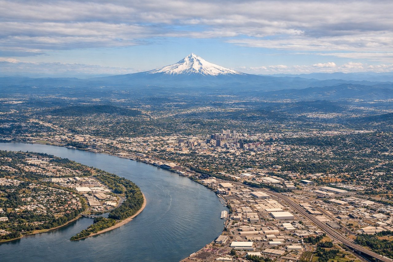
Takeoff from PDX
LEFTPDX typically departs to the north on Runway 10L/10R. Left-side seats face west initially, giving views of the Cascade Range and Mount Hood as you climb out over the Willamette Valley. Right seats see industrial areas and the Columbia River but lack the dramatic volcanic peaks.
Landing at CVG
RIGHTCVG typically lands on Runway 18L/18R from the north. Right-side seats during descent offer views of the Ohio River's distinctive meanders and the Cincinnati basin. Left seats see mostly farmland and suburban sprawl without the river's defining geography.
Will your flight be in sunlight?
Pick a date and time in the Sun Map to watch the sun move across your whole flight.
About This Route
Which side of the plane should I sit on flying from Portland International (PDX) to Cincinnati Northern Kentucky International (CVG)?
Sit on the Left side of the plane for the best views on flights from Portland to Cincinnati. The departure view of Mount Hood and the Cascades is more visually distinctive than the landing view. While the Ohio River approach is geographically interesting, the volcanic peaks of the Pacific Northwest are more dramatic and memorable from altitude.
What can I see during takeoff from Portland International in Portland?
During takeoff from Portland International (PDX), sit on the Left side for the best views. PDX typically departs to the north on Runway 10L/10R. Left-side seats face west initially, giving views of the Cascade Range and Mount Hood as you climb out over the Willamette Valley. Right seats see industrial areas and the Columbia River but lack the dramatic volcanic peaks. Notable sights include: Mount Hood (11,240 ft, visible 50+ miles southeast), Cascade Range ridgeline, Willamette Valley floor, Columbia River gorge to the north.
What can I see when landing at Cincinnati Northern Kentucky International in Cincinnati?
When landing at Cincinnati Northern Kentucky International (CVG), sit on the Right side for the best views. CVG typically lands on Runway 18L/18R from the north. Right-side seats during descent offer views of the Ohio River's distinctive meanders and the Cincinnati basin. Left seats see mostly farmland and suburban sprawl without the river's defining geography. Notable sights include: Ohio River with characteristic bends, Cincinnati downtown skyline (modest but visible), Little Miami River confluence, surrounding forested hills of southwestern Ohio.
How long is the flight from Portland to Cincinnati?
The flight from Portland International (PDX) to Cincinnati Northern Kentucky International (CVG) takes about 4 hours 15 minutes. The shortest flight path between them is 1,970 miles (3,171 km); winds and air traffic control usually add a few percent.
What does the Portland to Cincinnati flight path pass over?
The flight path crosses the Rocky Mountains (visible around 2 hours out, roughly over central Idaho/western Montana), then descends across the Great Plains. Notable features include the Bitterroot Range, Flathead region, and the transition from mountainous terrain to the agricultural plains of the Midwest. The Missouri River basin becomes visible in the latter half of the flight as you approach Ohio.