Right side scores 4.0 versus left's 2.5 due to superior mountain scenery on both legs. The takeoff captures the dramatic Serra Geral escarpment, while the landing features the snow-capped Andes and Mapocho River valley approach—both visually distinctive and geographically significant. Left side offers only flat plateau and valley views with minimal terrain variation.
Flown CWB to SCL? Did we get it right?
Flight Path
Curitiba to Santiago is 1,405 miles (2,262 km), a flight of about 3 hours 15 minutes.
The flight path crosses the Atlantic Forest region of southern Brazil, then transitions over the flat pampas of northern Argentina and southern Paraguay. The Paraná River valley lies to the west of the direct route. As the aircraft approaches Chile, the pre-Andean foothills become visible, followed by the main Cordillera de los Andes ridge. The route generally follows a southwest bearing, crossing from subtropical forest terrain into temperate steppe and then into the high Andes.
Great circle distance and headings ›


Phase by phase
Takeoff from CWB
RIGHTRight side captures Curitiba's urban sprawl and the immediate transition into the Serra Geral escarpment, a dramatic geological feature. Left side shows only flat inland plateau terrain with minimal visual interest during climb-out.
Landing at SCL
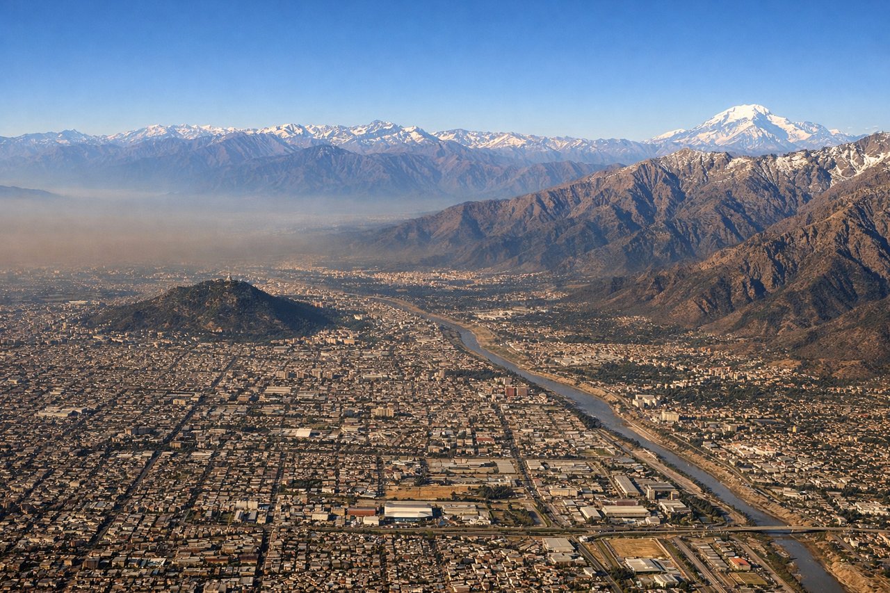
RIGHTRight side provides the dramatic final approach over the Andes foothills and the Mapocho River valley leading into Santiago. The Cordillera de los Andes dominates the approach with snow-capped peaks visible on clear days. Left side shows only the flat central valley and urban sprawl with no mountain drama.
Will your flight be in sunlight?
Pick a date and time in the Sun Map to watch the sun move across your whole flight.
About This Route
Which side of the plane should I sit on flying from Afonso Pena (CWB) to Arturo Merino Benitez International (SCL)?
Sit on the Right side of the plane for the best views on flights from Curitiba to Santiago. Right side scores 4.0 versus left's 2.5 due to superior mountain scenery on both legs. The takeoff captures the dramatic Serra Geral escarpment, while the landing features the snow-capped Andes and Mapocho River valley approach—both visually distinctive and geographically significant. Left side offers only flat plateau and valley views with minimal terrain variation.
What can I see during takeoff from Afonso Pena in Curitiba?
During takeoff from Afonso Pena (CWB), sit on the Right side for the best views. Right side captures Curitiba's urban sprawl and the immediate transition into the Serra Geral escarpment, a dramatic geological feature. Left side shows only flat inland plateau terrain with minimal visual interest during climb-out. Notable sights include: Serra Geral escarpment edge, Curitiba metropolitan area grid, Paraná plateau interior.
What can I see when landing at Arturo Merino Benitez International in Santiago?
When landing at Arturo Merino Benitez International (SCL), sit on the Right side for the best views. Right side provides the dramatic final approach over the Andes foothills and the Mapocho River valley leading into Santiago. The Cordillera de los Andes dominates the approach with snow-capped peaks visible on clear days. Left side shows only the flat central valley and urban sprawl with no mountain drama. Notable sights include: Cordillera de los Andes peaks, Mapocho River valley, Santiago metropolitan basin, pre-Andean foothills.
How long is the flight from Curitiba to Santiago?
The flight from Afonso Pena (CWB) to Arturo Merino Benitez International (SCL) takes about 3 hours 15 minutes. The shortest flight path between them is 1,405 miles (2,262 km); winds and air traffic control usually add a few percent.
What does the Curitiba to Santiago flight path pass over?
The flight path crosses the Atlantic Forest region of southern Brazil, then transitions over the flat pampas of northern Argentina and southern Paraguay. The Paraná River valley lies to the west of the direct route. As the aircraft approaches Chile, the pre-Andean foothills become visible, followed by the main Cordillera de los Andes ridge. The route generally follows a southwest bearing, crossing from subtropical forest terrain into temperate steppe and then into the high Andes.