Right side edges ahead due to superior takeoff scenery at Cam Ranh Bay, which provides immediate visual drama and distinctive coastal features. While landing views are equal between sides (both capture delta features), the strong right-side departure experience tips the overall score. This is a short, relatively flat route with limited terrain drama—neither side reaches 3.0 individually, but right's coastal advantage during climb-out makes it the better choice.
Flown CXR to HAN? Did we get it right?
Flight Path
Nha Trang/nha Trang aiurportCam Ranh to Hanoi is 676 miles (1,088 km), a flight of about 2 hours 5 minutes.
Coastal plain north of Nha Trang with scattered fishing villages and lagoons; transition from Khanh Hoa Province to Thanh Hoa Province; Red River Delta begins appearing around 30 minutes before landing; no significant mountains or dramatic terrain—route follows Vietnam's coastal lowlands and delta regions throughout
Great circle distance and headings ›Phase by phase
Takeoff from CXR
RIGHTRight side captures Cam Ranh Bay's distinctive crescent coastline and turquoise waters during initial climb, providing immediate scenic interest. Left side faces inland terrain with less dramatic visual contrast during departure.
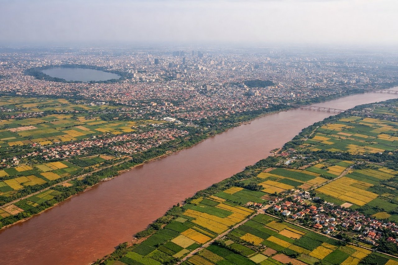
Landing at HAN
LEFTLeft side during approach to Hanoi captures the Red River Delta's intricate waterway network and agricultural patchwork, plus views of Hanoi's urban sprawl. Right side faces open countryside with less distinctive features during descent.
Will your flight be in sunlight?
Pick a date and time in the Sun Map to watch the sun move across your whole flight.
About This Route
Which side of the plane should I sit on flying from Cam Ranh International Airport / Cam Ranh Air Base (CXR) to Noibai International (HAN)?
Sit on the Right side of the plane for the best views on flights from Nha Trang/nha Trang aiurportCam Ranh to Hanoi. Right side edges ahead due to superior takeoff scenery at Cam Ranh Bay, which provides immediate visual drama and distinctive coastal features. While landing views are equal between sides (both capture delta features), the strong right-side departure experience tips the overall score. This is a short, relatively flat route with limited terrain drama—neither side reaches 3.0 individually, but right's coastal advantage during climb-out makes it the better choice.
What can I see during takeoff from Cam Ranh International Airport / Cam Ranh Air Base in Nha Trang/nha Trang aiurportCam Ranh?
During takeoff from Cam Ranh International Airport / Cam Ranh Air Base (CXR), sit on the Right side for the best views. Right side captures Cam Ranh Bay's distinctive crescent coastline and turquoise waters during initial climb, providing immediate scenic interest. Left side faces inland terrain with less dramatic visual contrast during departure. Notable sights include: Cam Ranh Bay (crescent-shaped harbor), Cam Ranh Peninsula, South China Sea coastline, Nha Trang city lights (if early morning/evening departure).
What can I see when landing at Noibai International in Hanoi?
When landing at Noibai International (HAN), sit on the Left side for the best views. Left side during approach to Hanoi captures the Red River Delta's intricate waterway network and agricultural patchwork, plus views of Hanoi's urban sprawl. Right side faces open countryside with less distinctive features during descent. Notable sights include: Red River Delta (braided channels and irrigation patterns), Hanoi city sprawl, Thai Nguyen Province highlands (distant), Red River main channel.
How long is the flight from Nha Trang/nha Trang aiurportCam Ranh to Hanoi?
The flight from Cam Ranh International Airport / Cam Ranh Air Base (CXR) to Noibai International (HAN) takes about 2 hours 5 minutes. The shortest flight path between them is 676 miles (1,088 km); winds and air traffic control usually add a few percent.
What does the Nha Trang/nha Trang aiurportCam Ranh to Hanoi flight path pass over?
Coastal plain north of Nha Trang with scattered fishing villages and lagoons; transition from Khanh Hoa Province to Thanh Hoa Province; Red River Delta begins appearing around 30 minutes before landing; no significant mountains or dramatic terrain—route follows Vietnam's coastal lowlands and delta regions throughout