Right side scores higher (3.5 vs 2.5) because it captures two visually distinct and geographically dramatic sequences: the Red River Delta's intricate agricultural landscape during takeoff, and Cam Ranh Bay's striking turquoise waters and rocky coastal features during landing. The left side offers only modest inland terrain throughout the flight. The route's scenic value concentrates on the right side.
Flown HAN to CXR? Did we get it right?
Flight Path
Hanoi to Nha Trang/nha Trang aiurportCam Ranh is 676 miles (1,088 km), a flight of about 2 hours 5 minutes.
Central Vietnamese coastline with Nha Trang city and harbor visible to the left during cruise; the transition from Red River Delta's flat agricultural plains to the rising limestone hills and karst formations of central Vietnam; Halong Bay region (far north, not directly on route but visible from altitude on clear days); the narrow coastal strip between mountains and South China Sea
Great circle distance and headings ›Phase by phase
Takeoff from HAN
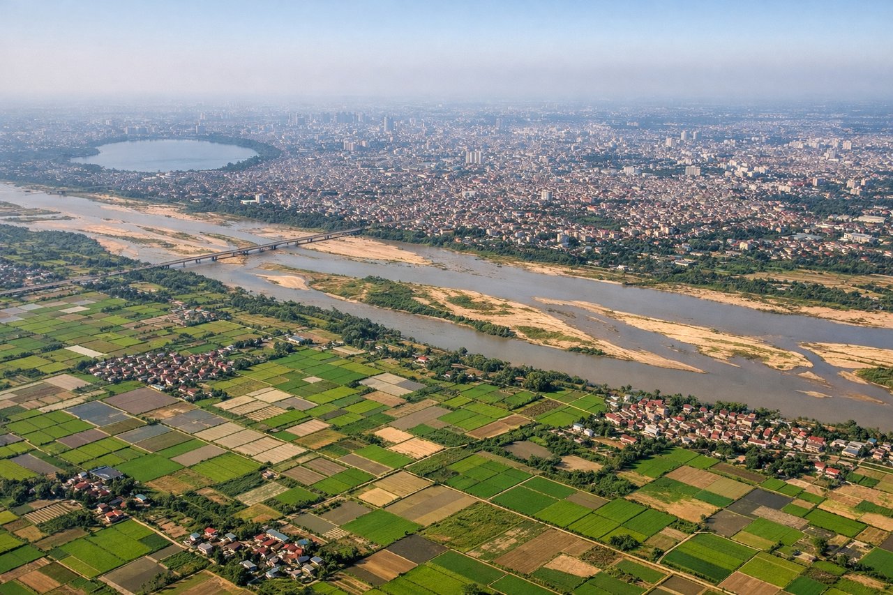
RIGHTRight side captures the Red River Delta and Hanoi's urban sprawl during initial climb. The delta's agricultural grid and waterways are distinctive from 3,000–8,000 feet. Left side faces inland terrain with less visual definition.
Landing at CXR
RIGHTRight side offers the dramatic approach to Cam Ranh Bay and its distinctive coastal geography. The turquoise waters, rocky peninsulas, and Cam Ranh Air Base facilities are visually striking during descent and final approach. Left side shows only inland hills and open terrain.
Will your flight be in sunlight?
Pick a date and time in the Sun Map to watch the sun move across your whole flight.
About This Route
Which side of the plane should I sit on flying from Noibai International (HAN) to Cam Ranh International Airport / Cam Ranh Air Base (CXR)?
Sit on the Right side of the plane for the best views on flights from Hanoi to Nha Trang/nha Trang aiurportCam Ranh. Right side scores higher (3.5 vs 2.5) because it captures two visually distinct and geographically dramatic sequences: the Red River Delta's intricate agricultural landscape during takeoff, and Cam Ranh Bay's striking turquoise waters and rocky coastal features during landing. The left side offers only modest inland terrain throughout the flight. The route's scenic value concentrates on the right side.
What can I see during takeoff from Noibai International in Hanoi?
During takeoff from Noibai International (HAN), sit on the Right side for the best views. Right side captures the Red River Delta and Hanoi's urban sprawl during initial climb. The delta's agricultural grid and waterways are distinctive from 3,000–8,000 feet. Left side faces inland terrain with less visual definition. Notable sights include: Red River Delta with its intricate canal network, Hanoi city center and harbor districts, Thai Nguyen highlands to the northwest (distant).
What can I see when landing at Cam Ranh International Airport / Cam Ranh Air Base in Nha Trang/nha Trang aiurportCam Ranh?
When landing at Cam Ranh International Airport / Cam Ranh Air Base (CXR), sit on the Right side for the best views. Right side offers the dramatic approach to Cam Ranh Bay and its distinctive coastal geography. The turquoise waters, rocky peninsulas, and Cam Ranh Air Base facilities are visually striking during descent and final approach. Left side shows only inland hills and open terrain. Notable sights include: Cam Ranh Bay with its turquoise waters and rocky headlands, Cam Ranh Peninsula and air base runway, Hon Tre Island and smaller islands dotting the bay, coastal limestone hills.
How long is the flight from Hanoi to Nha Trang/nha Trang aiurportCam Ranh?
The flight from Noibai International (HAN) to Cam Ranh International Airport / Cam Ranh Air Base (CXR) takes about 2 hours 5 minutes. The shortest flight path between them is 676 miles (1,088 km); winds and air traffic control usually add a few percent.
What does the Hanoi to Nha Trang/nha Trang aiurportCam Ranh flight path pass over?
Central Vietnamese coastline with Nha Trang city and harbor visible to the left during cruise; the transition from Red River Delta's flat agricultural plains to the rising limestone hills and karst formations of central Vietnam; Halong Bay region (far north, not directly on route but visible from altitude on clear days); the narrow coastal strip between mountains and South China Sea